Country:

 City:
City:


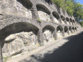
Park on the left in the small car park opposite the picnic area at a place called Les Trois Ponts.
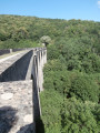
(S/E) Take the path that climbs up opposite the old bridge. It generally follows the ridge and joins a road.
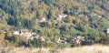
(1) Turn right, walk through the hamlet of La Bruyère and take the path on the left as you leave the village, leaving the return route on your right. You’ll come to a fork at the end of a field on your left.
(2) Carry on to the right and, after a sharp right-hand bend, join the ridge and climb up to a cross-country track.
(3) Turn right and carry on straight along the ridge to the Col du Villaret.
(4) Carry on straight ahead to reach the Col des Airettes, where the path gives way to a forest track.
(5) Follow the forest road.
(6) Cross the Vis and carry on to the Col des Tempêtes.
(7) Turn right to head due north and reach the next junction.
(8) Take the hairpin bend to the left, leaving the forest track and joining another one. Follow this track to the left for a few dozen metres, before leaving it and heading right uphill to a junction of paths.
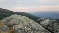
(9) Turn left and follow a round-trip route to the summit of Pic Saint-Guiral, skirting it on the right.
(10) Retrace your steps along the same route to the previous junction.
(9) Head straight on to the GR® 66 and 71, which run alongside the Trois Quilles nature reserve, and look for the start of a path on the right, about fifty metres before the road leading to the Col de l’Homme Mort.
(11) Leave the forest track and take this path beneath the pine trees. Reach the Col de l’Homme Mort.
(12) Here, rejoin the GR® and follow it uphill through the pine trees between the road and the wide track leading straight ahead. Continue uphill along a track until you reach the Col des Pises.
(13) Leave the track and continue straight ahead on the GR® to head into the grassy area and descend into the beech forest. Pass the observatory, reach the shore of Lac des Pises and turn right towards a wooden bridge.
(14) Cross the bridge to go round the lake on the right. At the next three-way junction, leave the GR® by heading uphill to the right before the dam. Walk past the Baraque de Pialot, rejoin the GR® and keep right at each junction. Continue to the Col des Portes.
(15) Continue along the forest track, then take the path up the hillside to the right at the next three-way junction. In the right-hand bend, at the small pass, leave the track and take the path on the left after a short grassy patch. The path is obscured by broom. Follow the cairns until you reach the bottom of the valley.
(16) Take the track opposite and head down to the left towards the south-west. Do not go down into the riverbed. Follow the track for about 3.5 km until you reach a sharp bend to the right, where you’ll find a path branching off to the left marked by a metal barrier.
(17) Pass this on the left and head down through the broom. Continue through the forest until you emerge and reach a small pass.
(18) Head slightly to the right ahead. Descend, generally following the ridge, cross a forest track and then the road twice as it winds round a bend, until you reach Arrigas Town Hall.
(19) Take the road to the left at the bend by the town hall, then leave the road to the right onto a path that runs alongside the cemetery on your left. Head downhill, cross the river and climb back up to the left to reach the hamlet of La Bruyère, which you cross once more.
(1) At the bend, take the path on the left which runs alongside the last house and follow the route back to Les Trois Ponts (S/E).


 Visorando Member

 Moderate
 Easy
Easy  Association / Club / Walk leader