Country:
 City:
City:


Take the RD10, which climbs up from Plombières-les-Dijon towards Pasques, and park at the car park on the Route Forestière de la Tuilerie.
(S/E) Head due west into the Combe du Bois de Souillé, immediately on the left after the car park. Follow the path along the valley floor until you emerge onto the plateau where the path joins the D10. Follow the D10 straight ahead for about 100 m, until you reach a path branching off at a right angle to your right. This path marks the boundary between the municipalities of Plombières-les-Dijon and Lantenay.
(1) Take this path and follow it uphill for about 1 km until it intersects at a right angle with another path that runs along the edge of the Prenois plateau.
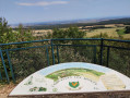
(2) Turn right and follow this path along the edge of the plateau for about 1.5 km. It crosses lovely limestone grasslands and offers a few glimpses of the Ouche valley and the neighbouring hills: views of Mont Afrique and Notre-Dame d’Étang in places. Continue until you reach the very top of the Combe au Frêne.
(3) Take the signposted path which descends to the right down the Combe au Frêne for about 3 km, until you reach the point where the Tuilerie track climbs back up towards the Contard plateau.
(4) Turn left and follow this track uphill for about 100 metres, until you reach the start of a lovely little path that heads through the woods on your right.
(5) Follow this path to the Source de la Tuilerie, rejoin the track at the bottom of the valley and follow it to the left to return to the car park (S/E).
 Visorando Member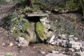
 Moderate
 Difficult
  Association / Club / Walk leader