


 Country:

 City:


Park in the small car park near Saint-Pierre Church. Other parking options are available in the village.
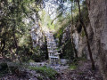
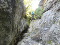
(S/E) With your back to the church, walk up through the village for about fifty metres. Take the signposted path which climbs to the right towards the Combe de Saint-André. Caution: steep and exposed sections. You’ll reach the signpost for “Combe de Saint-André”.
(1) Turn right to follow the signposted path which climbs up the valley towards the Croix de Fer. You’ll come out onto a tarmac road (D1A, Route de la Gabelle).
(2) Cross this road carefully, head into the meadow opposite and follow the signposted path through the woodland to the left. Cross the road again a little further on, then take the path that runs alongside it. Follow this path through the woodland without crossing the road again; pass a hunting blind, walk alongside a fence, pass a second blind before reaching a small grassy track in the Combe d’Imberge.
(3) Head up this track to the right, cross the D1A one last time – taking care as always – to join a slightly wider track leading to the D1 at the ‘Pié d’Ubac’ sign.
(4) Cross this road with care and follow the signposted path opposite. Head up towards Les Colombets, turn left at the T-junction, leaving the hamlet on your right, and reach Les Bataliers.
(5) Carry on straight ahead, ignoring the turn-off to Les Garrigas on the right, and arrive at the Col de Notre-Dame des Abeilles.
(6) Cross the D1 with care, walk alongside it on the right for a few metres, then take the path that runs alongside it. You’ll arrive at a small car park in the hamlet of Les Abeilles, with the chapel opposite.
(7) Head down to the left onto the little Route des Isnards, cross the hamlet and rejoin the D1A. Turn right onto this road and follow it for about 200 metres.
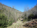
(8) Just after the bridge and the ‘Les Isnards’ road sign, turn left onto a path leading downhill. Shortly afterwards, turn right onto a small path between two low walls. When you reach a fork, follow the level path that branches off to the right, still between two low walls. Then turn left at another fork and gradually descend until you emerge at the bottom of the Combe du Puits Verrier.
(9) Head right to follow the path there. Ignore the path climbing up to the right towards La Gabelle and, further down, you’ll pass a charcoal kiln with very black ground, flanked by the ruins of a shelter to one side. Join a track coming in from the left.
(10) Continue straight on, passing beneath an old hunting post, and carry on along the path at the bottom of the valley. Turn right along this path to go over a small cliff, then descend back to the valley floor. You’ll reach a track; take it to the left and emerge onto a tarmac road: the D942 – Route de la Nesque.
(11) Carefully follow this road to the left. Go round several bends, cross a bridge and walk for about 200 m to reach the start of the low wall running alongside the bend, lined with upright stones.
(12) Turn left at a hairpin bend onto a path that climbs in a series of hairpin bends through the pine trees. Pass hunting post no. 2, then, just after hunting post no. 1 and about thirty metres before the end of the path, take the path that climbs diagonally to the right. You’ll emerge into some clearings; cross over to the other side and join the access path to the old Braillon farm.
(13) Take this path to the right, then turn right onto an old village track which climbs through the woodland alongside a low stone wall. Continue to the left wherethe wall breaks offand carry on to the summit. At the top, cross a grassy track, reach a junction of tracks and head straight on for about a hundred metres. Then leave the track at the next right-hand bend to take the wooded path downhill to the left. Arrive at the hamlet of Flaoussiers, pass between the houses and reach the junction with a cross-country track.
(14) Turn left onto this track, then leave it to take a path on the right through the brambles. When you reach a track, take the entrance to a field straight ahead, then a path immediately to the left. At the top, join the GRP® Massif du Ventoux trail: marked with yellow and red signs.
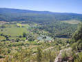
(15) Follow it straight ahead and head down towards Monieux: panoramic views over the Nesque valley. Enter Monieux, come out onto Rue du Pré d’Estève, then continue along Rue de l’Horloge to reach the car park (S/E).
 Visorando Member

 Easy
 Difficult

