The heights of Échenevex

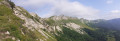
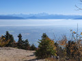
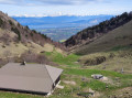
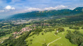
An easy walk on the edge of the nature reserve. There are several vantage points along the route, particularly offering views of Mont Blanc, Lake Geneva and the Lake Geneva basin. You’ll see dinosaur footprints. Depending on the season, you may also see a small stream, the Crotte.

Details

100455830
Creation:
Last update:
Last review:
  • Walking
    Activity: Walking
  • ↔
    Distance: 3.06 mi
  • ◔
    Average duration: 2h 10 
  • ▲
    Difficulty: Easy

  • ⚐
    Back to start: Yes
  • ↗
    Ascent: + 899 ft
  • ↘
    Descent: - 899 ft

  • ▲
    Highest point: 2,595 ft
  • ▼
    Lowest point: 2,060 ft

Description of the walk

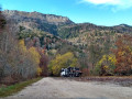
The starting point is at a place called Vallière, at the junction between the local road and the dirt track known as Chemin du Raffort: parking is available on site.

(S/E) Set off with your back to the local road and follow this track as it leads into the woodland. You’ll soon reach your first viewpoint overlooking Lake Geneva and the Alps.

(1) Ignore the return path on the left and carry straight on.

(2) Turn left to take a shortcut which rejoins the path further up. Leave the path briefly to go and see the dinosaur footprints on the right .

(3) Carry on straight ahead to reach the boundary of the Protected Natural Area.

(4) Turn back.

(3) Turn right and head for another viewpoint.

(5) Carry on to the right for a few dozen metres, then turn right. Much further on, you’ll reach another viewpoint. Walk for just under a hundred metres to reach a crossroads.

(6) Turn right, reach another star-shaped junction and head straight ahead. Then turn left at a 90° angle to reach the small stream known as La Crotte.

(7) Turn left, return to the star-shaped junction and head almost straight ahead to return to the junction where the circular loop begins.

(6) Walk for about twenty metres, then turn left. You’ll come out onto a cross-path; continue left to reach another viewpoint on Chemin du Rucher.

(8) Follow this path, veer left just after two farm sheds to head back towards Chemin du Raffort, which you took at the start. About a hundred metres before reaching it, turn right and return to the first viewpoint.

(1) Turn right to head straight back to the car park (S/E).

Waypoints

  1. S/E : mi 0 - alt. 2,060 ft - Vallière, crossroads
  2. 1 : mi 0.17 - alt. 2,178 ft - Junction of the circular loop
  3. 2 : mi 0.45 - alt. 2,362 ft - Shortcut to the left
  4. 3 : mi 0.57 - alt. 2,484 ft - Dinosaur footprints
  5. 4 : mi 0.67 - alt. 2,559 ft - Sign marking the entrance to the Protected Natural Area
  6. 5 : mi 0.94 - alt. 2,392 ft - Viewpoint
  7. 6 : mi 1.46 - alt. 2,346 ft - Junction with the La Crotte circular loop
  8. 7 : mi 1.66 - alt. 2,569 ft - La Crotte
  9. 8 : mi 2.23 - alt. 2,247 ft - Viewpoint
  10. S/E : mi 3.06 - alt. 2,060 ft - Vallière, crossroads

Notes

An easy walk suitable for the whole family, but not suitable for pushchairs.

At several points, you will be on the edge of the Protected Natural Area: please ensure you comply with the regulations in force.

This route passes through a protected area, which may be subject to special regulations:

Worth a visit

(3) If you look closely at the rocks, you can see dinosaur footprints: https://lepaysgessien.lemessager.fr/31622/article/2021-10-14/echenevex-les-empreintes-de-dinosaures-oubliees-du-pays-de-gex.

After the walk, you can stop off at the Source de L’Allondon, a small spring on the outskirts of Échenevex which is a lovely spot, offering everything you need to relax after your walk.

If you’re with dogs, you’ll be on the edge of the Protected Natural Area (4).

The Échenevex goat farm: you can buy directly from the farm during your walk https://www.pension-equiparadis-chevrerie-de-capucine.fr/?utm_medium=referral&utm_source=gmb&utm_campaign=lnk-gmb

Other walks in the area

For more walks, use our search engine .

The GPS track and description are the property of this route's author. Please do not copy them without permission.