


Refine your search for walks in Col du Sabion (2263m)
Col du Sabion (2263m) walks


 Sabion Pass and Lakes
 Visorando Member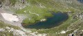
 6.16 mi
 +1,014 ft
 -984 ft
 3h 45
3h 45
 Moderate
 Departure from Tende (Alpes-Maritimes)
A very pleasant mountain-side walk with views over the Casterino valley and the peaks of the Vallée des Merveilles; to round off the outward leg, there is a magnificent view of the Italian side, featuring Lago della Vacca and a beautiful waterfall that feeds into the lake.
Walks near Col du Sabion (2263m)
Castérino – Nice Mountain Hut
 8.98 mi
+4,928 ft
-3,258 ft
7 hrs
8.98 mi
+4,928 ft
-3,258 ft
7 hrs
 Very difficult
Departure from Tende (Alpes-Maritimes)
Very difficult
Departure from Tende (Alpes-Maritimes)
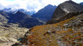
This first stage takes you from the bottom of the Roya Valley to the Nice Refuge. The proposed route is longer and more difficult than the one via the Baisse du Basto, but much less busy. On this demanding detour, you’ll enjoy the passage over the Pas de l’Agnel, the stretch into Italy as far as the Pas de Pagari, stopping off at the Rifugio Pagari, nestled against the summit of the Malédie. During the descent to the Refuge de Nice, you’ll enjoy the tranquillity of the Lacs Clapier.
From Valmasque to Lac des Mesches via Mont Bégo
 13.66 mi
+4,006 ft
-5,118 ft
10 hrs
Very difficult
Departure from Tende (Alpes-Maritimes)
13.66 mi
+4,006 ft
-5,118 ft
10 hrs
Very difficult
Departure from Tende (Alpes-Maritimes)
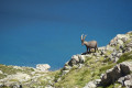
This long one-way hike (two vehicles required) will take you up the pretty Valmasque Valley and its three beautiful lakes to the pass above the Vallée des Merveilles, before climbing to the summit of Mont Bégo via a sometimes steep and slightly vertiginous path, in an area where you may encounter magnificent ibex.
Finally, there is a very long descent to the lakes around the Refuge des Merveilles, then through the Vallon de la Minière to Lac des Mesches.
From Castérino to the Refuge des Merveilles
 8.31 mi
+3,058 ft
-1,736 ft
6h 30
8.31 mi
+3,058 ft
-1,736 ft
6h 30
 Difficult
Departure from Tende (Alpes-Maritimes)
Difficult
Departure from Tende (Alpes-Maritimes)
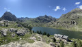
The first part of the magnificent circular walk starting from Castérino to explore the Vallée des Merveilles, passing by the Refuge de Fontanalba, the rock carvings in the Nature Reserve and the Voie Sacrée, and finishing at the Refuge des Merveilles.
Castérino – Saint-Dalmas-de-Tende
 6.97 mi
+633 ft
-3,451 ft
3h 45
Moderate
Departure from Tende (Alpes-Maritimes)
6.97 mi
+633 ft
-3,451 ft
3h 45
Moderate
Departure from Tende (Alpes-Maritimes)
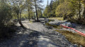
After two days in the high mountains, this route will take you back into the Roya Valley. You’ll look out over the Vallon de Castérino and Lac des Mesches, before descending rapidly to Saint-Dalmas-de-Tende via the Chemin des Bois.
From Casterino to the Refuge des Merveilles via Mont Bégo
7.66 mi
+3,917 ft
-2,034 ft
6h 55
Very difficult
Departure from Tende (Alpes-Maritimes)
Second stage of the five-day Vievola–Saint-Martin Vesubie hike.
⚠️ 18/08/2026: Route amended at point 4.
Nice Refuge - Merveilles Refuge
 5.74 mi
+1,995 ft
-2,303 ft
4h 20
Difficult
Departure from Belvédère (Alpes-Maritimes)
5.74 mi
+1,995 ft
-2,303 ft
4h 20
Difficult
Departure from Belvédère (Alpes-Maritimes)
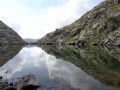
Starting from the Refuge de Nice, the fourth stage of this journey through the Mercantour is the shortest. Short but just as difficult. You’ll pass the Baisse du Basto, the highest point ofthe GR®52. You’ll cross over to Lac du Basto, then it’s the climb up the Baisse de la Valmasque, before descending into the Vallée des Merveilles.
Refuge de Nice - Refuge de la Madone de Fenestre
 3.36 mi
+1,512 ft
-2,533 ft
2h 50
Difficult
Departure from Belvédère (Alpes-Maritimes)
3.36 mi
+1,512 ft
-2,533 ft
2h 50
Difficult
Departure from Belvédère (Alpes-Maritimes)
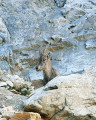
This route, which runs parallel to the border, is dominated throughout by the large peak of Gélas, the highest summit in the area.
Nice Mountain Hut – Madone de Fenestre Mountain Hut
 4.88 mi
+2,523 ft
-3,527 ft
7 hrs
Very difficult
Departure from Belvédère (Alpes-Maritimes)
4.88 mi
+2,523 ft
-3,527 ft
7 hrs
Very difficult
Departure from Belvédère (Alpes-Maritimes)
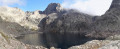
This second day will take you to the foot of the Cime du Gélas (just 200 m below the summit); you’ll walk for a long time alongside Lac Long and the superb Malédie. You’ll then head into another small valley to admire the Cime Saint-Robert. The Lac Blanc, from which the stream flows, is none other than the Vésubie, and of course, the Gélas on its western face. The route will become more familiar and less strenuous once you rejoin the path coming from the Lac de la Fenestre.
La Minière de Vallauria - Col de Turini
 12.49 mi
+4,009 ft
-3,635 ft
8 hrs
Very difficult
Departure from Tende (Alpes-Maritimes)
12.49 mi
+4,009 ft
-3,635 ft
8 hrs
Very difficult
Departure from Tende (Alpes-Maritimes)
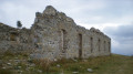
Thissecond stage is the most alpine of the three. At the Refuge des Merveilles, you’ll admire the beauty of the landscapes, from the Cime du Diable to the Vallon des Merveilles. You’ll pass several lakes before descending into a more Mediterranean-style valley at the Pas du Diable. With the Redoute des Trois Communes in sight for much of the way, you’ll walk along the old border ridge, dotted with defensive structures. Near the Authion, numerous ruins will remind you of the end of the last war.
Ascent to the Merveilles refuge from Lac des Mesches
 4.74 mi
+2,487 ft
-46 ft
4h 20
Moderate
Departure from Tende (Alpes-Maritimes)
4.74 mi
+2,487 ft
-46 ft
4h 20
Moderate
Departure from Tende (Alpes-Maritimes)
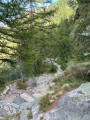
The Refuge des Merveilles can be a destination in itself or the starting point for a guided tour of the petroglyphs or other hikes. The climb to the refuge via Lac des Mesches takes 3 hours and 15 minutes (excluding breaks) and has the advantage of being accessible by car or public transport (see "Practical Information").