


Refine your search for walks in col du Vial (1223m)
col du Vial (1223m) walks


 Mont Vial from Malaussène
 Visorando Member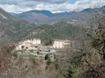
 12.02 mi
 +4,524 ft
 -4,518 ft
 9h 30
9h 30
 Difficult
 Departure from Malaussène (Alpes-Maritimes)
A beautiful route through the ‘moyen pays’ region, offering the chance to explore the village of Malaussène, the forest and the ridge of Mont Vial. The 360° panorama from Mont Vial is sublime, with views of both sea and mountains.
Walks near col du Vial (1223m)
The steep path on the western flank of Mont Arpasse
 6.19 mi
+1,424 ft
-2,136 ft
4h 05
Difficult
Departure from Alpes-Maritimes
6.19 mi
+1,424 ft
-2,136 ft
4h 05
Difficult
Departure from Alpes-Maritimes
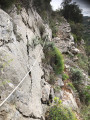
This unique one-way hike (allow for two vehicles) takes you up Mont Arpasse via the little-used south-eastern route. The final stretch is a path nearly 3 km long, sometimes carved into the cliff face, steep and vertiginous, clinging to the mountainous western flank of Mont Arpasse. It was built by the constructors of the Vésubie Canal in the 1870s and offers views of the Var throughout.
The section between marker 296 and the finish is reserved for experienced walkers.
Levens - Nice
13.55 mi
+2,077 ft
-3,734 ft
8h 00
Difficult
Departure from Alpes-Maritimes
Étape de la traversée des Alpes de Levens jusqu'à Nice. Randonnée permettant de traverser la bande littorale typiquement méditerranéenne et arriver à la Mer Méditerranée à Nice.
Utelle - Levens
7.41 mi
+1,870 ft
-2,680 ft
5h 00
 Moderate
Departure from Utelle (Alpes-Maritimes)
Moderate
Departure from Utelle (Alpes-Maritimes)
Etape de la traversée des Alpes d'Utelle jusqu'à Levens. Randonnée entre la vallée de la Vésubie et les derniers reliefs alpins.
From Utelle to Nice Ville railway station
 21.50 mi
+3,806 ft
-6,385 ft
13h 10
Difficult
Departure from Utelle (Alpes-Maritimes)
21.50 mi
+3,806 ft
-6,385 ft
13h 10
Difficult
Departure from Utelle (Alpes-Maritimes)
This twenty-first stage, once you have crossed the Vésubie, takes place in the Nice Pre-Alps and brings the GTA (Grande Traversée des Alpes) to a close by the sea. From the Place de la Fontaine in Utelle, the GR®5 heads west, then south, crossing a few small valleys to reach the hamlet of Cros d’Utelle. It crosses the Vésubie valley, climbs the opposite slope after the town of Levens, ascends through woodland to Colla Partida, passes beneath Mont Cima and descends to the beautiful circular fortified village of Aspremont. The path climbs the western flank of Mont Chauve d’Aspremont without reaching the summit. It descends the Crête de Graus until it reaches Château Renard and then La Bauma. The path enters a valley, which it follows eastwards, then due south towards La Fontaine Sainte, and crosses the bridge over the Autoroute de la Provençale. It enters the city of Nice, which it crosses from north to south to reach Nice Ville railway station.
 Croix de Verse via the Cheiron forest
 6.82 mi
+1,516 ft
-1,427 ft
5 hrs
Moderate
Departure from Alpes-Maritimes
6.82 mi
+1,516 ft
-1,427 ft
5 hrs
Moderate
Departure from Alpes-Maritimes
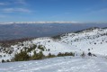
A beautiful snowshoe hike (or not in winter) with no difficulty and panoramic views of the Mercantour peaks and the French Riviera on a clear day.
After a pleasant first section in the Cheiron forest, you cross a small valley before climbing up to Plan des Baumetes and reaching the Crête du Cheiron at Croix de Verse (1,706 m).
360° view of the sea at Argentera!
Baou de Saint-Jeannet
 Association / Club / Walk leader
 3.69 mi
+1,217 ft
-1,138 ft
2h 45
Moderate
Departure from Saint-Jeannet (Alpes-Maritimes) (Alpes-Maritimes)
3.69 mi
+1,217 ft
-1,138 ft
2h 45
Moderate
Departure from Saint-Jeannet (Alpes-Maritimes) (Alpes-Maritimes)
An easy hike in spring or autumn.
At the top of the Baou, there is a magnificent view of the French Riviera with a very accurate orientation table to identify the points along the coast and the surrounding peaks.
The 4 Baous Circuit
10.28 mi
+3,547 ft
-3,363 ft
8 hrs
 Very difficult
Departure from Saint-Jeannet (Alpes-Maritimes) (Alpes-Maritimes)
Very difficult
Departure from Saint-Jeannet (Alpes-Maritimes) (Alpes-Maritimes)
A magnificent walk offering numerous views of the sea, the Var valley, and the coast with its various towns, headlands and islands (with a bit of luck, you might spot Corsica, Sainte-Victoire and the Mercantour peaks). However, this walk is challenging due to its length and elevation gain, and is therefore only suitable for fit walkers.
Moderator update on 6 April 2021: Please note! There is a private property issue between (11) and (12). See the suggestion in the description and in the reviews dated 24 April 2021.
Saint-Dalmas de Valdeblore - Utelle
15.74 mi
+4,354 ft
-5,919 ft
11h 00
Difficult
Departure from Valdeblore (Alpes-Maritimes)
Étape de la traversée des Alpes de Saint-Dalmas de Valdeblore jusqu'à Utelle. Randonnée sur une ligne de crête offrant des panoramas extraordinaires sur l'arrière pays niçois.
Saint-Dalmas de Valdeblore – Le Boréon
 12.91 mi
+4,491 ft
-3,720 ft
10 hrs
Very difficult
Departure from Valdeblore (Alpes-Maritimes)
12.91 mi
+4,491 ft
-3,720 ft
10 hrs
Very difficult
Departure from Valdeblore (Alpes-Maritimes)
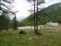
Second stage of the route and first stage on theGR®52. A long 21km stage taking in the Col de Veillos, numerous lakes, the Col du Barn, the Vacherie du Collet and the Col de Salèse, ending at a place called Le Boréon.
A spectacular stage thanks to its landscapes and views, but very difficult.
From Saint-Dalmas to Utelle
 15.80 mi
+4,124 ft
-5,745 ft
10h 50
Difficult
Departure from Valdeblore (Alpes-Maritimes)
15.80 mi
+4,124 ft
-5,745 ft
10h 50
Difficult
Departure from Valdeblore (Alpes-Maritimes)
This twentieth stage marks the end of the crossing of the Mercantour Massif. From Saint-Dalmas, the GR®5 heads south to climb the steep slope towards the Cime de Colmiane, which it bypasses by heading for the Col du Varaire. It crosses the Bois Noir and reaches the Col des Deux Caïres, then the Caïre Gros. The route follows its ridge and, hugging the hillside, passes beneath Mont Chalancha, La Partissuola and the Cime de la Combe before descending to the small pass of Trous. Before the Col du Fort, the path descends to the Granges de la Brasque, crosses the upper part of the Riou du Figaret valley and arrives at the Col d’Andrion. Cutting across the hairpin bends of the M33, the GR®5 reaches the Col des Fournès and the Col de Gratteloup. Through rocky gaps, it runs alongside the Petit Brec d’Utelle and then the Brec d’Utelle. From there, the path descends towards the Crête de l’Albaréa and reaches the Col du Castel Ginesté. It crosses the slope below the ridges of the Têtes du Sac de Bécasse, Parabosquet and Les Pennes to reach the Utelle community lodge.