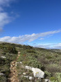
Baou de Saint-Jeannet

An easy hike in spring or autumn.
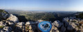
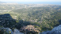
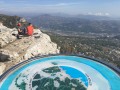
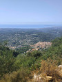
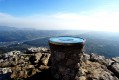
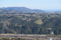
At the top of the Baou, there is a magnificent view of the French Riviera with a very accurate orientation table to identify the points along the coast and the surrounding peaks.

Details

2751
Creation:
Last update:
Last review:
  • Walking
    Activity: Walking
  • ↔
    Distance: 3.69 mi
  • ◔
    Average duration: 2h 45 
  • ▲
    Difficulty: Moderate

  • ⚐
    Back to start: No
  • ↗
    Ascent: + 1,217 ft
  • ↘
    Descent: - 1,138 ft

  • ▲
    Highest point: 2,589 ft
  • ▼
    Lowest point: 1,388 ft

Photos

Description of the walk

Park in the car park at the top of St Jeannet (see note in the Practical Information section).
(S/E) From the car park, signpost 90 will take you to the centre of the village. After 200 metres, take the street opposite the war memorial, Rue de la Croix. Turn right onto a small street that climbs very steeply to reach Rue du Baou.

(1) Turn right and climb steeply. After four hairpin bends, you will reach marker 94, which indicates theGR®51.
The path is very wide and less steep than the village streets. After 900 metres, you will reach signpost 84 at the crossroads of two paths.

(2) Turn left, leaving theGR®51, and head south-west to the junction with signpost 85.

(3) Turn left heading south on the path that ends at the top of Baou de St-Jeannet.
Take advantage of the orientation table and the magnificent view. The cliff is truly impressive, and the village is right at your feet.

(4) Retrace your steps to return to marker 85.

(3) Continue north to La Roque, turn left onto the path and rejoin theGR®51further on.
Note: at the Grotte Scelo, the yellow trail does not follow the route on the map. (See GPS data).

(5) Turn right, pass marker 83 and continue to the crossroads at marker 84.

(2) Retrace your steps to return to the car park (S/E).

Waypoints

  1. S : mi 0 - alt. 1,394 ft - Parking at the top of St Jeannet
  2. 1 : mi 0.21 - alt. 1,486 ft - Rue du Baou
  3. 2 : mi 0.97 - alt. 2,169 ft - Beacon 84
  4. 3 : mi 1.35 - alt. 2,559 ft - Marker 85
  5. 4 : mi 1.63 - alt. 2,579 ft - Baou de St-Jeannet
  6. 5 : mi 2.44 - alt. 2,526 ft - Beacon 83
  7. E : mi 3.69 - alt. 1,453 ft - Parking at the top of St Jeannet

Notes

Arrive early enough to park at the top of the village of St Jeannet, 8 km from Vence. We arrived at 10 a.m. in February and there were no spaces left!
Please note! On old maps published in 2000, there are marker numbers that are still on the ground but no longer appear on the new maps.
Please note! There are no water points on the route! Avoid doing this in the middle of summer!
We did this route with two young children without any problems, but be careful at certain times of the year as it can get very hot! Don't forget to take enough water to stay hydrated!

Worth a visit

See the centuries-old oak tree on the Baou de la Gaude. The Scelo cave is very close to the path on the way up.

Always be cautious and plan ahead when you're outdoors. Visorando and the author of this route cannot be held responsible for any accidents occurring on this route.

The GR® and PR® markings are the intellectual property of the Fédération Française de Randonnée Pédestre.

Reviews and comments

4.7 / 5
Based on 65 reviews

Reliability of the description
4.6 / 5
Ease of following the route
4.7 / 5
Route interest
4.7 / 5
User 29052146

Overall rating : 4.3 / 5

Date of your route : Apr 27, 2026
Reliability of the description : ★★★★☆ Good
Ease of following the route : ★★★★☆ Good
Route interest : ★★★★★ Very good
Very busy route : No

A lovely find!

Machine-translated

User 27607347

Overall rating : 5 / 5

Date of your route : Apr 20, 2026
Reliability of the description : ★★★★★ Very good
Ease of following the route : ★★★★★ Very good
Route interest : ★★★★★ Very good
Very busy route : Yes

A difficult route, not an average one

Machine-translated

Dominique Perichon
Dominique Perichon

Overall rating : 4.7 / 5

Date of your route : Mar 19, 2026
Reliability of the description : ★★★★☆ Good
Ease of following the route : ★★★★★ Very good
Route interest : ★★★★★ Very good
Very busy route : No

A very pleasant hike with a magnificent view from the summit.
The climb has a slightly tricky section over the rocks but is easily managed.
The suggested return route is pleasant and easier for the descent
Thank you, Visiorando.

Machine-translated

Remi_22
Remi_22

Overall rating : 4.3 / 5

Date of your route : Mar 27, 2026
Reliability of the description : ★★★★☆ Good
Ease of following the route : ★★★★★ Very good
Route interest : ★★★★☆ Good
Very busy route : Yes

A very beautiful route, but very touristy and very busy, even if you set off at 7:00 am in March. The view from the summit is magical, and to round off the route a bit, I went to the summit of Riorun at 846m, right next to point 5. It’s much wilder there than at Baou Saint-Jeannet, and the view of the Mercantour with its snow-capped peaks is absolutely incredible!

Machine-translated

Isabelle54
Isabelle54

Overall rating : 5 / 5

Date of your route : Mar 24, 2026
Reliability of the description : ★★★★★ Very good
Ease of following the route : ★★★★★ Very good
Route interest : ★★★★★ Very good
Very busy route : Yes

There’s a lovely view of the coast from the top of the baou.
Please note there is very limited parking in the village. The trail is very popular with hikers and climbers.

Machine-translated

Chafic
Chafic

Overall rating : 5 / 5

Date of your route : Oct 27, 2025
Reliability of the description : ★★★★★ Very good
Ease of following the route : ★★★★★ Very good
Route interest : ★★★★★ Very good
Very busy route : Yes

Beautiful view at the summit, even though it was a bit crowded on this lovely October Sunday.
The climb is short but quite steep.
The car parks were full by 11 a.m.

Machine-translated

User 18981897

Overall rating : 5 / 5

Date of your route : Oct 07, 2025
Reliability of the description : ★★★★★ Very good
Ease of following the route : ★★★★★ Very good
Route interest : ★★★★★ Very good
Very busy route : Yes

A very beautiful route taken as a group in early October 2025. It is strongly recommended to park your car in the free René Veyssi car park (limited to 3 hours with a parking disc) or in the 2 car parks below it, P2 or P3, which have no time limit.
https://maps.app.goo.gl/BcmkHKZckd1wezEi...
Avoid driving through the village if you arrive at the Saint-Jeannet car park to reach the car parks above!

Machine-translated

BernardGarcia
BernardGarcia

Overall rating : 5 / 5

Date of your route : Apr 03, 2025
Reliability of the description : ★★★★★ Very good
Ease of following the route : ★★★★★ Very good
Route interest : ★★★★★ Very good
Very busy route : Yes

An excellent medium-level hike with breathtaking views at the top of the Baou.

Machine-translated

plainemontagne0750
plainemontagne0750

Overall rating : 3.7 / 5

Date of your route : Dec 02, 2024
Reliability of the description : ★★★★☆ Good
Ease of following the route : ★★★★☆ Good
Route interest : ★★★☆☆ Average
Very busy route : Yes

On Sundays, it's a boulevard and the Place de la Concorde!
The return journey was quieter, but also longer, via Le Castellet.

Machine-translated

Malland
Malland

Overall rating : 4 / 5

Date of your route : Nov 14, 2024
Reliability of the description : ★★★★☆ Good
Ease of following the route : ★★★★☆ Good
Route interest : ★★★★☆ Good
Very busy route : Yes

A short but pleasant walk.
The section between points 2 and 3 is a little surprising, with rocky areas that I don't think are very suitable for very young children. I wouldn't recommend this downhill section (rocks and slippery sections). Unless I've missed the right path
The section between points 3 and 4 goes fairly quickly with no real path once you've passed the cairns. It's up to you to choose your path among the small rocks.
A superb view from the orientation table, which has unfortunately been vandalised.
There were a few people on the platform at lunchtime with two groups of hikers, but otherwise few people on the paths.
It was easier to find the best path from the platform. I would advise families with very young children to do the same route on the outward journey and on the return journey. So 1-2-5-3-4 and back in the same way.
As for the GR51, it's in excellent condition all the way.

Machine-translated

Sak
Sak

Overall rating : 4.7 / 5

Date of your route : Nov 10, 2024
Reliability of the description : ★★★★☆ Good
Ease of following the route : ★★★★★ Very good
Route interest : ★★★★★ Very good
Very busy route : Yes

Walk made with 2 children aged 10 and 12. Accessible and not difficult.

Machine-translated

randonneurintrépide
randonneurintrépide

Overall rating : 5 / 5

Date of your route : Oct 22, 2024
Reliability of the description : ★★★★★ Very good
Ease of following the route : ★★★★★ Very good
Route interest : ★★★★★ Very good
Very busy route : Yes

We extended our walk by visiting the drystone shelters. There are lots of interesting ones.

Machine-translated

Mika067
Mika067

Overall rating : 5 / 5

Date of your route : Nov 01, 2024
Reliability of the description : ★★★★★ Very good
Ease of following the route : ★★★★★ Very good
Route interest : ★★★★★ Very good
Very busy route : No

Doing it early in the morning to see the sunrise is simply magnificent.

Machine-translated

PAACAAL
PAACAAL

Overall rating : 5 / 5

Date of your route : Oct 14, 2024
Reliability of the description : ★★★★★ Very good
Ease of following the route : ★★★★★ Very good
Route interest : ★★★★★ Very good
Very busy route : Yes

It's no great adventure, but you're never disappointed by this great classic, for which you have to leave early to avoid crowds. And even earlier to see the sun rise. You may never forget it....
Watch out for stones polished and smeared with clay by the footsteps of walkers. Zip and Boom!

Machine-translated

Milan Rozonics
Milan Rozonics

Overall rating : 3.7 / 5

Date of your route : Oct 05, 2024
Reliability of the description : ★★★★☆ Good
Ease of following the route : ★★★☆☆ Average
Route interest : ★★★★☆ Good
Very busy route : Yes

It's an exciting trail that's not too difficult, with beautiful scenery.

Machine-translated

Other walks in the area

For more walks, use our search engine .

The GPS track and description are the property of this route's author. Please do not copy them without permission.