The 4 Baous Circuit

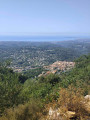
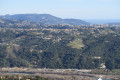
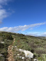
A magnificent walk offering numerous views of the sea, the Var valley, and the coast with its various towns, headlands and islands (with a bit of luck, you might spot Corsica, Sainte-Victoire and the Mercantour peaks). However, this walk is challenging due to its length and elevation gain, and is therefore only suitable for fit walkers.
Moderator update on 6 April 2021: Please note! There is a private property issue between (11) and (12). See the suggestion in the description and in the reviews dated 24 April 2021.

Details

1079138
Creation:
Last update:
Last review:
  • Walking
    Activity: Walking
  • ↔
    Distance: 10.28 mi
  • ◔
    Duration according to the author: 8 hrs 
  • ▲
    Difficulty: Very difficult

  • ⚐
    Back to start: No
  • ↗
    Ascent: + 3,547 ft
  • ↘
    Descent: - 3,363 ft

  • ▲
    Highest point: 2,746 ft
  • ▼
    Lowest point: 1,007 ft

Description of the walk

Head back to the car park at the entrance to Saint-Jeannet.

(S) Pass marker no. 99 to take the tarmac road beneath the Baou de la Gaude, which follows theGR®51marked in red and white; follow it to marker no. 98.

(1) Leave the road and take the path which crosses a stream that is often dry; this involves a steep climb alongside an underground pipe. Reach marker no. 74 (shown on the map but missing at the time of this walk).

(2) Turn left onto the ascending track, leaving theGR® here, and continue to the junction at marker no. 75. Turn left towards Baou de la Gaude. You’ll come to another junction at marker no. 97.

(3) Take the path on the left to reach the summit of the first Baou, the Baou de la Gaude. Enjoy the remarkable view.

(4) Return via the same route to marker no. 97.

(3) Continue the descent, reach marker 96, turn left to quickly reach the junction at marker 95 on theGR®51.

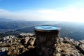
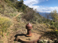
(5) Start the climb on the right; at marker 84, turn left, and do the same at marker 85. Reach the second Baou, that of Saint-Jeannet. Take in the view from the orientation table at this Baou, with a geocache nearby.

(6) Head back down to marker no. 95, following the same route as on the way up.

(5) Turn right onto theGR®51along the 4x4 track leading to Saint-Jeannet. Before reaching the village, you’ll come to marker no. 94 and the barrier blocking access to cars.

(7) Go through the barrier and continue straight ahead to reach Saint-Jeannet from the top. Walk through the village and arrive in front of the school, taking whichever route you prefer (stairs, narrow streets).

(8) Head down the tarmac road until you reach the Saint-Jeannet–Vence road.

(9) Turn right onto it.

::10;; Cross the River Cagne. Continue to the junction with the road leading to Les Canons.

(11) Editor’s note: issue with private property on the original route; suggestion: continue straight ahead on the road then take the first path on the right. At the T-junction, turn right to reach ::11:

Head up this road to the right. At the hamlet of Les Canons, take the path on the left which joins the Chemin du Riou.

(12) Turn right onto this track, continue straight on and reach marker no. 122.

(13) Leave the track and start the climb to the left along a winding path. You’ll emerge onto the ridge at marker no. 123.

(14) Turn left to quickly reach the third Baou, the Baou des Noirs. Enjoy the view.

(15) Head back down to the previous junction.

(14) Continue along the ridge opposite, then veer left to return to the junction marked by signpost no. 124. Turn left and reach the junction marked by signpost no. 125. Keep left and head towards signpost no. 139. Stay on the left-hand path to reach a junction with a track on the right.

(16) Climb up to the left to reach the fourth Baou, the Baou des Blancs.

(17) Return to the junction with the path.

(16) Take the path to the left and complete the descent to the memorial stone on the road to the Col de Vence (E).

Waypoints

  1. S : mi 0 - alt. 1,358 ft - Saint-Jeannet car park
  2. 1 : mi 0.62 - alt. 1,565 ft - Marker no. 98
  3. 2 : mi 1.13 - alt. 2,044 ft - Marker no. 74
  4. 3 : mi 2.16 - alt. 2,680 ft - Marker no. 97
  5. 4 : mi 2.47 - alt. 2,582 ft - Baou de la Gaude
  6. 5 : mi 3.31 - alt. 2,060 ft - Marker no. 95
  7. 6 : mi 4.02 - alt. 2,585 ft - Baou de Saint-Jeannet
  8. 7 : mi 5.21 - alt. 1,732 ft - Marker no. 94
  9. 8 : mi 5.69 - alt. 1,355 ft - School
  10. 9 : mi 6.32 - alt. 1,020 ft - Route Saint-Jeannet – Vence
  11. 10 : mi 6.77 - alt. 1,007 ft - Cagne (fleuve)
  12. 11 : mi 6.98 - alt. 1,053 ft - ‘Les Canons’ route
  13. 12 : mi 7.37 - alt. 1,391 ft - Chemin du Riou
  14. 13 : mi 7.58 - alt. 1,388 ft - Marker no. 122
  15. 14 : mi 8.07 - alt. 2,123 ft - Marker no. 123
  16. 15 : mi 8.17 - alt. 2,211 ft - Baou des Noirs
  17. 16 : mi 9.71 - alt. 2,070 ft - Crossroads of the trail
  18. 17 : mi 9.84 - alt. 2,116 ft - Baou des Blancs or Baou de Vence
  19. E : mi 10.28 - alt. 1,542 ft - Route du Col de Vence. Near the - Lubiane (rivière)

Notes

If you have two cars, a shuttle (less than 10 km) makes the return journey easier; otherwise, walk down to Vence bus station and take a bus back to Saint-Jeannet.

I did the walk in this direction, but the other way seems more sensible to me for reaching the Baou de Saint-Jeannet orientation table via the climbers’ route and avoiding a section shared with other routes; please note that the section between the rock outcrops is tricky (navigating the path and level 3 climbing sections).

Worth a visit

Make the most of the various viewpoints.
The contrast between the coast and the hinterland is striking.

Always be cautious and plan ahead when you're outdoors. Visorando and the author of this route cannot be held responsible for any accidents occurring on this route.

The GR® and PR® markings are the intellectual property of the Fédération Française de Randonnée Pédestre.

Reviews and comments

4.4 / 5
Based on 3 reviews

Reliability of the description
4.7 / 5
Ease of following the route
4 / 5
Route interest
4.7 / 5
Ericaw
Ericaw
• Edited:

Overall rating : 4.3 / 5

Date of your route : May 03, 2026
Reliability of the description : ★★★★★ Very good
Ease of following the route : ★★★☆☆ Average
Route interest : ★★★★★ Very good
Very busy route : Yes

Hello!
I went on this hike with my son on 2 May 2026.
Stunning panoramic views from the top of the Baous de la Gaude, Saint-Jeannet, Les Noirs and Les Blancs.
PLEASE NOTE: although the route description has been updated, the GPX track has not been updated!
I assumed the route had been updated to match the description, and as a result, we ended up on private property with ‘beware of the dog’ signs…
Otherwise, a great hike.
Completed in 6 hours 55 minutes at a leisurely pace.
Distance 19.26 km
Elevation gain: 1,142 m, elevation loss: 1,100 m

Machine-translated

claireanna
claireanna

Overall rating : 5 / 5

Date of your route : May 29, 2021
Reliability of the description : ★★★★★ Very good
Ease of following the route : ★★★★★ Very good
Route interest : ★★★★★ Very good
Very busy route : No

Hello,

I did the walk in the opposite direction, from Vence to St Jeannet, and coming from Antibes I took the train to Cagnes-sur-Mer and then bus number 9 up to Vence, which took me about forty minutes. Similarly, in St Jeannet, I took bus 54 and then the train from Saint-Laurent-du-Var. It’s perfectly doable as there are plenty of buses and trains on Saturdays. As for sections 10, 11 and 12, instead of taking the private paths, I followed the instructions from Aveauville; the path from Chemin de Riou is indeed very steep, then I crossed the footbridge and took the path leading to marker 81 (this path runs alongside a house).

Other than that, it was a brilliant walk, with fantastic views from the four Baous.

Machine-translated

lorenzo1962
lorenzo1962

Overall rating : 4 / 5

Date of your route : May 24, 2021
Reliability of the description : ★★★★☆ Good
Ease of following the route : ★★★★☆ Good
Route interest : ★★★★☆ Good
Very busy route : Yes

We walked from Vence to Saint Jeannet; the only concern, of course, was passing through ‘private property’. On the advice of locals, we took a footpath that allowed us to descend into the valley and then climb up the western side of the Baou de Saint Jeannet, avoiding the road and the need to cross through Saint Jeannet (and, whilst we were at it, avoiding the climb via Saint Jeannet, which is extremely busy).
A lovely route, but perhaps it might be possible to stay on the ridges between the Baou Noir and the Baou de Saint Jeannet… I do mean ‘perhaps’.

Machine-translated

abeauville
abeauville

Suggestion to avoid the problem of the climb (10)–(11)–(12), as well as the long, arduous stretch along the busy Saint-Jeannet–Vence road:
(6) Retrace your steps; at marker 85, take the (signposted) path on the left.
(7) Turn left at marker 83, then left again at marker 80.
(8) At marker (81), head down to the right towards La Cagne (path marked in yellow, clearly defined, but not shown on the IGN map). You’ll come to a footbridge; cross it.
(9) At the end of the footbridge, turn right onto the very well-defined path (but unmarked and not shown on the map). Steep climb up to the Chemin du Riou.
(10) Take the Chemin du Riou to the left for about 1 km until you reach marker 122; see (12).

Machine-translated

abeauville
abeauville

The section from 10 to 11 via Les Canons is actually a series of private tracks that are off-limits. We were able to go up after negotiating with one of the landowners, but according to him, others are far less tolerant.

Machine-translated

Other walks in the area

For more walks, use our search engine .

The GPS track and description are the property of this route's author. Please do not copy them without permission.