The Crête de Glaisette, starting from Brunissard

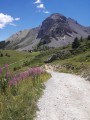
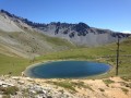
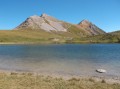
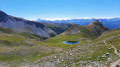
This circular route around the Col Tronchet takes you to the summit of the Crête de Glaisette, where you can enjoy a remarkable panoramic view of the Queyras mountains.

Details

13569049
Creation:
Last update:
Last review:
  • Walking
    Activity: Walking
  • ↔
    Distance: 5.52 mi
  • ◔
    Average duration: 4h 15 
  • ▲
    Difficulty: Moderate

  • ⚐
    Back to start: Yes
  • ↗
    Ascent: + 1,965 ft
  • ↘
    Descent: - 1,936 ft

  • ▲
    Highest point: 7,805 ft
  • ▼
    Lowest point: 5,958 ft

Description of the walk

Park in the Draye car park, situated on the side of the D 902 road at the hairpin bend
- before Brunissard when coming from Briançon,
- after Brunissard when coming from Arvieux.

(S/E) Cross the road and, at the signpost, take the path downhill. Head towards the junction with a track.

(1) Turn left onto theGR®58, marked in red and white and shared with theGRP® Tour de la Dent du Ratier, and begin a relatively steep climb. Reach the Torrent du Pinet ravine.

(2) Continue along theGR®, reach the Pouït junction and join thePR® path leading up to the Aiguillettes. Continue to the left to reach an almost level path.

(3) Turn right and, after a gentle climb, reach the Col du Tronchet. Leave theGR® here and continue to the right to reach the summit of the Crête de Glaisette.

(4) Follow the route back in the opposite direction to return to the junction you passed earlier.

(3) Head straight ahead, continuing on an almost flat path. Pass the path leading to Lac de Souliers on your right. Continue through the forest and, via a very gentle descent, reach the Casse Déserte car park.

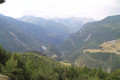
(5) Take the descending path straight ahead, signposted ‘Brunissard’ on a wooden sign. Continue down the slope until you reach the Torrent de l’Izoard. Then head left into a sort of canyon with magnificent white rocks to reach the Draye car park (S/E).

Waypoints

  1. S/E : mi 0 - alt. 6,017 ft - La Draye car park
  2. 1 : mi 0.52 - alt. 5,971 ft - GR junction
  3. 2 : mi 1.31 - alt. 6,755 ft - Torrent du Pin
  4. 3 : mi 2.06 - alt. 7,566 ft - Crossroads. Return route to the Crête de Glaisette
  5. 4 : mi 2.5 - alt. 7,736 ft - Crête de Glaisette - Col du Tronchet
  6. 5 : mi 4.23 - alt. 7,215 ft - Casse Déserte car park
  7. S/E : mi 5.52 - alt. 6,017 ft - La Draye car park

Notes

Please note there is no water at this car park; make sure you bring enough with you.

Worth a visit

(4) A stunning 360° view of the Queyras mountains, particularly its two highest peaks: Rochebrune and La Font Sancte.
(5) The Casse Déserte site, famous for its coverage of the Tour de France cycle race, is well worth a stop to admire the magnificent rock formations here.

Always be cautious and plan ahead when you're outdoors. Visorando and the author of this route cannot be held responsible for any accidents occurring on this route.

The GR® and PR® markings are the intellectual property of the Fédération Française de Randonnée Pédestre.

Reviews and comments

5 / 5
Based on 2 reviews

Reliability of the description
5 / 5
Ease of following the route
5 / 5
Route interest
5 / 5
Bernard ROUSSEL
Bernard ROUSSEL

Overall rating : 5 / 5

Date of your route : Aug 24, 2024
Reliability of the description : ★★★★★ Very good
Ease of following the route : ★★★★★ Very good
Route interest : ★★★★★ Very good
Very busy route : No

A lovely route with a few steep slopes, which make reaching the pass all the more rewarding. A magnificent 360° view from the ridge. A spectacular descent from the Casse Déserte car park along the torrent.
Well worth doing again at the start of the season when the flowers are in bloom.

Machine-translated

Gendrot Sylvie
Gendrot Sylvie

Overall rating : 5 / 5

Date of your route : Aug 21, 2023
Reliability of the description : ★★★★★ Very good
Ease of following the route : ★★★★★ Very good
Route interest : ★★★★★ Very good
Very busy route : No

A lovely walk, with varied trails and a superb view at the end, offering a 360-degree panorama.

Machine-translated

Other walks in the area

For more walks, use our search engine .

The GPS track and description are the property of this route's author. Please do not copy them without permission.