Col du Replat

This alpine hike allows you to get a taste of the high peaks and soak up the high-mountain atmosphere in an exceptional setting.
(The final section of the route is on a glacier and requires familiarity with this type of terrain)

Details

n°315488
Creation:
Last update:
Last review:
  • Walking
    Activity: Walking
  • ↔
    Distance: 13.09 mi
  • ◔
    Duration according to the author: 8 hrs 
  • ▲
    Difficulty: Very difficult

  • ⚐
    Back to start: Yes
  • ↗
    Ascent: + 5,705 ft
  • ↘
    Descent: - 5,732 ft

  • ▲
    Highest point: 10,915 ft
  • ▼
    Lowest point: 5,351 ft

Photos

Description of the walk

Coming from Grenoble, drive through Bourg d’Oisans and head towards Saint Christophe en Oisans via the Route de la Bérarde.
Pass through the hamlet of Saint Christophe, then take the first road on the left towards Layrette and Les Prés; follow the road uphill to the car park at 1,635 m and park here.

(S/E) Start north of the car park, follow the path to the stream, which you cross via a footbridge, then continue to a junction of paths.

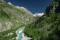
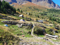
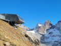
(1) Take the path on the right which climbs up the valley, on the right bank of the Torrent du Diable, to the Refuge de la Selle at 2,673 m.

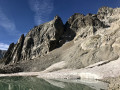
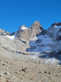
(2) Continue north-east past the refuge to reach the glacier at around 2,860m.

(3) From here, you enter high-mountain terrain: continuing is reserved for very experienced hikers accustomed to this type of glacier traverse,
Set foot on the Selle Glacier, heading for the Col du Replat at the top of a steeper snow slope (glacier) to the east-southeast. Reach the foot of the pass at around 3,140 metres.

(4) It is essential to put on crampons here (if you haven’t already done so) for the final ascent, which is significantly steeper. You will then reach the Col du Replat (3,335 m).

(5) Follow the same route back to return to the car park (S/E).

Waypoints

  1. S/E : mi 0 - alt. 5,377 ft - Car park 1639
  2. 1 : mi 0.27 - alt. 5,528 ft - Crossroads
  3. 2 : mi 4.53 - alt. 8,783 ft - Refuge de la Selle
  4. 3 : mi 5.71 - alt. 9,698 ft - La Selle Glacier
  5. 4 : mi 6.3 - alt. 10,322 ft - At the foot of the steep slope
  6. 5 : mi 6.55 - alt. 10,883 ft - Col du Replat
  7. S/E : mi 13.09 - alt. 5,377 ft - Car park

Notes

The hike can be split up with an overnight stay at the Refuge de la Selle.
There are numerous streams along the route to the refuge where you can fill up with water.
As this is a round-trip hike, everyone can set their own goal and turn back according to their ambitions (mountain hut, glacier or pass).
Walking on a glacier requires specific precautions; if your destination is the pass, crampons are essential.

You’ll be hiking in the heart of the Écrins National Park.

The Écrins massif is an exceptional area, open to all, with a natural, cultural and scenic heritage that is truly unique. To protect these treasures, the heart of the park is marked by blue-white-red flags, and certain regulations must be observed. Please familiarise yourself with these regulations when planning your hike, to help preserve this shared heritage, at https://www.ecrins-parcnational.fr.

Worth a visit

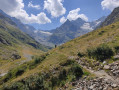
During the climb to the refuge, you can admire a wide variety of flowers.
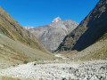
Magnificent scenery above the refuge.
From the pass, a magnificent panorama: the Glacier de la Selle, the Pic de la Grave, the Râteau and the Barre des Ecrins.

Reviews and comments

4.5 / 5
Based on 2 reviews

Reliability of the description
4.5 / 5
Ease of following the route
4.5 / 5
Route interest
4.5 / 5
sempervivum
sempervivum

Overall rating : 4.7 / 5

Date of your route : Nov 03, 2026
Reliability of the description : ★★★★★ Very good
Ease of following the route : ★★★★★ Very good
Route interest : ★★★★☆ Good
Very busy route : No

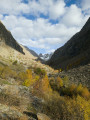
A bit of a late-season hike: many of the tributaries were frozen over and the footbridge over the Puy stream had been taken down for the winter. I put on my crampons to cross some of them. Making progress over the scree slopes is quite difficult; the path has sometimes been washed away by the torrents. I stopped at the unmanned mountain hut, which is a good starting point for the surrounding glaciers. There were some lovely deciduous trees at the start of the walk. I didn’t see a soul all day, just a chamois. The GPS track shows 14.7 kilometres there and back.

Machine-translated

Garnesier
Garnesier

Overall rating : 4.3 / 5

Date of your route : Aug 13, 2018
Reliability of the description : ★★★★☆ Good
Ease of following the route : ★★★★☆ Good
Route interest : ★★★★★ Very good

The GPS showed 10 km to the refuge, not 7 km – the valley of the Selle is endless...

Machine-translated

Other walks in the area

For more walks, use our search engine .

The GPS track and description are the property of this route's author. Please do not copy them without permission.