


Refine your search for walks in Col du Prat du Rey (1185m)
Col du Prat du Rey (1185m) walks


 Long circular loop of the Pibeste-Aoulhet Reserve
 Visorando Member
 15.30 mi
 +5,512 ft
 -5,512 ft
 10 hrs
 Very difficult
 Departure from Saint-Pé-de-Bigorre (Hautes-Pyrénées)
An exceptional, challenging and demanding route through the Très-Croutz forest, first on the Gave de Pau side, with a brief detour to the Val d'Azun side at the Col d'Andorre, then on the plateau at 1,400 m, between the Col d'Espadres and the Saint-Pé ridge (Maletaule or Soums).Summer pastures with centuries of pastoral activity, at the crossroads of important local historical sites, including the famous Très Croutz (the Three Crosses of the Bigourdan bishoprics).
Walks near Col du Prat du Rey (1185m)
The Henri IV Trail
 20.70 mi
+732 ft
-1,421 ft
10h 10
20.70 mi
+732 ft
-1,421 ft
10h 10
 Difficult
Departure from Lourdes (Hautes-Pyrénées)
Difficult
Departure from Lourdes (Hautes-Pyrénées)
A beautiful route linking Lourdes to Pau along an ancient Roman road steeped in history. The Henri IV trail stretches across the Hautes-Pyrénées and Pyrénées-Atlantiques departments, along the foothills of the Pyrenees.
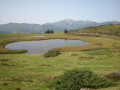
From the Col de Couraduque to the Col du Soulor via Lac de Soum
 5.01 mi
+1,083 ft
-738 ft
3h 15
5.01 mi
+1,083 ft
-738 ft
3h 15
 Average
Departure from Aucun (Hautes-Pyrénées)
Average
Departure from Aucun (Hautes-Pyrénées)
An easy walk with some lovely views. Using two cars (one at Couraduque and one at Soulor) makes this walk accessible to everyone. Otherwise, you can return via the same route in the opposite direction.
The valleys of Yerse and Aguée via Arriousec to Peyras
 10.62 mi
+4,695 ft
-4,678 ft
8 hrs
Very difficult
Departure from Asson (Pyrénées-Atlantiques)
10.62 mi
+4,695 ft
-4,678 ft
8 hrs
Very difficult
Departure from Asson (Pyrénées-Atlantiques)
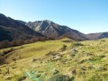
On the forgotten trails of Saint-Pé-de-Bigorre No. 5A long journey from the Ouzom Valley, through Les Aoules, to the Génies Valley, in the unfathomable Saint-Pé massif.In all seasons, the landscapes and forests are impressive and majestic.Its main attraction lies in the beauty of the two valleys crossed from end to end: the Yerse and the Aguée, sites of ancestral pastoralism where shepherds and their flocks lived from June to October. There are still many traces of this to be found.
From Les Aoules to Ferrières via the Soum de Souste and the Soum d’Arangou
4.42 mi
+2,241 ft
-1,962 ft
4h 00
Average
Departure from Arthez-d'Asson (Pyrénées-Atlantiques)
This walk is only suitable for walkers who are comfortable with steep and long climbs. This rarely used route offers a peaceful walk in absolute silence in the shade of the Monbula woods. You must first leave a car at the finish point on the D126, on the left-hand side of the road, and then walk to the Aoules car park. The walk can be done in either direction, but the descent towards Ferrières will be easier.
3 days in the Central Pyrenees Park from Cauterets
 30.88 mi
+10,197 ft
-10,226 ft
3 days
Difficult
Departure from Cauterets (Hautes-Pyrénées)
30.88 mi
+10,197 ft
-10,226 ft
3 days
Difficult
Departure from Cauterets (Hautes-Pyrénées)
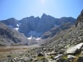
Explore the Pyrenees National Park (central section) with a trip to Spain, lakes and mountain passes at an altitude of 2,600 metres.
With an average elevation gain of ± 1,230 m and a distance of 17 km per day, this trip is, all in all, quite strenuous.
Please take into account the cumulative elevation gain and the distance to be covered.
The trip takes place between 1000 m and 2655 m altitude.
The start of this route is accessible by public transport (coaches and shuttle bus from Cauterets in summer).
From Cauterets to Ilhéou
 9.24 mi
+4,295 ft
-1,217 ft
8h 00
Average
Departure from Cauterets (Hautes-Pyrénées)
9.24 mi
+4,295 ft
-1,217 ft
8h 00
Average
Departure from Cauterets (Hautes-Pyrénées)
First day of a three-day route in the Central Pyrenees National Park.
This circular is best done from mid-June until the first cold spells.
Ascent to Lac Noir, Col d'Ilhéou, Ilhéou Refuge and Lac d'Ilhéou.