


Refine your search for walks in Col du Galibier
Col du Galibier walks


 From the Col du Lautaret to the Col du Galibier by road
 Visorando Member
 10.08 mi
 +1,683 ft
 -1,677 ft
 6h 05
6h 05
 Moderate
 Departure from Le Monêtier-les-Bains (Hautes-Alpes)
A unique hike, presenting no real difficulty, suitable for everyone and offering extraordinary scenery!
Best done in spring or autumn, when the Col du Galibier road is closed to traffic.
Walks near Col du Galibier
From the Col du Lautaret to the Alpe de Villard d'Arène
 3.99 mi
+463 ft
-315 ft
2h 15
Moderate
Departure from Villar-d'Arêne (Hautes-Alpes)
3.99 mi
+463 ft
-315 ft
2h 15
Moderate
Departure from Villar-d'Arêne (Hautes-Alpes)
Stage1 of the Tour du Combeynot: From the Col du Lautaret to the Alpe de Villar-d'Arêne refuge via the schistose crevasse trail overlooking the Romanche valley. Unique view of the Écrins and Meije peaks.
Lac des Cerces - Lacs de la Madeleine via Pointe des Cerces
 7.84 mi
+3,963 ft
-3,261 ft
8 hrs
7.84 mi
+3,963 ft
-3,261 ft
8 hrs
 Very difficult
Departure from Valloire (Savoie)
Very difficult
Departure from Valloire (Savoie)
Day 2 in the Clarée Valley: ascent of Pointe des Cerces (unmarked mountain route), passage to Lac and Source de la Clarée and climb to the second bivouac at Lacs de la Madeleine (off-trail on the final section).
As with the other parts of this circular, this route is intended for experienced hikers who are accustomed to high mountains.
Lac de la Ponsonnière – Refuge des Drayères
 5.88 mi
+640 ft
-1,909 ft
3h 15
Moderate
Departure from Le Monêtier-les-Bains (Hautes-Alpes)
5.88 mi
+640 ft
-1,909 ft
3h 15
Moderate
Departure from Le Monêtier-les-Bains (Hautes-Alpes)
This second, slightly easier stage takes us past four magnificent lakes: Lac des Cerces, Lac du Grand Ban, Lac Rond and Lac de la Clarée
From Le Lauzet to the Col du Lautaret
4.19 mi
+1,325 ft
-26 ft
3h 05
Moderate
Departure from Le Monêtier-les-Bains (Hautes-Alpes)
Stage4 of the Tour du Combeynot: from the Guisane Valley to the Col du Lautaret
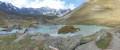
From Alpe de Villard-d'Arène to Monêtier-les-Bains
 9.74 mi
+1,289 ft
-3,261 ft
5h 35
Moderate
Departure from Villar-d'Arêne (Hautes-Alpes)
9.74 mi
+1,289 ft
-3,261 ft
5h 35
Moderate
Departure from Villar-d'Arêne (Hautes-Alpes)
Stage2 of the Tour du Combeynot: From the Romanche to the Guisane Valley via the Col d'Arsine, this stage takes place at the foot of the Agneaux
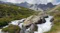
Alpe de Villar d'Arêne Mountain Hut - Monêtier-les-Bains
 9.66 mi
+1,266 ft
-3,271 ft
5h 35
9.66 mi
+1,266 ft
-3,271 ft
5h 35
 Difficult
Departure from Villar-d'Arêne (Hautes-Alpes)
Difficult
Departure from Villar-d'Arêne (Hautes-Alpes)
Stage9 of this route links the Refuge de l’Alpe de Villar-d’Arêne to Monêtier-les-Bains, taking a short detour to the Lac du Glacier d’Arsine, surrounded by the Pics de Chamoissière, d’Arsine, de Neige Cordier, the Pointe Cézanne and the Montagne des Agneaux. Unfortunately, the Arsine Glacier is suffering from global warming. The section starting from the pass along the Petit Tabuc stream in the valley, known as the Réou d'Arsine, is magnificent and very wild.
Refuge des Drayeres – Valmeinier 1,800
 10.62 mi
+2,500 ft
-3,848 ft
7h 05
Difficult
Departure from Névache (Hautes-Alpes)
10.62 mi
+2,500 ft
-3,848 ft
7h 05
Difficult
Departure from Névache (Hautes-Alpes)
The final stage of this route runs from the Refuge des Drayeres in the Clarée Valley to the resort of Valmeinier. You will pass the Deuil des Rochilles before emerging onto three magnificent high-altitude lakes: Lac de la Clarée, Lac Rond and Lac du Grand Ban. Next comes the ascent of the Col des Plagnettes, followed by the descent with the rocky ridge of the Grande Paré to your left and the Aiguille Noire to your right, then the ascent of the Pas des Griffes, before descending back to Valmeinier, the end point of this 5-day route.
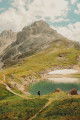
Refuge des Drayères – Pont de l’Alpe
 9.08 mi
+2,014 ft
-3,563 ft
5h 55
Moderate
Departure from Névache (Hautes-Alpes)
9.08 mi
+2,014 ft
-3,563 ft
5h 55
Moderate
Departure from Névache (Hautes-Alpes)
3rd and final stage. Starting from the Refuge des Drayères, head up to the source of the Clarée and return to Pont de l’Alpe via the Col de la Ponsonnière. A tour of the Massif des Cerces taking in numerous lakes, each more beautiful than the last: in turn, the Clarée, Rond, Grand Ban, Cerces, Ponsonnière and, finally, the Grand Lac.
From Goléon to Les Grandes Rousses: La Grave / Clavans
86.50 mi
+29,537 ft
-26,375 ft
3 days
Very difficult
Departure from La Grave (Hautes-Alpes)
From the Goléon massif to the Grandes Rousses massif, via the ridges between Emparis and Arves.A multi-day hike, with a bivouac, along the ridges between Emparis and Arves.
La Grave – Goléon Mountain Hut
4.72 mi
+3,271 ft
-108 ft
5h 00
Difficult
Departure from La Grave (Hautes-Alpes)
The idea behind this three-day self-supported trek is to link the Goléon massif to the Grandes Rousses massif via the ridges to the north of the Plateau d’Emparis.
It’s a wild hike requiring not only good physical fitness but also the ability to read maps and the terrain.
Thefirst day is just a warm-up.