Col des Tourettes

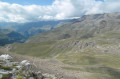
A slightly long hike with superb panoramic views from the Rabioux Valley.

Details

1415263
Creation:
Last update:
Last review:
  • Walking
    Activity: Walking
  • ↔
    Distance: 10.34 mi
  • ◔
    Average duration: 8h 05 
  • ▲
    Difficulty: Difficult

  • ⚐
    Back to start: Yes
  • ↗
    Ascent: + 3,835 ft
  • ↘
    Descent: - 3,835 ft

  • ▲
    Highest point: 8,386 ft
  • ▼
    Lowest point: 4,629 ft

Photos

Description of the walk

Start from the Muandes car park at the bottom of the Rabioux valley

(S/E) Set off along the track that starts at the entrance to the car park (or the path at the far end of the car park) towards the Charençons Lodge. Follow the track as it climbs gently up the Rabioux valley.

(1) Note the view of the Pisse waterfall on your right and continue due west along the track.

(2) Pass the Charençons Lodge and continue along the track, which winds its way up through a few hairpin bends to cross the Torrent de la Lauze. Further on, at a junction, ignore the track heading uphill to the left and follow the one straight ahead, which descends slightly. You’ll reach the Chalets du Serre.

(3) Carry on straight ahead along the well-marked path to the pass, ignoring the steeper path branching off to the left.

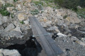
(4) Cross the first footbridge over the Rabioux. The climb is steep and steady until you reach the Torrent de la Combe des Ruines and a wooden footbridge.

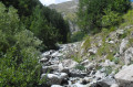
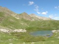
(5) Continue ascending diagonally (west-south-west) through woodland and then across meadows to the Dent stream, which provides a welcome supply of cool water.

(6) Take a sharp right-hand bend and continue traversing north-east.

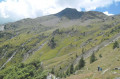
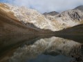
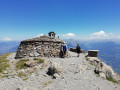
(7) After crossing a stream (the last water source), the going gets tougher: navigate some steep switchbacks. The final ascent over scree is arduous but fairly short, leading to the pass, where the views are superb on both sides.

(8) The return journey follows the same route as the ascent back to the car park (S/E).

Waypoints

  1. S/E : mi 0 - alt. 4,659 ft - Muandes car park
  2. 1 : mi 0.61 - alt. 4,787 ft - Cascade de la Pisse
  3. 2 : mi 1.55 - alt. 5,121 ft - Gîte Auberge des Charançons
  4. 3 : mi 2.33 - alt. 5,427 ft - Chalets du Serre
  5. 4 : mi 2.64 - alt. 5,594 ft - Footbridge over the Rabioux
  6. 5 : mi 2.94 - alt. 5,919 ft - Wooden footbridge
  7. 6 : mi 3.56 - alt. 6,801 ft - Torrent de la dent
  8. 7 : mi 4.05 - alt. 7,041 ft - Stream
  9. 8 : mi 5.17 - alt. 8,386 ft - Col des Tourettes (2606m)
  10. S/E : mi 10.34 - alt. 4,659 ft - Muandes car park

Notes

There are numerous water sources.

You are hiking in the heart of the Écrins National Park.

The Écrins massif is an exceptional area, open to all, boasting natural, cultural and scenic heritage of a rare kind. To protect these treasures, the heart of the park is marked by blue-white-red flags, within which regulations must be observed. Please familiarise yourself with these regulations when planning your hike, to help preserve this shared heritage, at https://www.ecrins-parcnational.fr.

Worth a visit

At (1), there is the option of a 15-minute round-trip walk northwards to get closer to the waterfall.

Reviews and comments

5 / 5
Based on 2 reviews

Reliability of the description
5 / 5
Ease of following the route
5 / 5
Route interest
5 / 5
MonfortBertrand
MonfortBertrand

Overall rating : 5 / 5

Date of your route : Aug 23, 2022
Reliability of the description : ★★★★★ Very good
Ease of following the route : ★★★★★ Very good
Route interest : ★★★★★ Very good
Very busy route : No

There is direct access to the Charbonnières car park at an altitude of 1,650 metres.
The track is very easy to drive on and saves you nearly 6 km there and back and a little over 200 m of elevation gain!
A well-deserved reward at the Col des Tourettes: a stunning panoramic view!

Machine-translated

bulto60
bulto60

Overall rating : 5 / 5

Date of your route : Aug 15, 2012
Reliability of the description : ★★★★★ Very good
Ease of following the route : ★★★★★ Very good
Route interest : ★★★★★ Very good

We carried on as far as Roc Blanc and made our way down through the Vallon de Distroit and past the Waterfall de la Pisse.
A superb circular walk, but a very long one.

Machine-translated

Other walks in the area

For more walks, use our search engine .

The GPS track and description are the property of this route's author. Please do not copy them without permission.