Country:

 City:
City:


Park in the car park at the Place de l’Église in Châteauroux-les-Alpes.
(S/E) Turn left onto the uphill street; you’ll soon reach the junction withthe GR®®50. Take the uphill path on the right to reach the hamlet of Les Pins. Head straight on along the road, passing through the hamlet of Le Vazet and then on to Le Martins. Leave the road and take the path opposite – this is theGR®®50, marked in red and white. Continue to the junction with a tarmac road.
(1) Turn left onto this road and follow it through Chameyer. At the Y-junction, turn right onto the ascending branch, continuing through the hamlet of Les Albrands to reach the hamlet of Les Gérards.
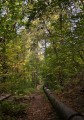
(2) Keep to the right on theGR®® and follow this wide track into the Montdauphin State Forest, indicated by a large ONF sign. At the junction, take the left-hand branch to reach the Bramafan Stream.
(3) Ford the stream, then keep to theGR®® on the right at the next junction and reach the highest point. You will then begin an easy descent. Pass under a power line and come to another junction.
(4) Leave theGR®® here and turn left onto a wide path between two hedgerows. Leave the path leading to Le Serre on your right and begin an easy climb back up to the Bramafan Stream.
(3) Follow the route taken on the way there in the opposite direction. At the junction on the descent, take the path on the right, marked by a red and white St Andrew’s cross. Continue in this direction despite the cross, until you reach the hamlet of La Reste. Stay on the road to the left as you leave the hamlet. You will reach the Gérards junction, which you passed on the way there.
(2) Head down to the right towards Les Rozans, joining theGR®®653Dhere. Continue on to reach the Saint-Roch Chapel.
(5) Take the road opposite and follow it to the car park at the church in Châteauroux-les-Alpes (S/E).

 Visorando Member

 National Park
 Easy
Easy 
 Difficult