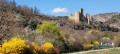
Tour of Neffes to Les Bonnets

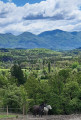
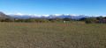
A circular loop around the village of Neffes, passing by the campsite, along small roads and paths accessible to all. It’s really more of a stroll to stretch your legs, although some open stretches offer views of Céüse, the Montagne de Charance and the Écrins.

Details

49515439
Creation:
Last update:
Last review:
  • Walking
    Activity: Walking
  • ↔
    Distance: 3.37 mi
  • ◔
    Average duration: 1h 50 
  • ▲
    Difficulty: Easy

  • ⚐
    Back to start: Yes
  • ↗
    Ascent: + 348 ft
  • ↘
    Descent: - 377 ft

  • ▲
    Highest point: 2,470 ft
  • ▼
    Lowest point: 2,142 ft

Photos

Description of the walk

Reach the village of Neffes via the D46 or the D446. Park at the southern entrance to the village, in the car park by Neffes school.
Two bus routes serve Neffes: route 31 (Gap–Neffes–Sigoyer) or route 100 (Gap–Tallard–La Saulce).

(S/E) Walk up to the church along the path running alongside the Route de Pelleautier. Join the GR®93 and the GRP® between Céüse and Durance.

(1) Turn right onto the Chemin de l’Église. Walk between the church and the town hall, following the GR®® signposts. Reach the Route de Gap (D46) and cross it carefully to continue along the GR® on the opposite side. The neighbourhood is very quiet and offers an unobstructed view of Céüse: turn round to take it in. Carry on a little further to see Les Écrins and Charance come into view on the left.

(2) Follow the path as it turns left and join the small tarmac road known as the Chemin des Bonnets.

(3) Turn right, leaving the GR®93 and following the PR® (orange markings).

(4) Continue straight ahead on the Chemin des Bonnets, which descends towards the south-west. Stay on the Chemin des Bonnets, ignoring the other paths to the right or left. Pass the entrance to the campsite and walk alongside it until you reach the bend.

(5) Take the dirt track on the left, which runs alongside the campsite fence, to reach the Mardarel. After 150 m, take the path on the right to cross the Mardarel stream via a wooden footbridge. Ignore the path branching off to the right and continue along the path, heading south-east.

(6) Leave the footpath and join the track on the right which descends south-west.

(7) Take the track that climbs to the right along the field, up to the first bend. Then leave the track before it becomes a private road (it leads up to a farm) and follow the tree-lined edge to join the Chemin des Blayes directly.

(8) Take the tarmac road on the right, heading north-west at first, then turn left at the first junction to join the Route de Tallard (D46).

(9) Walk up to the right along the road , keeping well to the right of the traffic, until you reach the village.
Opposite the library (former school), cross over to the left and head back to the starting car park (S/E).

Waypoints

  1. S/E : mi 0 - alt. 2,421 ft - Neffes school car park
  2. 1 : mi 0.09 - alt. 2,464 ft - Church Square - Église de Neffes
  3. 2 : mi 0.66 - alt. 2,356 ft - Serre Bourges bend
  4. 3 : mi 0.83 - alt. 2,293 ft - Chemin des Bonnets - Rousine (rivière)
  5. 4 : mi 1.12 - alt. 2,257 ft - Les Bonnets
  6. 5 : mi 1.69 - alt. 2,218 ft - Les Bonnets campsite, turn left
  7. 6 : mi 2.03 - alt. 2,152 ft - Shortcut to the Mardarel
  8. 7 : mi 2.12 - alt. 2,146 ft - Junction with the private track
  9. 8 : mi 2.28 - alt. 2,218 ft - Chemin des Blayes
  10. 9 : mi 2.54 - alt. 2,339 ft - Route de Tallard, D46
  11. S/E : mi 3.37 - alt. 2,421 ft - Neffes school car park

Notes

Fountain and children’s playground in the village of Neffes.

You can start this circular route from the Les Bonnets or Les Gravières campsites, near point (5).

You can take a shortcut between points (2) and (4) via an old path that appears on the IGN map, but which is no longer very clearly marked and leads between some recently built houses.

Worth a visit

In the heart of the village of Neffes, as well as the church, don’t miss the pretty fountain at the junction of a cobbled lane, and the old wash house at the northern entrance to the village (Route de Pelleautier).

The meaning of the place name ‘Neffes’ is rather obscure. André Faure suggests it may derive from the Germanic personal name ‘Nevi’. Ernest Nègre suggests the Occitan root ‘Nefas’, meaning ‘clouds, a cloud driven by the wind’, which reflects the village’s location on terraces planted with medlar trees, above the Merdarel, which would then have been shrouded in mist whilst the lowlands were not.

Always be cautious and plan ahead when you're outdoors. Visorando and the author of this route cannot be held responsible for any accidents occurring on this route.

The GR® and PR® markings are the intellectual property of the Fédération Française de Randonnée Pédestre.

Reviews and comments

4.2 / 5
Based on 2 reviews

Reliability of the description
4.5 / 5
Ease of following the route
4.5 / 5
Route interest
3.5 / 5
GarlabanTaoume
GarlabanTaoume

Overall rating : 4.7 / 5

Date of your route : Jul 24, 2026
Reliability of the description : ★★★★★ Very good
Ease of following the route : ★★★★★ Very good
Route interest : ★★★★☆ Good
Very busy route : No

A lovely walk … in the cool of the morning👍

Machine-translated

User 26986307

Overall rating : 3.7 / 5

Date of your route : Aug 04, 2025
Reliability of the description : ★★★★☆ Good
Ease of following the route : ★★★★☆ Good
Route interest : ★★★☆☆ Average
Very busy route : No

Be careful, there is a tricky section between points 7 and 8
You have to pass a wire through a field

Machine-translated

Other walks in the area

For more walks, use our search engine .

The GPS track and description are the property of this route's author. Please do not copy them without permission.