Prades Royal Forest

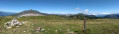
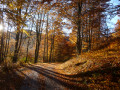
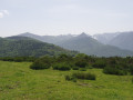
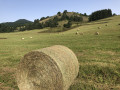
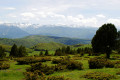
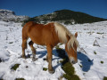
On the border between Ariège and Aude, this mid-mountain hike first takes you to the Col de la Gardie through a landscape of summer pastures where cattle and horses live in perfect harmony. The second part of the route takes place in the magnificent Royal Forest of Prades, where deciduous and coniferous trees grow side by side, offering a sumptuous array of colours in autumn. The return journey offers breathtaking views of all the peaks of the Haute Ariège.

Details

n°4203035
Creation:
Last update:
Last review:
  • Walking
    Activity: Walking
  • ↔
    Distance: 10.89 mi
  • ◔
    Average duration: 7h 05 
  • ▲
    Difficulty: Difficult

  • ⚐
    Back to start: Yes
  • ↗
    Ascent: + 2,425 ft
  • ↘
    Descent: - 2,418 ft

  • ▲
    Highest point: 5,489 ft
  • ▼
    Lowest point: 4,075 ft

Photos

Description of the walk

Park in the small car park at the Col de Marmare, at the junction of the D20 and the D613.

No signposting

(S/E) Take the path that starts to the left of the car park (do not take the obvious wide track on the right). Further up, this track narrows to a path and climbs through the woods before eventually emerging onto the plateau. Follow the edge of the woodland on your right, cross an electric fence and ignore the path on the left leading to the Rocher de Scaramus. You’ll soon reach a clearing where several drinking troughs have been set up.

(1) Turn left to pass between two drinking troughs and follow a wide herd track which climbs up a hollow, comes out onto level ground and rejoins the track you started on.

(2) Follow this track, keeping to the left to climb up a wide valley leading to the Pla de Sept Cases. After a hairpin bend to the right, the track turns east then north-east, becomes tarmacked for about a hundred metres, and reaches a junction at the entrance to vast, flat mountain pastures dotted with pine trees.

(3) Keep to the right and walk slightly downhill to the signpost at the Col de la Gardie, where thePR® path joining from Prades and continuing on to Fontfrède meets the track.

(4) Continue along the track, ignoring thePR® which branches off to the right into the mountain pasture and will be used on the return journey. After a virtually flat stretch, you’ll reach a junction situated about twenty metres before the sign for the Prades State Forest.

(5) Turn right and begin a tricky descent along a wide track rutted by passing herds. Once in the woods, do not miss the hairpin bend to the left where the track continues; it becomes steeper and leads to a flat area with a small stone hut on the left. Do not follow the track leading to it, but veer off to the right.

Mountain bike marker no. 4

Head back into the forest, where you’ll soon come to another track (not shown on the map) and follow it to the right. Ride along the Boudègue meadow, where, through the trees on the left, you can make out the imposing ruins of what must once have been a magnificent sheepfold.

The path runs alongside some rocky outcrops on the right, comes close to the Ruisseau de l’Ourza and then moves away from it, veering to the right. Continue with the Sarrat de Rouquières in your sights and, after a long, gentle descent, join the Fontfrède forest road at a hairpin bend.

No signposting

(6) Turn right to begin the long, gradual climb leading to the Fontfrède spring, where a forest track joins from the left.

YellowPR® signposting

(7) Keep to the right and continue through the Forêt Royale de Prades. After a double hairpin bend, the slope levels out as you pass the forest shelter on the right. Continue along the path until you reach a sharp bend to the right.

(8) Do not miss the signpost on the left, which directs you to leave the wide track for a narrow path that begins with a steep climb up the embankment. The climb, which is steep in places, continues through beautiful pine woodland to a wide, unnamed pass situated on the edge of the forest, opening out onto a large mountain pasture.

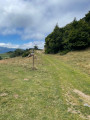
(9) Follow the track, which becomes somewhat indistinct a little further on. The markings, initially provided by wooden posts, disappear completely, but simply head diagonally down the meadow, aiming for the wide track you followed on the ascent and the signpost at the Col de la Gardie. The route is obvious.

(4) Retrace your steps in the opposite direction, enjoying the magnificent views of the Haute Ariège peaks throughout the descent.

(2) Continue along the track, ignoring the path taken on the way up, and head back into the forest. Return to the starting car park at the Col de Marmare (S/E)

Waypoints

  1. S/E : mi 0 - alt. 4,472 ft - Col de Marmare (1361m)
  2. 1 : mi 0.58 - alt. 4,770 ft - Watering holes
  3. 2 : mi 0.79 - alt. 4,852 ft - Track junction: L/ left – R/ straight on
  4. 3 : mi 2.39 - alt. 5,387 ft - Junction: A/ right – R/ left
  5. 4 : mi 2.55 - alt. 5,358 ft - Crossroads of the circular loop - Col de la Gardie (1630m)
  6. 5 : mi 2.92 - alt. 5,285 ft - Junction, turn right
  7. 6 : mi 5.27 - alt. 4,075 ft - Fontfrède Forest Road, on the right
  8. 7 : mi 6.38 - alt. 4,685 ft - Fontfrède, on the right
  9. 8 : mi 7.27 - alt. 5,085 ft - Signpost, on the left
  10. 9 : mi 7.62 - alt. 5,443 ft - Unnamed Pass
  11. S/E : mi 10.89 - alt. 4,472 ft - Col de Marmare (1361m)

Notes

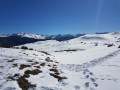
This walk was undertaken by the author on 17 October 2020. There was still some snow on the ground, but the thin layer did not pose any real difficulty. This is indeed a walk and not a snowshoe outing.

There are no water sources along the route.

Shelter is available at the forest ranger’s house past Fontfrède.

Hiking boots are recommended: some sections are rutted and may be muddy and damp in wet weather. This is particularly the case between (5) and (6).

Alternative route

(2) On the return journey, it is perfectly possible to retrace the ascent route by turning right. This shortens the walk slightly.

There are plenty of herds in this area, as well as horses, which are a real treat to behold. Please observe the usual safety precautions should you encounter the sheepdogs, who are generally very busy.

Worth a visit

Prades Royal Forest

In the 17th century, France’s forests, having been mismanaged, were no longer able to provide the timber needed to build the ships of the royal fleet. Louis XIV asked Colbert to draw up a new forestry code, which was applied to the Pyrenean mountains. This led to the creation of the ‘Royal Forest of Lourzat and Basqui’, whose majesty can still be appreciated today.

Prades

Always be cautious and plan ahead when you're outdoors. Visorando and the author of this route cannot be held responsible for any accidents occurring on this route.

The GR® and PR® markings are the intellectual property of the Fédération Française de Randonnée Pédestre.

Reviews and comments

5 / 5
Based on 1 review

Reliability of the description
5 / 5
Ease of following the route
5 / 5
Route interest
5 / 5
mourgoutc
mourgoutc

Overall rating : 5 / 5

Date of your route : May 13, 2021
Reliability of the description : ★★★★★ Very good
Ease of following the route : ★★★★★ Very good
Route interest : ★★★★★ Very good
Very busy route : No

A hike completed on Thursday 13 May 2021 in 6 hours in sunny weather. Magnificent views of the lush green forests of fir and beech trees and the snow-capped peaks of the Ariège Pyrenees on the horizon.
A detailed route description and precise signposting are essential in this maze of forest tracks.
The climb between points 6 and 8 isn’t tiring if you adjust your walking pace to the steep gradient.
Avoid the steep, muddy and slippery track through the Bois de l’Ourza (between points 5 and 6) in wet weather!
I recommend this lovely walk to forest lovers.

Machine-translated

Tenzig11250
Tenzig11250

Hello, we’re planning a hike once the snow’s here! Happy holidays!

Machine-translated

Other walks in the area

For more walks, use our search engine .

The GPS track and description are the property of this route's author. Please do not copy them without permission.