


 Country:

 City:


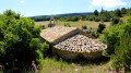

(S) Start from the Col de l’Homme Mort.
Follow the horse riding route heading due south, which lies between thePR® (on the left) and the D63 (on the right). Further down (elevation 1108), join thePR® path.
(1). Turn right and continue along thePR® until you reach a road (elevation 992).
(2) Head towards Ferrassières on the right, cross the D189 and rejoin it at a bend 200 m further on. Take the first street on the right and enter Ferrassières. Pass the next two streets on the right and turn left to cross the D189 and head towards the cemetery.
(3) Continue straight on along a track, passing through Vergolier. Further on, join the bridle path (elevation 894).
(4). Turn left for 400 m, crossing another path. At a fork, take the right-hand path. A little further on (elevation 856), ignore the bridleway branching off to the right and carry on straight ahead. The path becomes a road (elevation 869): carry on straight ahead to rejoin thePR®.
(5) Leave the road, turn right, ignore a signposted path leading off to the right 150 m further on, and carry on to reach the entrance to Aure.l
(6) Do not take the road on the left but the one opposite. Pass the steps on your right and continue along this street, which makes a first turn to the right. Once you reach the fountain, head down to the wash house. Do not take the main road (D942) but follow a small road opposite. Pass the next two paths on your left, turn right for 50 metres, then take the road on the left and head for the Sources du Riou junction.
(7) Pass thePR® sign on your right and carry on straight ahead. At a junction with several paths, continue straight ahead, ignoring all the paths on either side. Enter the Aurel State Forest via the Saint-Pierre track. Pass through Les Lauzes, where there is an old quarry, and ignore the path on the right. The track takes a first turn left then right and continues north-west. We will climb from 730 m to 1040 m.
Carry on along the dirt track, following thePR® straight ahead and ignoring the paths to the right and left.
(8) When you reach a clearing just before the 998-metre mark, ignore the two tracks on the right (only one of which is visible on the map) and those on the left. Carry on straight ahead for 100 metres, then turn right and head straight up the slope. At the next junction, ignore a path on the right leading into the lavender fields and continue to the left until you reach the Notre-Dame des Anges Chapel, your destination (E)

 Visorando Member

 Easy


 Difficult

