The Cosmodrome via Séderon and Le Rieu

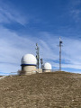
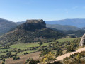
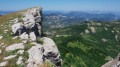
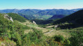
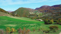
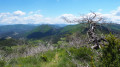
This walk takes you to the summit of Montagne de Bergiés and the cosmodrome facilities, then follows the Rieu stream to Séderon. Suitable in all seasons, alternating between shade and sunshine, but best avoided when there is too much snow. The views are exceptional throughout the route.
Definitely worth doing.

Details

n°30448749
Creation:
Last update:
Last review:
  • Walking
    Activity: Walking
  • ↔
    Distance: 9.22 mi
  • ◔
    Average duration: 6h 00 
  • ▲
    Difficulty: Moderate

  • ⚐
    Back to start: Yes
  • ↗
    Ascent: + 2,044 ft
  • ↘
    Descent: - 2,044 ft

  • ▲
    Highest point: 4,472 ft
  • ▼
    Lowest point: 2,608 ft

Photos

Description of the walk

In Séderon, near the church, you’ll find the car park where the walk starts.

(S/E) Set off southwards on the tarmac D542, then 300 m further on, leave the Avignon road.

(1) Turn right onto the Chemin de la Calade and head straight up the grassy path. Stay on the path as it descends to the left until you rejoin the road running alongside the Ravin de Lieron and then the Avignon road again. Turn right and cross the bridge.

(2) Turn right onto the Chemin du Bais and follow it for over 600 metres until you reach a narrow track on the left.

(3) Take this path, wade across the small stream and head uphill. Enter the forest and continue due west.

(4) Keep to the left-hand side of the path and climb a fairly steep slope until you come out onto a tarmac road.

(5) Turn right onto the road (Chemin de Bergies) and carry on until the road branches off to the left.

(6) Take the shortcut on the right along the grassy path to the Cosmodrome.

(7) Take in the scenery, rest on the comfortable benches, then head back along the little road to Bergies.

(8) Leave the road and take the path on the right, staying on the path.

(9) At the signpost, turn right and stay onthe PR®-marked path; be careful and follow the Rieu.

(10) Take the path on the right heading east, stay close to the stream and you’ll come to a wider track.

(11) Turn right onto the track.

(12) Take the path on the left to avoid the Rieu forest road for a short while, then rejoin the Laragne road. Follow it to the car park (S/E).

Waypoints

  1. S/E : mi 0 - alt. 2,618 ft - Car park near the church - Méouge (
  2. 1 : mi 0.13 - alt. 2,671 ft - Chemin de la Calade
  3. 2 : mi 0.65 - alt. 2,664 ft - Chemin du Bais
  4. 3 : mi 1.06 - alt. 2,730 ft - A lovely little path
  5. 4 : mi 1.77 - alt. 3,182 ft - Steep gradient
  6. 5 : mi 2.35 - alt. 3,678 ft - Tarmac road towards Bergiés
  7. 6 : mi 3.66 - alt. 4,058 ft - Grass shortcut
  8. 7 : mi 4.03 - alt. 4,465 ft - Observatoire de Bergies
  9. 8 : mi 4.5 - alt. 4,199 ft - Junction on the path
  10. 9 : mi 5.5 - alt. 3,865 ft - Signpost
  11. 10 : mi 6.07 - alt. 3,274 ft - Along the stream
  12. 11 : mi 7.99 - alt. 2,736 ft - Turn right onto the path
  13. 12 : mi 8.22 - alt. 2,700 ft - Route de Laragne
  14. S/E : mi 9.22 - alt. 2,615 ft - Car park near the church

Notes

An easy walk, well shaded. Make sure you wear suitable footwear.

Worth a visit

[The Bergiés Cosmodrome|https://www.observatoire-cosmodrome.net/}.

Always be cautious and plan ahead when you're outdoors. Visorando and the author of this route cannot be held responsible for any accidents occurring on this route.

The GR® and PR® markings are the intellectual property of the Fédération Française de Randonnée Pédestre.

Reviews and comments

4.2 / 5
Based on 2 reviews

Reliability of the description
4.5 / 5
Ease of following the route
4.5 / 5
Route interest
3.5 / 5
atraver
atraver

Overall rating : 3.7 / 5

Date of your route : Apr 24, 2025
Reliability of the description : ★★★★☆ Good
Ease of following the route : ★★★★☆ Good
Route interest : ★★★☆☆ Average
Very busy route : No

A long drive... on the way there.

Machine-translated

binome_fr
binome_fr

Overall rating : 4.7 / 5

Date of your route : Aug 26, 2023
Reliability of the description : ★★★★★ Very good
Ease of following the route : ★★★★★ Very good
Route interest : ★★★★☆ Good
Very busy route : No

A really lovely walk with few difficulties.
The view is incredible when you reach the space centre! The wooded section running alongside the stream is lovely in summer.
The last hour, on the way back to the starting point, is along a track… It’s a bit less interesting.

Machine-translated

Other walks in the area

For more walks, use our search engine .

The GPS track and description are the property of this route's author. Please do not copy them without permission.