leglode013

 Association / Club / Walk leader
- Website: facebook section randonnée Peyruis
Sign up:
Published route(s)
 Notre-Dame des Anges Chapel – Summit of Mont Ventoux
 7.46 mi
 +3,186 ft
 -371 ft
 6h 10
6h 10
 Moderate
 Departure from Aurel (Vaucluse) (Vaucluse)
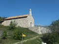
The ascent of Mont Ventoux starts from the Notre-Dame des Anges du Ventouret Chapel; reach the ridge and follow it to the Col des Tempêtes, and there we are on the Giant of Provence.
Saumane – Col de la Roche
 6.49 mi
+2,211 ft
-794 ft
4h 55
6.49 mi
+2,211 ft
-794 ft
4h 55
 Easy
Departure from Saumane (Alpes-de-Haute-Provence)
Easy
Departure from Saumane (Alpes-de-Haute-Provence)
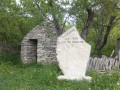
Above the village of Saumane, the Montagne de Lure was once a major centre for pastoralism. There are a large number of sheepfolds here, most of which were built in the 19th century. All constructed using dry stone from locally sourced materials, they are magnificent examples of a specialised technique executed to a very high standard.