


Refine your search for walks in Col de Gialorgues
Col de Gialorgues walks


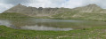
 The Estrop Lakes
 Visorando Member
 9.63 mi
 +2,549 ft
 -2,536 ft
 6h 40
 Moderate
 Departure from Entraunes (Alpes-Maritimes)
The Col de Gialorgues is a crossing point between the upper Var and upper Tinée regions, offering views of a glacial valley with the Lacs de l'Estrop lakes in a cirque.
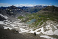
Tête de la Boulière via the Vallon de Gialorgues
 7.88 mi
+2,523 ft
-2,523 ft
5h 50
Moderate
Departure from Saint-Dalmas-le-Selvage (Alpes-Maritimes)
This walk, starting from the Vallon de Valloar, will take you through the Vallon de Gialorgues, past several lakes and offering varied panoramic views from the Col de Gialorgues and the Baisse de la Boulière.
The ascent to the Tête de la Boulière is straightforward and offers a superb panoramic view of the Haut-Var peaks (Cime de Pal, Fort Carra, Pointe Côte de l’Âne and Mont Pelat).
You are in the Mercantour National Park; there are regulations to be observed, and failure to comply may result in a fine of up to €1,500 – see the practical information.
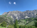
Tour de Roche Grande via Col des Trentes Souches and Vallon de l'Estrop
 15.04 mi
+5,203 ft
-5,187 ft
10 hrs
 Very difficult
Departure from Entraunes (Alpes-Maritimes)
This is a long but very beautiful hike starting from Entraunes, taking you through two wild valleys and offering magnificent views of the peaks of the Haut Var and Haut Verdon, as well as the valley leading up to the Col de la Cayolle. This hike is particularly recommended in early summer when the flowers are in full bloom.
Walks near Col de Gialorgues
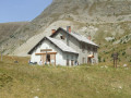
Refuge de la Cantonnière – Col de la Cayolle
 3.32 mi
+1,677 ft
-351 ft
3h 00
Moderate
Departure from Entraunes (Alpes-Maritimes)
A climb that offers views of different levels of the mountain: meadows, coniferous forest and alpine pastures.
Around Les Garrets
 14.67 mi
+4,055 ft
-4,108 ft
3 days
Moderate
Departure from Entraunes (Alpes-Maritimes)
A 3-day mountain hike going from refuge to refuge.
The daily stages are relatively short (3 to 5 hours), making it accessible to people of average fitness.
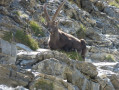
Wildlife (marmots, chamois, ibex and birds of prey) can be spotted quite easily at higher altitudes.
From the Refuge de la Cantonnière to the Refuge de la Cayolle via the Col de la Boucharde
 6.90 mi
+2,874 ft
-1,503 ft
5h 40
Moderate
Departure from Entraunes (Alpes-Maritimes)
This route from the Refuge de la Cantonnière to the Refuge de la Cayolle via the Col de la Boucharde is the first day of a three-day route in the Haut-Var. After a shaded climb alongside the Ruisseau de Sanguinière, the route ascends the Ravin de la Boucharde before descending to the Bachelard after crossing the pass. You then need to follow the left bank of the Bachelard back up to the Refuge de la Cayolle, where you will spend the night.
Col de la Cayolle – Lac d’Allos Mountain Hut
4.49 mi
+1,204 ft
-1,312 ft
3h 05
Moderate
Departure from Uvernet-Fours (Alpes-de-Haute-Provence)
A climb to a pass, followed by a descent of roughly the same length, with two beautiful lakes to admire. This walk also gives you the chance to compare the two sides of the mountain, which are quite different.
Saint-Dalmas-le-Selvage - Roya
13.32 mi
+4,255 ft
-4,203 ft
9h 50
 Difficult
Departure from Saint-Dalmas-le-Selvage (Alpes-Maritimes)
Étape de la traversée des Alpes de Saint-Dalmas-le-Selvage jusqu'à Roya. Randonnée offrant un très beau panorama sur la Haute Tinée avec passage de la station de ski d'Auron puis après le Col du Blainon entrée dans le vallon de Roya où le mouton est roi.
Lac d’Allos – Tête de Valplane – La Cluite car park
 4.56 mi
+1,306 ft
-2,707 ft
3h 15
Moderate
Departure from Allos (Alpes-de-Haute-Provence)
Alternative route to reach the Cluite car park from the Lac d’Allos refuge. The route passes via the Tête de Valplane, which offers breathtaking views of Lac d’Allos, the Cirque de l’Encombrette and the valley leading to Colmars. You are in the Mercantour National Park; there are regulations to be observed, and failure to do so may result in a fine of up to €1,500 – see the practical information.This route takes you off the marked trails; please read the reviews.
Lac d’Allos Mountain Hut – La Cantonnière Mountain Hut
 6.84 mi
+1,253 ft
-2,493 ft
4h 15
Moderate
Departure from Allos (Alpes-de-Haute-Provence)
The final stage, which is longer than the other two, takes you back to the starting point.
Auron – Longon dairy farm
 16.41 mi
+5,928 ft
-4,970 ft
10 hrs
Very difficult
Departure from Saint-Étienne-de-Tinée (Alpes-Maritimes)
A long but beautiful stage combining the austere landscape of Mont Mounier with the green mountain pastures of Longon.Look up to watch the vultures.A gentle finish at the Vacherie de Longon, surrounded by animals.
Mont Pelat - Allos via Le Cimet
 13.63 mi
+2,405 ft
-7,661 ft
8h 20
Very difficult
Departure from Allos (Alpes-de-Haute-Provence)
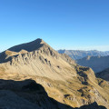
Second part of the circular. This second stage will take you to the village of Allos, starting from Mont Pelat, via the Trou de l'Aigle, the Cimet and its many waterfalls, including the Cascade du Pich and the Bois de Vacheresse.
Saint-Étienne-de-Tinée - Rabuons Refuge
 4.55 mi
+4,951 ft
-423 ft
6h 25
Difficult
Departure from Saint-Étienne-de-Tinée (Alpes-Maritimes)
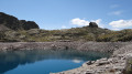
This first stage will take you to the Rabuons mountain hut, on the shores of the largest lake in the Alpes-Maritimes.The landscape is very rocky. You’ll come across plenty of Italians, as just across the border there are several mountain huts offering lovely routes via the nearby Pas de l’Ischiator.
⚠️ Allow around 4 hours for an average hiker in good physical condition to complete this walk.