


Refine your search for walks in Col de Chamont (681m)
Col de Chamont (681m) walks


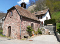
 A circular loop around the village of Fréland
 Visorando Member
 7.32 mi
 +1,499 ft
 -1,499 ft
 4h 40
 Moderate
 Departure from Fréland (Haut-Rhin)
This route will take you from an ancient Roman road to the heights of Fréland. Done in good weather at the end of winter, it offers a varied and peaceful hike. Along the way, you will see the first primroses, streams and a view of the Lapoutroie valley. On the way back, it is always a pleasure to cross Fréland. A short visit to the Welche country museum and its adjoining inn will be a pleasant way to round off the walk.
Col de Chamont starting from Fréland
 4.21 mi
+846 ft
-846 ft
2h 40
 Easy
Departure from Fréland (Haut-Rhin)
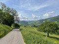
In spring, there is nothing more pleasant than this circular starting from Fréland and passing through the Col de Chamont. Lovely panoramic views of the Pays Welche, the Fréland and Lapoutroie valleys, the magnificent Mont Kalblin and beautiful forest passages.
From Lapoutroie to Fréland via the Col de Chamont
 6.99 mi
+1,339 ft
-1,329 ft
4h 25
Moderate
Departure from Lapoutroie (Haut-Rhin)
A steep start, a few sections through the forest, but above all beautiful views of Lapoutroie and the Val d’Orbey, the Brézouard and the Tête des Faux, as well as Fréland and the Kaelblin massif.
Walks near Col de Chamont (681m)
Col de Bagenelles – Schupferen
 10.77 mi
+2,694 ft
-1,847 ft
7h 20
Moderate
Departure from Le Bonhomme (Haut-Rhin)
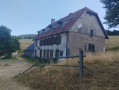
This third day follows the Sentier des Crêtes for the most part, passing through the burnt-out fields with beautiful panoramic views. A walk of moderate difficulty with several opportunities to stop and enjoy a blueberry tart
Schelmenkopf – Col des Bagenelles
 10.60 mi
+1,818 ft
-1,289 ft
6h 25
Moderate
Departure from Ribeauvillé (Haut-Rhin) (Haut-Rhin)
A leisurely second stage, apart perhaps from the total distance. It takes place mainly in the shade on mostly flat paths. You’ll pass beneath the Petit Brézouard and give the Grand Brézouard a wide berth – as it is a wildlife sanctuary – before heading directly to Le Haïcot and then on to the Col des Bagenelles.
Ribeauvillé–Hunawihr via the vineyards
1.75 mi
+299 ft
-220 ft
1h 05
Easy
Departure from Ribeauvillé (Haut-Rhin) (Haut-Rhin)
A lovely little walk that follows the edge of the woodland alongside the vineyards. Superb views of the surrounding villages.
Ribeauvillé - Le Bonhomme
 Tourism professional
 17.75 mi
+3,858 ft
-2,444 ft
11h 30
 Very difficult
Departure from Ribeauvillé (Haut-Rhin) (Haut-Rhin)
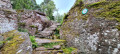
Stage thirteen, from Ribeauvillé to Le Bonhomme, is very long and involves a significant climb. It marks the hiker’s entry into the Hautes-Vosges and its first major peaks: Hirzberg and Brézouard, via the Lapoutroie valley. With a mountain atmosphere and superb views in store.
Tuckheim – Ribeauvillé
13.70 mi
+1,703 ft
-1,716 ft
7h 45
 Difficult
Departure from Turckheim (Haut-Rhin)
Viticulture is an integral part of the Alsatian landscape. There is even a route named after it. This route is the third stage of the vineyard trail and links Turckheim to Ribeauvillé. There are numerous vantage points, indeed they are almost everywhere outside the villages. The villages themselves are very traditional, with pretty half-timbered houses, and possess an undeniable charm. The region’s heritage is equally well represented.
Schupferen – Hahnenbrunnen
 12.27 mi
+1,798 ft
-1,762 ft
7h 15
Moderate
Departure from Stosswihr (Haut-Rhin)
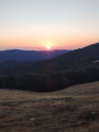
A stage of around twenty kilometres that begins in the shade of the forest, then runs alongside the Hirschsteine and Spitzenfels rocks, with a few sections secured by metal steps and fixed handrails, before continuing along the ridges after the Col de la Schlucht and passing beneath thethird-highest peak in the Vosges, the Hohneck.
 Mountain biking in the Vosges, Day 7: Col du Calvaire – Mulhbach-sur-Munster (Part 2)
10.32 mi
+1,230 ft
-2,566 ft
3 hrs
Difficult
Departure from Stosswihr (Haut-Rhin)
This route forms the second part of the 7th stage of a 7-day trek on the Alsatian side of the Vosges. The route follows mainly forest tracks in good condition. The signposting, which is excellent, consists of signs bearing an orange or red mountain bike logo accompanied by the letters TMV (Traversée du Massif Vosgien).
Col de la Schlucht – Le Grand Ballon: the Sentier des Crêtes
 16.57 mi
+3,238 ft
-2,556 ft
8 hrs
Very difficult
Departure from Le Valtin (Vosges)
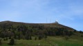
A very beautiful hike, taking in some remarkable sights: the Martinswand rocks, the summit of the Hohneck, the summit of the Kastelberg and the Grand Ballon (with the ‘Boule’ at the summit).
Charlemagne car park - Schiessrothried Lake
 5.84 mi
+728 ft
-1,683 ft
3h 20
Moderate
Departure from Xonrupt-Longemer (Vosges)
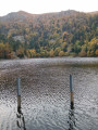
day1: hike around Hohneck, snowfield route and descent to Schiessrothried Lake.
Crossing the Southern Vosges from Kintzheim to Willer-sur-Thur
 56.12 mi
+10,161 ft
-9,600 ft
5 days
Difficult
Departure from Kintzheim (Bas-Rhin)
This route takes you across the Vosges in the Haut-Rhin, with moderate daily stages ranging from 15 to 20 km and an elevation gain generally between 800 and 900 m. These stages take between 6 and 7 hours, always ending near a mountain refuge, which must be booked in advance. The route follows paths marked by the Club Vosgien and passes through a wide variety of landscapes.