Country:

 City:


Starting point: the car park, Place de la Bazinie.
(S/E) Follow the street that runs between the town hall and the harbour basin, then cross the bridge over the canal on the right. Continue straight ahead along Avenue du Docteur James, passing the gendarmerie on your right, and cross the bridge over the railway line.
(1) Immediately afterwards, turn left onto Rue du 19 mars 1962, continue for about 300 m and, at the corner of No. 48, turn right onto Chemin de La Roque, following the red and yellow markings forthe GR® de Pays (follow these markings all the way to Baneuil).
(2) At the crossroads, turn right and continue to the end of Chemin Rouge, opposite house no. 980.
(3) Turn left and carry on straight ahead until you reach a three-way junction with a triangular central island.
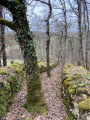
(4) Carry on straight ahead along the grassy path, passing houses on both the left and right, then enter the woodland. Descend into the valley and continue straight ahead, climbing gently until you reach a fork in the path.
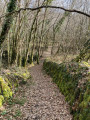
(5) Turn left, walk for about 200 m and continue along the Chemin Médiéval for 200 m. When you reach a house on your right, turn left and you’ll come to the tarmac road.
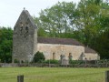
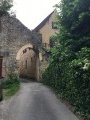
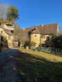
(6) Turn right and, when you reach the castle on your left, take the narrow lane on the right to reach Saint-Étienne Church.
(7) Carry on straight ahead past the church, then turn left, walk past the Town Hall and reach a three-way junction.
(8) Turn right onto Rue du Puits and, at the next junction at Les Bailleries, carry on straight ahead along the path that runs alongside the house and is then lined with boxwood. Continue along the tarmac road until you reach a crossroads on the edge of a residential area.
(9) Carry on straight ahead along Route de la Tronce, which turns into a track for a few metres before rejoining the tarmac and reaching the junction with Route de Saint-Sulplice. Turn right and follow this road to the level crossing. Cross it and head towards the Port de Couze basin.
(10) Cross the junction with care and continue straight on along the D660. Cross the bridge over the Dordogne, then take thefirst lane on the right (yellow signposting). This then turns 90° to the left and joins a side street. Continue to the right, cross the bridge over the Couze and you’ll find yourself facing a cliff.
(11) Turn left, passing the Moulin de la Rouzique (paper eco-museum). Cross the Route de Lanquais with care and continue straight ahead onto Allée des Noyers, following it to the end.
(12) Turn left onto Rue des Moulins des Barreaux, walk past the Romanesque Saint-Pierre Church, then cross Avenue de Cahors with care. At Saint-Étienne Church, head up to the right onto Chemin de Pecoral and look for the start of a tarmac path on the left, a few metres past No. 3 and before the bend to the right.
(13) Turn left, following the red and white markings forthe GR®6. At the four-way junction, continue straight ahead, then turn right and walk alongside a tennis court on your right. At the multi-way junction, follow the tarmac to the left until you reach a crossroad.
(14) Cross this road and head straight on, towards Peytavit. Follow this small road to the end.
(15) Take the path straight ahead, through the woodland. Then continue left along the tarmac road and, at the next junction, turn right towards Coste Perié. When you reach thefirst house in the hamlet, opposite a grassy track on the right, turn left. Walk for about 250 metres and, at the end of the road, follow a path to the right. Continue along the tarmac road and you’ll soon reach a three-way junction. Turn left, towards Falaise de Saint-Front, and head for the church.
(16) At the Church of Saint-Front de Culubri, head down the north side via the very steep, well-maintained path; caution is advised, particularly in wet weather. At the road, turn left and cross the bridge over the Dordogne. Then walk along the Place du 8 Mai 1945, then take Rue du Pont and Rue du Périgord. Opposite the playground, first turn left then right, walk past a wash house and head for the Place de la Bazine (S/E).

 Visorando Member
 Difficult

 Easy