The Chevreuil and Lann Bourgeol routes in Inguiniel

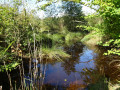
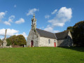
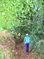
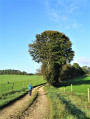
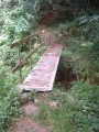
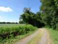
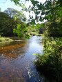
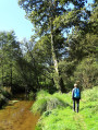
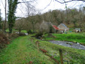
Starting from Locunel, the Chevreuil (10 km) and Lann Bourgeol (7.3 km) routes – which can be tackled in two stages or in one go – will take you along streams and through woodland to explore the Inguiniel countryside. You’ll be charmed by its characterful houses, Lochrist Chapel, its churchyard and its fountain.

Details

60358382
Creation:
Last update:
Last review:
  • Walking
    Activity: Walking
  • ↔
    Distance: 10.67 mi
  • ◔
    Average duration: 5h 15 
  • ▲
    Difficulty: Moderate

  • ⚐
    Back to start: Yes
  • ↗
    Ascent: + 433 ft
  • ↘
    Descent: - 433 ft

  • ▲
    Highest point: 554 ft
  • ▼
    Lowest point: 397 ft

Photos

Description of the walk

Locunel (D2 Plouay – Bubry), car park near the school.

(S/E) Leave the car park on the school side and continue straight ahead on the verge alongside the D2. Turn left twice to cross the village of Locunel, which still has its wayside cross and some fine farmhouses.

(1) At the third junction, take the farm track on the left. Carry on straight ahead to Lochrist. Don’t miss the fountain and the Lochrist cross on your right. Cross the farmyard, turn right, then left twice, passing close to the chapel and its enclosure.

(2) Carry on straight ahead and turn right as you leave the village. Head straight on along the track which bends to the right, then turn left onto the road at Poulprio.

(3) Turn right.

(4) About 250 m further on, turn left, then left again and carry on straight ahead through the Roscouëdo woods, ignoring the other paths.

(5) Turn right twice and cross the clearing. Cross the road.

(6) Turn left onto the path running alongside the road. At the bend, keep right, then follow the dip in the embankment to the left. Turn right twice. Follow the path (right, left and right twice) which leads to the water intake.

(7) Turn left, then right to reach Roscouëdo. After the bread oven, turn right, then straight ahead onto the path which turns left twice to rejoin the road.

(6) Turn left and immediately turn right into the woods. Fork left, stay on this path, then follow the embankment to the right. Turn left, then right onto the farm track. Continue left, then onto the road to reach the junction you passed on the way out at the 156th hill.

(4) Back at the 156th contour line, continue left along the road to reach Lochrist and its chapel.

(2) Take the farm track again (left before the chapel, then right and straight on). Return to the starting point by following the route in reverse.

(S/E) Cross the car park and exit to the right. Turn left, then go straight on before turning left onto the farm track, ignoring the paths on the right, until you reach Guern.

(8) Turn left twice and continue straight on to join the D2.

(9) Walk along the verge on the right, then cross carefully and head slightly to the left on the other side of the road. At the T-junction, turn right and continue to a crossroads.

(10) Turn left and carry on straight ahead at the junctions at Keransquer and Morgahez, then turn left and continue to the next junction.

(11) Turn right into the Lann Bourgeol Forest. Carry on straight ahead along the main path, passing close to the forest pond. Turn left twice, then right twice in the woods.

(12) Before you reach the road, turn left and carry on, ignoring the paths on the left. Turn right and then left before the barrier. Follow this path (right, straight on, left and right). Turn right before the embankment and walk between the fir trees to reach a road.

(13) Head left and, at the crossroads, take the farm track straight ahead until you reach the D2.

(14) Cross the road carefully and take the narrow path on your left. Continue to the left, then to the right to reach the car park at Locunel School (S/E).

Waypoints

  1. S/E : mi 0 - alt. 535 ft - Car park at Locunel School (D2 Plouay – Bubry)
  2. 1 : mi 0.29 - alt. 472 ft - Junction
  3. 2 : mi 1.14 - alt. 505 ft - Lochrist Chapel
  4. 3 : mi 1.84 - alt. 512 ft - Poulprio
  5. 4 : mi 2.04 - alt. 509 ft - Elevation 156
  6. 5 : mi 2.5 - alt. 522 ft - Roscouëdo Wood
  7. 6 : mi 2.67 - alt. 528 ft - Route
  8. 7 : mi 3.45 - alt. 502 ft - Roscouëdo water catchment
  9. 8 : mi 7.04 - alt. 479 ft - Guern
  10. 9 : mi 7.17 - alt. 466 ft - D2
  11. 10 : mi 7.61 - alt. 509 ft - Crossroads
  12. 11 : mi 8.19 - alt. 463 ft - Junction after Morgahez
  13. 12 : mi 8.94 - alt. 407 ft - Junction before the road
  14. 13 : mi 9.56 - alt. 509 ft - Route
  15. 14 : mi 10.35 - alt. 489 ft - D2
  16. S/E : mi 10.67 - alt. 535 ft - Car park at Locunel School (D2 Plouay – Bubry)

Notes

This route is included in the Morbihan Departmental Plan for Walking and Hiking Trails and is accredited by the French Hiking Federation. You can follow the yellow markings. There is an information board with a map and details of heritage sites at the start.

Worth a visit

This route is organised by Lorient Agglomération.

- Locunel: cross,17th–18th-century farmhouses.
- Wetlands: biodiversity hotspots, serving a hydraulic function (storage, water treatment).
- Lochrist Calvary and washhouse fountain: fountain protected by walls (niche carved with a figure, basins).
- Lochrist parish enclosure (17th century): chapel with altarpiece (late17th century), ossuary, gate and Calvary (1671).
- Roscouëdo Wood: village common land, wooded heathland since 1950.
- Roscouëdo water intake: situated at the site of the village’s former fountain, within a wooded protection zone. The intake is now inactive.
- Roscouëdo: farmhouses (17th–18th centuries), well, bread oven.
- Le Guern:15th–18th-century farm.
- Lann Bourgeol communal forest: 70 ha of deciduous and coniferous trees managed by the National Forestry Office

Reviews and comments

4.6 / 5
Based on 3 reviews

Reliability of the description
4.7 / 5
Ease of following the route
4.7 / 5
Route interest
4.3 / 5
MarieClaude Sodano
MarieClaude Sodano

Overall rating : 4 / 5

Date of your route : Jun 23, 2026
Reliability of the description : ★★★★☆ Good
Ease of following the route : ★★★★☆ Good
Route interest : ★★★★☆ Good
Very busy route : No

Problems with signposting overgrown with vegetation in the Boise area

Machine-translated

Odile F
Odile F

Overall rating : 5 / 5

Date of your route : Aug 25, 2025
Reliability of the description : ★★★★★ Very good
Ease of following the route : ★★★★★ Very good
Route interest : ★★★★★ Very good
Very busy route : Yes

very beautiful route. We did it in two separate loops. Shaded, clean and well signposted. A superb day out.
Well done to the Lorient community of communes.

Machine-translated

Pascal C56
Pascal C56

Overall rating : 4.7 / 5

Date of your route : Jun 22, 2025
Reliability of the description : ★★★★★ Very good
Ease of following the route : ★★★★★ Very good
Route interest : ★★★★☆ Good
Very busy route : No

Well-marked trail, recently maintained, no significant difficulties, easily divided into two sections, with Locunel as the starting point, junction point and finish point for the 10 km "Chevreuil" and 7.7 km "Bourgeol" trails.
Accessible to all.
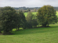
A good mix of heritage, forest and countryside with a few views of the bocage.
I highly recommend it!

Machine-translated

Other walks in the area

For more walks, use our search engine .

The GPS track and description are the property of this route's author. Please do not copy them without permission.