The Brandifrout Route in Bubry

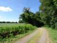
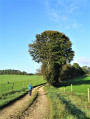
Crossing the streams and the wild Brandifrout valley, following sunken lanes and forest tracks, this route will take you on a journey of discovery through Bubry’s heritage: villages, chapels, fountains, mills…

Details

56866462
Creation:
Last update:
Last review:
  • Walking
    Activity: Walking
  • ↔
    Distance: 5.14 mi
  • ◔
    Average duration: 2h 40 
  • ▲
    Difficulty: Easy

  • ⚐
    Back to start: Yes
  • ↗
    Ascent: + 315 ft
  • ↘
    Descent: - 344 ft

  • ▲
    Highest point: 479 ft
  • ▼
    Lowest point: 269 ft

Photos

Description of the walk

Start: Saint-Trémeur Chapel (D2, towards Melrand; turn right; car park and covered picnic area after the chapel).

Yellow markings

(S/E) On leaving the car park, turn left, then right at the entrance to the woods. Stay on the path that passes near the Saint-Trémeur Fountain. Follow the track that runs alongside and crosses the stream. Continue left, then right onto the farm track to reach the Brûlé bread oven.

(1) Continue along the farm track to the right after the bread oven. Cross the road and take the path on the right-hand verge along the embankment, running parallel to the road for about 150 m. Enter the woods on the left and stay on the main path, which turns left, then right, then straight on, and then right again. When you reach the Ruisseau du Brandifrout, follow it to the right as far as Pont Davy.

(2) Cross Davy Bridge to the left and head up the sunken path. At the road, carry on straight ahead, then turn right at Botfaux. The road gives way to a footpath leading to the entrance to Locqueltas. Carry on straight ahead, passing close to the Chapel of Notre-Dame de la Salette.

(3) After the chapel, turn right. You can also go straight on to see the fountain below, before retracing your steps. Continue along the farm track, going straight on, then turning left at the successive junctions. When you reach the road, carry on straight ahead, then turn left, until you reach the Kerioguen crossroads.

(4) Turn left, then take the path on the left as you leave the village. Stay on the main path, going straight on, then turn right at the crossroads. You’ll come to a road.

(5) Turn left, and head up the path on the left. Follow it, turning right three times. Pass the Moulin de Brûlé d’en Bas. You’ll reach a road at the Moulin de Brûlé d’en Haut.

(6) Turn left, then right, at the Moulin de Brûlé pond. Continue straight on, then turn left twice at the Bail fountain, before heading straight up to the Chapel of Saint-Trémeur (S/E).


Waypoints

  1. S/E : mi 0 - alt. 436 ft - Saint-Trémeur Chapel
  2. 1 : mi 0.43 - alt. 335 ft - Brûlé bread oven
  3. 2 : mi 1.26 - alt. 292 ft - Davy Bridge
  4. 3 : mi 1.86 - alt. 453 ft - Notre-Dame de la Salette Chapel
  5. 4 : mi 2.87 - alt. 453 ft - Kerioguen
  6. 5 : mi 3.61 - alt. 269 ft - Road, turn left
  7. 6 : mi 4.54 - alt. 285 ft - Brûlé d’en Haut Mill
  8. S/E : mi 5.14 - alt. 436 ft - Saint-Trémeur Chapel

Notes

Route certified by the Morbihan branch of the French Hiking Federation and the Morbihan Department; follow the yellowPR® markings.
Sheltered picnic area at the starting point.

Worth a visit

This route is organised by Lorient Agglomération. Find out more: https://www.lorient-agglo.bzh/a-vivre/to...

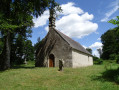
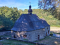
Saint-Trémeur Chapel: A building dating from the late16th tothe 17th centuries, with sculptures and furnishings fromthe 15th tothe 19th centuries.
Saint-Trémeur Fountain (1719): a triangular wall fountain depicting Saint Trémeur without a head (he is usually shown holding his head in his hands, a reference to his beheading by his father, Count Conomor, in the 6th century).
Bread oven at the dairy farm of Brulé: (19th century)
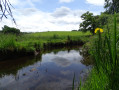
The Brandifrout: a tributary of the Blavet (14 km), a Natura 2000 site (preservation of the habitat of the freshwater pearl mussel).
Davy Bridge (17th century): Spanning the ancient road from Carhaix to Locmariaquer (pre-Roman)
Notre-Dame de la Salette Chapel and Fountains: a building constructed between 1848 and 1859 (in honour of the Virgin Mary who appeared at La Salette in 1846) on the site of the former Saint-Gildas Chapel (17th century, which gave its name to the locality of Locqueltas);17th–19th-century furnishings; two fountains, one rectangular inside the building, the other pillar-supported and topped with a pavilion-style roof (19th century), alongside a washhouse (20th century) at the bottom of the valley.
Brulé Mill: Former grain mill of the Brûlé manor, converted in the 19th century.
Bail Fountain: Domestic fountain in the village of Talenay

Always be cautious and plan ahead when you're outdoors. Visorando and the author of this route cannot be held responsible for any accidents occurring on this route.

The GR® and PR® markings are the intellectual property of the Fédération Française de Randonnée Pédestre.

Reviews and comments

4.8 / 5
Based on 2 reviews

Reliability of the description
5 / 5
Ease of following the route
4.5 / 5
Route interest
5 / 5
Faut qu'ça marche
Faut qu'ça marche
• Edited:

Overall rating : 4.7 / 5

Date of your route : Aug 06, 2026
Reliability of the description : ★★★★★ Very good
Ease of following the route : ★★★★☆ Good
Route interest : ★★★★★ Very good
Very busy route : No

I walked this route in August. Right from the start, it was a really pleasant experience (car park, map, signposts to points of interest). The paths were perfectly maintained and the various points of interest didn’t disappoint!
Well done on this lovely walk. Thank you for putting it together.

Machine-translated

User 987091

Overall rating : 5 / 5

Date of your route : Aug 25, 2025
Reliability of the description : ★★★★★ Very good
Ease of following the route : ★★★★★ Very good
Route interest : ★★★★★ Very good
Very busy route : No

Nice hike with interesting points of interest

A bit long after point 3

Very aggressive guard dogs at point 5 – avoid by changing the route after point 4

Machine-translated

Other walks in the area

For more walks, use our search engine .

The GPS track and description are the property of this route's author. Please do not copy them without permission.