


Détail des étapes :
Jour 1 : Vievola - Casterino par le Vallon de Caramagne et la Baisse de Peyrefique
Jour 2 : Casterino - Mont Bego - Refuge des Merveilles
Jour 3 : Refuge des Merveilles - Baisse de la Valmasque - Baisse du Basto - Refuge de Nice
Jour 4 : Refuge de Nice - Pas du Mont Colomb - Refuge de la Madonne des Fenestres
Jour 5 : Refuge de la Madonne des Fenestres - Cime du Pisset - Cime de Piagu - Saint Martin Vésubie
Circuit Vievola - Saint Martin Vésubie

Circuit de 5 jours dans le massif du Mercantour, au départ du hameau de Vievola (cummune de Tende) jusqu'à Saint Martin Vésubie.
Details
Creation:
Last update:
-
 Activity: Walking
 -
 Distance: 24.18 mi
 -
 Average duration: 5 days
 -
 Difficulty: Moderate
 -
-
 Back to start: No
 -
 Ascent: + 11,309 ft
 -
 Descent: - 8,261 ft
 -
-
 Highest point: 8,825 ft
 -
 Lowest point: 3,196 ft
-
 Country:
France
Country:
France
-
 Areas: Alps, Mercantour
 -
 City:
Tende (06430)
City:
Tende (06430) -
 Start: N 44.114488° / E 7.56419°
 -
 End: N 44.095678° / E 7.356546°
 -


 Hour-by-hour weather
Stages of the route
This route needs several days, find the details below:
Notes
Other walks in the area
Chapel of Saint-Sauveur in Tende
 Visorando Member
 2.24 mi
+922 ft
-922 ft
1h 50
Moderate
Departure from Tende (Alpes-Maritimes)
2.24 mi
+922 ft
-922 ft
1h 50
Moderate
Departure from Tende (Alpes-Maritimes)
Discover one of the highest points in the village of Tende by climbing up to the Saint-Sauveur Chapel.
This chapel, listed as a historic monument since 26 May 2000, was built on the orders of the first Count of Tende for his wife, who was Orthodox. It features 14th-century murals.
The route is short but the climb is steep (250m elevation gain over less than 1km).
Caution: tricky passage at the end.
Sabion Pass and Lakes
 6.16 mi
+1,014 ft
-984 ft
3h 45
Moderate
Departure from Tende (Alpes-Maritimes)
6.16 mi
+1,014 ft
-984 ft
3h 45
Moderate
Departure from Tende (Alpes-Maritimes)
A very pleasant mountain-side walk with views over the Casterino valley and the peaks of the Vallée des Merveilles; to round off the outward leg, there is a magnificent view of the Italian side, featuring Lago della Vacca and a beautiful waterfall that feeds into the lake.
Cime du Sabion
 6.16 mi
+2,024 ft
-2,001 ft
4h 35
Moderate
Departure from Tende (Alpes-Maritimes)
6.16 mi
+2,024 ft
-2,001 ft
4h 35
Moderate
Departure from Tende (Alpes-Maritimes)
Cime du Sabion is a Franco-Italian peak rising to 2,610 m. From the summit, with one foot in France and one in Italy, you can admire Mont Bégo and the main peaks of the Valmasque valley to the south-west. To the north, you’ll have a bird’s-eye view of the Entracque valley. To the east, you’ll be impressed by the vast, rugged cirque carved out at the foot of the peaks of Sabion, Peïrefique and the Roche de l’Abysse.See restrictions in the practical information section
The Peïrefique Lakes
 5.37 mi
+1,624 ft
-1,601 ft
3h 55
Moderate
Departure from Tende (Alpes-Maritimes)
5.37 mi
+1,624 ft
-1,601 ft
3h 55
Moderate
Departure from Tende (Alpes-Maritimes)
Nestled in a rugged cirque at the foot of the Roche de l’Abysse and the Pointe de Peïrefique, these two small lakes will enchant you.
Moderator update as at 24/09/2020: Please note! The access road to the starting point is now closed to all vehicles except 4x4s.
From Casterino to the Refuge des Merveilles via Mont Bégo
7.66 mi
+3,917 ft
-2,034 ft
6h 55
 Very difficult
Departure from Tende (Alpes-Maritimes)
Very difficult
Departure from Tende (Alpes-Maritimes)
Second stage of the five-day Vievola–Saint-Martin Vesubie hike.
⚠️ 18/08/2026: Route amended at point 4.
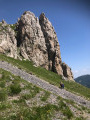
The summit of Chanvrairée and the return off-trail via Plan Tendasque
 7.96 mi
+3,002 ft
-2,986 ft
6h 15
7.96 mi
+3,002 ft
-2,986 ft
6h 15
 Difficult
Departure from Tende (Alpes-Maritimes)
Difficult
Departure from Tende (Alpes-Maritimes)
The ridges and summit of Chanvrairée offer stunning 360° panoramic views, including the Mercantour. After passing the fortified structures dating from the 1930s, which form part of the Italian defence line known as the 8th caposaldo Pian Tendasco, the little-used return route passes through an area frequented by chamois. Keep an eye out!
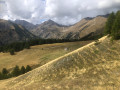
The Baisse d'Ourne de Castérino
 6.09 mi
+1,841 ft
-1,854 ft
4h 25
Moderate
Departure from Tende (Alpes-Maritimes)
6.09 mi
+1,841 ft
-1,854 ft
4h 25
Moderate
Departure from Tende (Alpes-Maritimes)
A very pretty hike, offering beautiful views of the Alps, including Monts Bégo, Clapier and Grand Capelet, in the upper part. The return journey is along a very pleasant, unmarked, little-used wooded path. In total, there is a small elevation gain of 490 m, which will help you get back into shape.
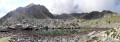
Lake Sainte-Marie
 8.30 mi
+2,779 ft
-2,772 ft
6h 15
Moderate
Departure from Tende (Alpes-Maritimes)
8.30 mi
+2,779 ft
-2,772 ft
6h 15
Moderate
Departure from Tende (Alpes-Maritimes)
Lac Sainte-Marie, situated 350 metres higher than the famous and much-visited Lac des Grenouilles, is well worth the slight extra effort. At the foot of Mont Sainte-Marie, peace and tranquillity await you.
Not to be confused with Lac de Sainte-Marie, situated to the south-west of Mont Sainte-Marie.
For more walks, use our search engine .
The GPS track and description are the property of this route's author. Please do not copy them without permission.

