


No description
Du refuge Nice au refuge de la Madone des Fenestres

Quatrième étape de la randonnée sur 5 jours Vievola - Saint-Martin-Vesubie.
This walk is part of a multi-day hike: Circuit Vievola - Saint Martin Vésubie
Details
Creation:
Last update:
–
–
-
 Activity: Walking
 -
 Distance: 3.65 mi
 -
 Average duration: 4 hrs
 -
 Difficulty: Moderate
 -
-
 Back to start: No
 -
 Ascent: + 1,404 ft
 -
 Descent: - 2,457 ft
 -
-
 Highest point: 8,363 ft
 -
 Lowest point: 6,152 ft
-
 Country:
France
Country:
France
-
 Areas: Alps, Mercantour
 -
 City:
Belvédère (06450)
City:
Belvédère (06450) -
 Start: N 44.104539° / E 7.400618°
 -
 End: N 44.095678° / E 7.356546°
 -
 IGN map(s): Ref. 3741OT
 -


 Hour-by-hour weather
Description of the walk
Waypoints
- S : mi 0 - alt. 7,270 ft
- E : mi 3.65 - alt. 6,243 ft
Other walks in the area
The Mont Clapier Lakes from the Nice refuge
 Visorando Member
 2.00 mi
+1,191 ft
-1,194 ft
1h 55
Moderate
Departure from Belvédère (Alpes-Maritimes)
2.00 mi
+1,191 ft
-1,194 ft
1h 55
Moderate
Departure from Belvédère (Alpes-Maritimes)
A short additional hike if you arrive at the Nice refuge too early. The lakes of Mont Clapier are a lovely and charming destination. As in the rest of the Mercantour, chamois and ibex are everywhere.
The lakes may still be frozen in mid-June. The path is not signposted, but is clearly visible. The same instructions appear on the map and on the suggested walks displayed at the entrance to the refuge. The elevation gain is approximately 300m.
Nice Refuge - Merveilles Refuge
 5.74 mi
+1,995 ft
-2,303 ft
4h 20
5.74 mi
+1,995 ft
-2,303 ft
4h 20
 Difficult
Departure from Belvédère (Alpes-Maritimes)
Difficult
Departure from Belvédère (Alpes-Maritimes)
Starting from the Refuge de Nice, the fourth stage of this journey through the Mercantour is the shortest. Short but just as difficult. You’ll pass the Baisse du Basto, the highest point ofthe GR®52. You’ll cross over to Lac du Basto, then it’s the climb up the Baisse de la Valmasque, before descending into the Vallée des Merveilles.
Nice Mountain Hut – Madone de Fenestre Mountain Hut
 4.88 mi
+2,523 ft
-3,527 ft
7 hrs
4.88 mi
+2,523 ft
-3,527 ft
7 hrs
 Very difficult
Departure from Belvédère (Alpes-Maritimes)
Very difficult
Departure from Belvédère (Alpes-Maritimes)
This second day will take you to the foot of the Cime du Gélas (just 200 m below the summit); you’ll walk for a long time alongside Lac Long and the superb Malédie. You’ll then head into another small valley to admire the Cime Saint-Robert. The Lac Blanc, from which the stream flows, is none other than the Vésubie, and of course, the Gélas on its western face. The route will become more familiar and less strenuous once you rejoin the path coming from the Lac de la Fenestre.
Refuge de Nice - Refuge de la Madone de Fenestre
 3.36 mi
+1,512 ft
-2,533 ft
2h 50
Difficult
Departure from Belvédère (Alpes-Maritimes)
3.36 mi
+1,512 ft
-2,533 ft
2h 50
Difficult
Departure from Belvédère (Alpes-Maritimes)
This route, which runs parallel to the border, is dominated throughout by the large peak of Gélas, the highest summit in the area.
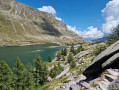
Pont du Countet - Refuge des Merveilles
 3.63 mi
+2,697 ft
-1,276 ft
4h 00
Moderate
Departure from Belvédère (Alpes-Maritimes)
3.63 mi
+2,697 ft
-1,276 ft
4h 00
Moderate
Departure from Belvédère (Alpes-Maritimes)
Discover the Vallée des Merveilles by connecting the Vallée de la Gordolasque to the famous Refuge des Merveilles.
Route in the Mercantour
20.23 mi
+9,656 ft
-9,665 ft
4 days
Difficult
Departure from Belvédère (Alpes-Maritimes)
Four-day route in the Mercantour Massif. Passing through the unmissable Vallée des Merveilles, continuing on to the Refuges de Nice and Madone de Fenestre, then ending the circular at Pont du Countet, the terminus of the Gordolasque valley road.
Mont des Merveilles
 5.54 mi
+3,297 ft
-3,297 ft
5h 25
Difficult
Departure from Belvédère (Alpes-Maritimes)
5.54 mi
+3,297 ft
-3,297 ft
5h 25
Difficult
Departure from Belvédère (Alpes-Maritimes)
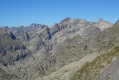
Mont des Merveilles or Caïre des Conques is a peak located between the Vallée des Merveilles and the Vallée de la Gordolasque.
This hike from Pont du Countet will take you up Pas de l'Arpette via Vallon d'Empuonrame.
On the agenda: beautiful panoramic views of several lakes and the peaks of the Mercantour, as well as encounters with chamois and marmots if you're lucky.
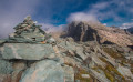
Mont des Merveilles and Grand Capelet from Gordolasque
 7.40 mi
+4,465 ft
-4,465 ft
6 hrs
Very difficult
Departure from Belvédère (Alpes-Maritimes)
7.40 mi
+4,465 ft
-4,465 ft
6 hrs
Very difficult
Departure from Belvédère (Alpes-Maritimes)
This hike is mostly off-trail, with significant elevation gain, and is reserved for experienced walkers. The view from the summit of Grand Capelet, at the crossroads of the Gordolasque, Merveilles and Valmasque valleys, is undoubtedly one of the most beautiful in the Mercantour.Please take note of the practical information.
For more walks, use our search engine .
The GPS track and description are the property of this route's author. Please do not copy them without permission.

