Country:
 City:
City:


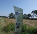
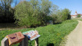
The start point is the Flots Bleus car park, situated along the D971 departmental road in the centre of the village. Ample parking is available for motorhomes. A large sign detailing the three routes in the area is located at the start.
(S/E) From the car park, walk along the D971 on the pavement towards Louhans; turn left at the first street, Rue de la Charité, and follow the street all the way to the end.
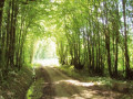
(1) At the junction, turn right onto Rue de l’Église towards the cemetery, then take Impasse du Vernay, the first street on the left – a tarmac road that quickly turns into a stony track.
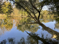
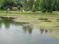
Carry on to the first ‘cut’, the Coupure de la Seugnière – a bend in the River Seille that was cut off when the river was channelled at the end of the 18th century – where you’ll come across the first three information boards.
(2) The first is dedicated to the bocage landscape you’re passing through, the second to the wildlife. It invites you to take a break and be mindful of your surroundings. You might be lucky enough to spot herons or Eurasian curlews, which favour the meadows bordering the Seille. Thethird board offers you the chance to learn more about bird tracks. Tables and benches are also provided so you can enjoy the peace and quiet of the spot.
Continue along the path to the towpath beside the Seille.
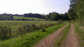
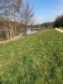
(3) If you turn right, you’ll head towards Louhans, which is 2 km away. To follow the route, keep left and take the towpath that runs alongside the Seille towards the lock, after reading the information on thefourth information board explaining the water cuts. There are three further information boards along the way to the lock. They focus on the birds, fish and meadows around you. It is not uncommon to come across pleasure boats sailing on the Seille. There are also plenty of anglers about. A quick hello and keeping dogs on a lead are appreciated.
(4) At the lock, turn right to reach the Square des Américains (where tables and benches in the shade are available for a picnic. Please take care: there is little space at the side of the road and there is traffic on this departmental road. Two information boards recount the passage of American troops in 1944 and navigation on the Seille.)
To continue the walk, turn left; there is a footpath running alongside the road. Do, however, remain alert to traffic. After the flood information sign, turn left onto Rue de l’Église. (You can access the heritage orchard opposite the sign.) Cross the D167 departmental road with care. Continue to Rue des Écoles, on the right, just before the church.
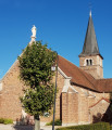
(5) Near the church, two information boards explain the architecture of the Bresse region and market gardening, an activity that was once widespread in the area. Continue right along Rue des Écoles to reach the Flots Bleus car park (S/E).



 A route with very few signposts, but still enjoyable.
 Tourist office