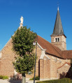
Through the Sornay hedgerows

Sornay, a rural village with a population of 2,000, is situated near Louhans-Châteaurenaud and Branges and is bordered by two rivers: the Sâne Morte and the Seille. The latter, popular with anglers and boaters, features a towpath ideal for exploring the wetlands and their characteristic flora and fauna.

Details

n°28382004
Creation:
Last update:
Last review:
  • Walking
    Activity: Walking
  • ↔
    Distance: 9.15 mi
  • ◔
    Average duration: 4h 15 
  • ▲
    Difficulty: Average

  • ⚐
    Back to start: Yes
  • ↗
    Ascent: + 72 ft
  • ↘
    Descent: - 72 ft

  • ▲
    Highest point: 653 ft
  • ▼
    Lowest point: 577 ft

Photos

Description of the walk

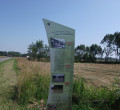
The start point is the Flots Bleus car park, situated along the D971 county road in the centre of the village. There is ample parking for motorhomes. A large sign detailing the three walking routes in the village is located at the start.

(S/E) From the car park, opposite the town hall, turn right onto Rue des Écoles and continue until you reach Rue de l’Église.

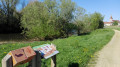
(1) Turn left onto this street. Near the church, two information boards explain the architecture of the Bresse region and market gardening, an activity that was once very widespread in the area. Continue to the D167 departmental road.

(2) Cross the departmental road with care. Note the heritage orchard on the right and the market-gardening greenhouses on the left. Continue for 1 km and turn left onto Chemin des Sassaudes until you reach the next junction.

(3) Turn right onto Chemin de la Varenne until you reach the next junction, Chemin des Ferdières.

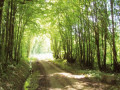
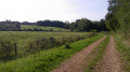
(4) Carry on to the right for about 250 m and turn right onto Impasse Carré. You’ll pass through a poplar grove and a large meadow along a stony path before reaching the banks of the Seille on the towpath.

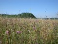
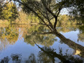
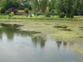
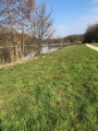
(5) Turn left and follow the Seille. Continue for 2 km. You’ll be able to spot birds and flowers in the meadows, as well as the reed beds along the Seille. On the opposite bank, herds of cattle graze in the pastures. A tower, the former dovecote of the Château du Thiellay in Savigny-sur-Seille, is also visible. It is not uncommon to come across pleasure boats sailing on the Seille. There are also plenty of anglers about. A quick hello and keeping dogs on a lead are appreciated. You will also see poplar groves along your route.

(6) Turn left onto Impasse du Thiellet and continue to the D971 departmental road.

(7) Cross the D971 departmental road with care and continue along Chemin de la Platière until you reach Route du Haut de Grannod.

(8) Turn left and note a beautiful farmhouse with a dovecote near your path. Continue until you reach a Fork in the road.

(9) Turn right onto thesecond track, Desserte des Diablières. After 500 m, at the junction, carry straight on along Desserte des Diablières until you reach the D167.

(10) Turn carefully right onto this road, go for 100 m and take the first track on the left. Follow it until you reach a tarmac road.

(11) At the road, turn right and then right again a few metres further on, onto Route de la Croix. Carry on until you reach the Moulin de Sâne. It is on your right, as is the river Sâne Morte.

(12) Turn left onto Route du Moulin de Sâne, then take thefirst track on the left, Chemin du Mont Ecot. Continue for 500 m.

(13) Turn left onto Chemin des Cantons. Continue for 150 m and turn right onto a stony track. Continue until you reach the next tarmac road.

(14) Turn left onto Chemin des Communautés de la Croix and continue along Rue des Amortets. Pass the football ground and the tennis courts. Cross the D971 county road with care to reach the starting point (S/E).


Waypoints

  1. S/E : mi 0 - alt. 597 ft - Flots Bleus car park (D971)
  2. 1 : mi 0.29 - alt. 591 ft - Rue de l’Église
  3. 2 : mi 0.59 - alt. 584 ft - Conservation orchard (D187)
  4. 3 : mi 1.38 - alt. 630 ft - Chemin de la Varenne
  5. 4 : mi 1.75 - alt. 633 ft - Chemin des Ferdières
  6. 5 : mi 2.51 - alt. 581 ft - Towpath - Seille (Affluent de la Saône)
  7. 6 : mi 3.81 - alt. 581 ft - Impasse du Thiellet - Seille (Affluent de la Saône)
  8. 7 : mi 4.37 - alt. 594 ft - Chemin de la Platière
  9. 8 : mi 4.75 - alt. 650 ft - Haut de Grannod
  10. 9 : mi 4.97 - alt. 646 ft - Diablières
  11. 10 : mi 6.08 - alt. 640 ft - Route de la Chapelle-Thècle
  12. 11 : mi 6.68 - alt. 630 ft - La Croix
  13. 12 : mi 7.09 - alt. 607 ft - Moulin de la - Sâne Morte (rivière) - Affluent de la Sâne vive
  14. 13 : mi 7.46 - alt. 640 ft - Chemin des Cantons
  15. 14 : mi 8.16 - alt. 627 ft - Chemin des Communautés de la Croix
  16. S/E : mi 9.15 - alt. 597 ft - Flots Bleus car park (D971)

Notes

The walk starts from the village of Sornay, where free parking is available. Trainers or light walking shoes are sufficient.
This walk is best enjoyed at different times of year to discover the various cycles of this natural environment.
Please note that part of the trail is inaccessible during periods of high water.
This trail is signposted with directional signs (SO3) and yellow painted markings.

Worth a visit

An easy route of around 15 kilometres.
The section along the banks of the Seille is pleasant in all seasons.
The meadows are full of flowers in spring.

Reviews and comments

4.3 / 5
Based on 3 reviews

Reliability of the description
4.3 / 5
Ease of following the route
4.7 / 5
Route interest
4 / 5
OT Bresse Bourguignonne

Hello,
thank you for taking the time to leave a review and share your thoughts on this walk.

Have a lovely day

Bresse-Bourguignonne Tourist Office
Mélise

Machine-translated

alainumpapa
alainumpapa

Overall rating : 4.7 / 5

Date of your route : Aug 30, 2026
Reliability of the description : ★★★★★ Very good
Ease of following the route : ★★★★★ Very good
Route interest : ★★★★☆ Good
Very busy route : No

A lovely, peaceful walk with a variety of terrain (grassy paths as well as tarmac roads). The scenery varies depending on the time of day...

Machine-translated

OT Bresse Bourguignonne

Hello,

Thank you for leaving a review of the walk you went on. The banks of the Seille are lovely indeed.

Have a lovely day

Mélise
Bresse Bourguignonne Tourist Office

Machine-translated

Sauvage 39
Sauvage 39

Overall rating : 3.3 / 5

Date of your route : Apr 15, 2024
Reliability of the description : ★★★☆☆ Average
Ease of following the route : ★★★★☆ Good
Route interest : ★★★☆☆ Average
Very busy route : No

The banks of the Seille are lovely, though there’s a lot of tarmac along the route.

Machine-translated

OT Bresse Bourguignonne

Hello,
Thank you for leaving a review – we’re delighted that you enjoyed this hike.

Have a lovely day

Mélise
Bresse Bourguignonne Tourist Office

Machine-translated

pon39
pon39

Overall rating : 5 / 5

Date of your route : Feb 10, 2023
Reliability of the description : ★★★★★ Very good
Ease of following the route : ★★★★★ Very good
Route interest : ★★★★★ Very good
Very busy route : No

Lovely, renovated Bresse-style houses, a detailed description, an enjoyable route – well done.

Machine-translated

Other walks in the area

For more walks, use our search engine .

The GPS track and description are the property of this route's author. Please do not copy them without permission.