Country:

 City:


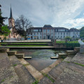
Parking available next to Oberbronn Cemetery.
(S/E) With your back to the cemetery, take Rue des Églises on the left (marked with a Red Triangle), then continue straight on along Rue des Fontaines, following it until you reach the village boundary.
(1) Leave this street and follow the path on your right towards the Immenkopf (marked with a Red Triangle) until you reach the Lauterbach stream.
(2) Cross the stream and follow the path which zigzags uphill to the right. Further up, you’ll come to a flight of steps; after this, follow the path to the right towards the Immenkopf and the Weisse Birke.
(3) At this point, you have two options:
- follow the path on the left (marked with a Red Triangle), which leads to the Immenkopf and then rejoins this same path further on (this does not make the walk any longer),
- continue along the path on the right-hand side (marked with a Blue Triangle) to reach the Weisse Birke (route).
(4) At the junction, turn north onto the path marked with a Red Triangle until you reach the multi-way junction.
(5) Continue straight on along the path that climbs towards the Holdereck Pass (marked with a Yellow Ring).
(6) At the pass, follow the path on the right (marked with a Red Rectangle) to the Ungerthal Pass.
(7) Cross the road with care and continue straight ahead on the Wasenkoepfel Forest Track (marked with a Red Rectangle). At the next junction, ignore the two paths on the right and follow the path on the left (marked with a Red Rectangle-White Rectangle-Red Rectangle) to Kreutztannen.
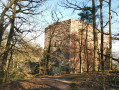
(8) Follow the Discovery Trail, which branches off to the left towards the Hexenplätzel (marked with a Blue Disc and a Red Rectangle). This trail passes through the Reisberg before reaching Wasenbourg Castle.
(9) In front of the castle entrance, follow the path leading down to the right (marked with a Red Rectangle). Please note: after a sharp bend, do not miss the path leading down to the left (marked with a Blue Rectangle) towards Niederbronn.
(10) When you reach the junction, follow the path leading off to the right (marked with a Blue Rectangle) towards the Rettersberg.
(11) Follow the path leading off to the right for a few metres, then turn left onto the path marked with a Blue Triangle and follow it to Buckelstein.
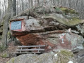
(12) Follow the path leading down to the left, which passes by the Buckelstein, where you can admire a magnificent panoramic view of the valley. Then continue down the zigzagging path (be careful – there are a few steps at the start, but there’s a handrail!) to reach Oberbronn.
(13) Follow Rue Gelders to the right and continue to the Town Hall. From there, turn right and walk down Rue Principale to the junction with Rue des Églises on your right. Follow Rue des Églises to return to the car park at the start of the route, by the Oberbronn cemetery (S/E).

 Visorando Member

 Difficult
 Tourism professional