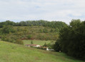
“Le petit de Donzac” route on the Sentiers du Brulhois

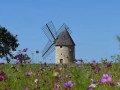
Whether on foot, by mountain bike or on horseback, with friends, family or on your own, set off to explore this lovely route, accessible to everyone! Located in the commune of Donzac, this easy route, with very little elevation gain, takes you into the heart of the Brulhois countryside, through numerous orchards, country lanes and agricultural landscapes.

A pleasant and peaceful walk, ideal for enjoying the fresh air, admiring the scenery and discovering the riches of our region. A perfect route for a family outing, a leisurely stroll or simply for the pleasure of being surrounded by nature! This is route no. 7 of the Sentiers du Brulhois.

Details

n°111249890
Creation:
Last update:
Last review:
–
  • Walking
    Activity: Walking
  • ↔
    Distance: 3.97 mi
  • ◔
    Average duration: 1h 50 
  • ▲
    Difficulty: Easy

  • ⚐
    Back to start: Yes
  • ↗
    Ascent: + 43 ft
  • ↘
    Descent: - 43 ft

  • ▲
    Highest point: 272 ft
  • ▼
    Lowest point: 223 ft

Description of the walk

Set off from the car park at the Conservatoire de la Ruralité in Donzac.

(S/E) Take the D30 towards Dunes, then take the first road on the right.

(1) Leave the road at the junction and take the path on the left. Then continue straight ahead along the Chemin de Bois Jourdan.

(2) Before you reach a riding centre, take the path on the left and head up to the orchard.

(3) Turn onto the path on the right and walk round the orchards, keeping to the left.

(4) Cross the D30 carefully and head straight ahead along Impasse du Mousse for about 100 m.

(5) Leave the road at a track on the left and continue until you reach a road.

(6) Turn left onto Chemin de Couget until you reach Avenue du Brulhois.

(7) Cross the D30 again carefully and take the Carrelot de Coulon opposite.

(3) Then follow the path you took on the way out and return to Donzac via the reverse route (S/E).

Waypoints

  1. S/E : mi 0 - alt. 230 ft - Car park at the - Conservatoire de la ruralité de Donzac
  2. 1 : mi 0.3 - alt. 223 ft - Fork in the path
  3. 2 : mi 0.81 - alt. 230 ft - T-junction before the riding centre
  4. 3 : mi 1.02 - alt. 243 ft - Crossroads of the circular loop
  5. 4 : mi 1.96 - alt. 272 ft - Junction with the D30
  6. 5 : mi 2.08 - alt. 269 ft - Fork in the path
  7. 6 : mi 2.31 - alt. 269 ft - Chemin de Couget
  8. 7 : mi 2.53 - alt. 246 ft - Avenue du Brulhois D30
  9. S/E : mi 3.97 - alt. 230 ft - Car park at the - Conservatoire de la ruralité de Donzac

Notes

The ‘Sentiers du Brulhois’ form part of a network of short walking routes designed for walkers, mountain bikers and horse riders (some sections are accessible to horse-drawn carriages) in the south of the Communauté de Communes des Deux Rives area. A range of routes of varying lengths are available, starting from the villages of Donzac, Dunes, Sistels and Saint-Loup. On these walks, which take a few hours, you’ll discover the rolling landscapes of the Brulhois region, the architectural heritage of the Gascon bastides and the charm of the flower-filled villages.

Worth a visit

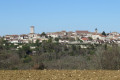
Discover the charm of the flower-filledvillage of Donzac and its rural heritage.

Don’t miss the Conservatoire de la Ruralité et des Métiers d’Autrefois, which houses an impressive collection of nearly 20,000 objects bearing witness to life and traditional crafts of days gone by.

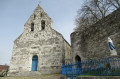
Also worth exploring nearby: Saint-Martial Church, the Chapelle des Mariniers, the old washhouse and the peaceful Lac des Sources.

A wonderful opportunity to combine nature , exploration and heritage during your walk!

Other walks in the area

For more walks, use our search engine .

The GPS track and description are the property of this route's author. Please do not copy them without permission.