The ‘Petit de Sistels’ trail on the Sentiers du Brulhois

Whether on foot, by mountain bike or on horseback, with friends, family or on your own, this route is ideal for anyone looking to enjoy an easy and pleasant stroll in the countryside. Located in the village of Sistels, the Petit de Sistels is one of the most accessible routes on the Sentiers du Brulhois. Presenting no particular difficulty, it mainly passes through farmland and follows peaceful country lanes. A perfect route for families, beginners or simply for those who wish to get some fresh air and enjoy nature at their own pace.
The official name of the walk is: Le Petit de Sistels Route – Route No. 6 of the Sentiers du Brulhois

Details

n°111104327
Creation:
Last update:
Last review:
–
  • Walking
    Activity: Walking
  • ↔
    Distance: 2.46 mi
  • ◔
    Average duration: 1h 15 
  • ▲
    Difficulty: Easy

  • ⚐
    Back to start: Yes
  • ↗
    Ascent: + 180 ft
  • ↘
    Descent: - 184 ft

  • ▲
    Highest point: 627 ft
  • ▼
    Lowest point: 456 ft
  • ⚐ Country: France
  • ⚐ City: Sistels (82340)
  • ⚑
    Start/End: N 44.062066° / E 0.78387°
  • ❏
    IGN map(s): Ref. 1941O
  • Hour-by-hour weather

Description of the walk

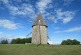
Set off from the water tower car park.

(S/E) Head towards the D71 on the right and follow it, turning left until you reach the Fork in the road.

(1) At the Fork in the road, take the Côte de Loustet on the right.

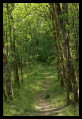
(2) Leave the road at the junction and take the path on the left, continuing along the edge of the woods. Then follow the road on the right.

(3) Cross the D71 road at the junction and continue along the path to the lake.

(4) Walk all the way round the lake on the right-hand side and keep going straight on until you reach the woods.

(5) Continue along the edge of the woodland, then turn left along the vineyards, close to the road, to reach the village of Sistels (S/E).

Waypoints

  1. S/E : mi 0 - alt. 627 ft - Water tower car park
  2. 1 : mi 0.26 - alt. 597 ft - Fork in the road
  3. 2 : mi 0.43 - alt. 558 ft - Crossroads
  4. 3 : mi 1 - alt. 545 ft - Crossroads
  5. 4 : mi 1.28 - alt. 492 ft - Lake
  6. 5 : mi 1.79 - alt. 512 ft - Edge of the woodland
  7. S/E : mi 2.46 - alt. 627 ft - Water tower car park

Notes

The ‘Sentiers du Brulhois’ are a network of short walking routes designed for walkers, mountain bikers and horse riders (some sections are accessible to horse-drawn carriages) in the south of the Communauté de Communes des Deux Rives area. A range of routes of varying lengths are available, starting from the villages of Donzac, Dunes, Sistels and Saint-Loup. On these walks, which take a few hours, you’ll discover the rolling countryside of the Brulhois region, the architectural heritage of the Gascon bastides and the charm of the flower-filled villages.

Worth a visit

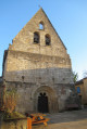
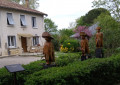
The village of Sistels with its rural charm, the rolling landscapes of the Brulhois, the country lanes lined with meadows and cultivated fields, and the lovely views over the surrounding countryside.

Other walks in the area

For more walks, use our search engine .

The GPS track and description are the property of this route's author. Please do not copy them without permission.