Country:
 City:


Park in the car park of the Cressensac multi-purpose hall.
Yellow signposts
(S/E) Take the path opposite the community hall and follow it to the end to reach Rue de la Fontaine Chaumont.
(1) Turn left and follow the path – part of which is tarmac – until you reach a road.
(2) Continue to the right until you reach the hamlet of Neyragues.
(3) In the centre of the hamlet, turn left onto Route de la Bélonie and take a moment to visit the communal oven, which has been restored by the hamlet’s residents. Carry on for 100 m until you reach the aviary on the right, and take a short detour to the well. At the last house, take the grassy path on the right, between the properties, until you reach the central square. Follow the wall to the left, go round the back of the barn, and you’ll come out onto the Route du Vialard, which you take to the left. Walk past the farm on your left.
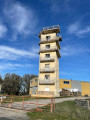
(4) Head along the path on the left, which curves widely to the left, passing twice under the high-voltage power line, and join the Chemin de Tersac. Follow this path, keeping in the same direction, until you reach a right-angled junction with another path. Opposite, you’ll have a view of the tower of Tersac Castle (now a farm).
(5) Turn left onto the track linking Cressensac to Gignac, and continue to the crossroads near the first houses.
(6) Turn right. Cross the D87 with care, and continue along the path opposite. At the end, take the road on the left.
(7) Just past the houses, take the path on the right. Carry on straight ahead at the nearby junction and climb to the top of the hill. Take the path on the left.
(8) Note the survey marker indicating the precise altitude of 324 m. You are now at the highest point of the route, offering a view of the village. A windmill once stood on this spot. Walk on for about a hundred metres, then turn left to head down the path known as the ‘Moulin à Vent’ (Windmill Path) – which becomes particularly picturesque in its second half – until you reach the tarmac road to Meyrignac.
(9) Turn right and follow this road until you reach the junction with the Route de Gignac.
(10) Turn right and continue to the D820 roundabout. Turn left for about twenty metres, then cross the road so you can use the pavement on the opposite side. Continue left until you reach the pedestrian crossing, then cross the road again to return to the car park of the community hall (S/E).

 Visorando Member
 Moderate

 Association / Club / Walk leader