The Églantines Route from Cressensac

A walk around the village of Cressensac, an ancient village with a rich heritage. Two castles: Tersac, to the west, built in 860, which was a hive of activity under Henry IV and is now in ruins; Chausseneige, a private property to the east, built in the 12th century and rebuilt in the 12th century in the Renaissance style. A presbytery in the heart of the village. In 1789, the parish became a commune, having previously been part of the Viscounty of Turenne in the 9th century.

Details

34094009
Creation:
Last update:
Last review:
  • Walking
    Activity: Walking
  • ↔
    Distance: 6.20 mi
  • ◔
    Average duration: 3h 10 
  • ▲
    Difficulty: Easy

  • ⚐
    Back to start: Yes
  • ↗
    Ascent: + 377 ft
  • ↘
    Descent: - 364 ft

  • ▲
    Highest point: 1,053 ft
  • ▼
    Lowest point: 820 ft
  • ⚐ Country: France
  • ⚐ City: Cressensac (46600)
  • ⚑
    Start/End: N 45.019672° / E 1.517111°
  • ❏
    IGN map(s): Ref. 2135O
  • Hour-by-hour weather

Description of the walk

Parking available for cars and coaches in the free car park near the Salle des Fêtes. Hiking trail marked in yellow, PR®.

(S/E) Take the start of the Chemin des Randonneurs opposite (signs indicating the routes). Follow the Églantines route, then head towards Fontaine de Chaumont. Continue and cross the D820 with care.

(1) Head slightly to the left, then right, and follow Rue de la Paternerie until you reach the junction with Chemin des Bergeries.

(2) Turn left onto this path, then, at the end, turn right, heading due north along the Route de Bélès, until you reach the junction with the Route de Vaurés: signposts are provided throughout this route.

(3) Turn right towards Beles (stone cross), and continue to the left. After a barn on the right, carry on to the left until you reach a tarmac road.

(4) Carry on to the left to pass under the A20 motorway. Then turn right and continue for about 75 m.

(5) Turn left towards Chausseneige, carry on past the entrance to the château (not visible), and further on, about 400 m away, look out for the Rochette truffle farm on the left. Carry on to the junction with the road from Cressensac to Turenne. Note the tall, triangular inter-departmental boundary marker, inscribed with ‘Lot/Corrèze’.

(6) Take the path opposite, then turn left onto the road leading to Chaffol Haut. Continue along this path and turn right towards Chaffol Bas.

(7) Continue along the road to the left until you reach a junction with the D87. Turn right onto this road and follow it for about 150 metres.

(8) Turn onto the road on the left (towards La Fouillade, Cieussac) which runs alongside the motorway.

(9) Turn right to pass under the motorway again and carry on to the junction with the D87.

(10) Turn right for 50 metres, then turn left towards La Jarrige. At the Fork in the road, turn left and continue to the cemetery.

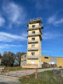
::11: Turn right towards the centre of Cressensac. After the town hall, follow the road to the left, Rue de la Mairie, passing the Church of Saint-Barthélémy, built in 1500 and restored in the 19th century. You’ll also notice a tower on the left, a former presbytery that has become the Maison des associations. Continue to the D820.

(12) Continue left along the pavement running alongside the departmental road, cross at the pedestrian crossing in front of the post office and continue to the left. Note a memorial stone on the left in this square and a hotel-restaurant opposite.
Turn right to return to the car park at the Salle des Fêtes (S/E).


Waypoints

  1. S/E : mi 0 - alt. 965 ft - Salle des Fêtes car park
  2. 1 : mi 0.38 - alt. 997 ft - D820
  3. 2 : mi 0.75 - alt. 909 ft - Chemin des Bergeries
  4. 3 : mi 1.44 - alt. 948 ft - Junction with Route de Vaurés
  5. 4 : mi 1.8 - alt. 896 ft - Route
  6. 5 : mi 2.02 - alt. 906 ft - Junction
  7. 6 : mi 3.09 - alt. 1,020 ft - The road from Cressensac to Turenne
  8. 7 : mi 3.78 - alt. 961 ft - Chaffol Bas
  9. 8 : mi 4.38 - alt. 823 ft - Junction
  10. 9 : mi 4.69 - alt. 856 ft - Passage under the motorway
  11. 10 : mi 5.23 - alt. 896 ft - D87
  12. 11 : mi 5.85 - alt. 988 ft - Cemetery
  13. 12 : mi 6.07 - alt. 968 ft - D820
  14. S/E : mi 6.2 - alt. 965 ft - Salle des Fêtes car park

Notes

Hiking boots and clothing, hat or cap, walking poles, drinks.
Hotel and restaurants on site.

Worth a visit

Château Chausseneige.
Places to visit in the surrounding area: Turenne, Brive, Collonge-la-Rouge, Souillac, Martel, Sarlat, etc.

Always be cautious and plan ahead when you're outdoors. Visorando and the author of this route cannot be held responsible for any accidents occurring on this route.

The GR® and PR® markings are the intellectual property of the Fédération Française de Randonnée Pédestre.

Reviews and comments

3.8 / 5
Based on 4 reviews

Reliability of the description
4.3 / 5
Ease of following the route
4.3 / 5
Route interest
3 / 5
flégeolois
flégeolois

Overall rating : 3.3 / 5

Date of your route : Apr 13, 2026
Reliability of the description : ★★★★☆ Good
Ease of following the route : ★★★★☆ Good
Route interest : ★★☆☆☆ Disappointing
Very busy route : No

Too much driving

Machine-translated

Celineetfrederic
Celineetfrederic

Overall rating : 4.7 / 5

Date of your route : Jan 01, 2026
Reliability of the description : ★★★★★ Very good
Ease of following the route : ★★★★★ Very good
Route interest : ★★★★☆ Good
Very busy route : No

Pleasant hike with excellent explanations
Thank you

Machine-translated

MIFA46
MIFA46

Overall rating : 3.7 / 5

Date of your route : Aug 22, 2025
Reliability of the description : ★★★★☆ Good
Ease of following the route : ★★★★☆ Good
Route interest : ★★★☆☆ Average
Very busy route : No

A pleasant route, which for me was more like the "Blackberry and Fig Trail" given the season ;-). Beautiful sections in the woods.
Well signposted from the village, the signs are sometimes few and far between, but the GPS route is excellent! It's a lovely Sunday stroll. Unfortunately, I didn't have time to enjoy all the other trails on offer in the municipality. Congratulations on making the effort to create all these routes.
Thank you to the author.

Machine-translated

Robert_Gignac
Robert_Gignac

Overall rating : 3.7 / 5

Date of your route : Jan 29, 2024
Reliability of the description : ★★★★☆ Good
Ease of following the route : ★★★★☆ Good
Route interest : ★★★☆☆ Average
Very busy route : No

There are two errors on the information sheet:
the highest point is not 381 m!
The lowest point is not 291 m!

Machine-translated

Other walks in the area

For more walks, use our search engine .

The GPS track and description are the property of this route's author. Please do not copy them without permission.