Route du Patrimoine de Cousolre

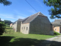
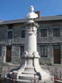
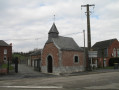
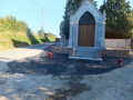
On this 3.5km route through the village, discover the typical architectural heritage of the Avesnois region with its pretty blue-stone houses, chapels and oratories, as well as the magnificent bandstand in the square.

Details

n°1746038
Creation:
Last update:
Last review:
  • Walking
    Activity: Walking
  • ↔
    Distance: 2.13 mi
  • ◔
    Average duration: 1h 05 
  • ▲
    Difficulty: Easy

  • ⚐
    Back to start: Yes
  • ↗
    Ascent: + 138 ft
  • ↘
    Descent: - 148 ft

  • ▲
    Highest point: 650 ft
  • ▼
    Lowest point: 502 ft

Photos

Description of the walk

Park in the Maison du Patrimoine car park.

(S/E) Follow the Route Nationale towards the bandstand, then the Town Hall on Place Charles de Gaulle.
Walk past the Town Hall and carry on to the Saint-Walbert Chapel. Once you reach the chapel, retrace your steps.

(1) Take the first street on the right, Rue Saint-Roch, and carry on straight ahead to the Saint-Roch Chapel.

(2) Retrace your steps to Rue Joffroy. Turn right. At the Stop sign, turn right onto the Route Nationale.
Stop at the Maison des Conventionnels, then cross the bridge over the Thure. Next, turn left onto Rue du Vieux Couvent.
Turn right, go up the steps on Rue de la Montagne and carry on straight ahead to reach Place de la République and the Notre-Dame de Guérison Chapel.

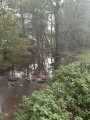
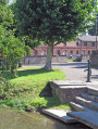
(3) Turn left into Rue Saint-Joseph. At the end of the street, continue to the right into Rue Marius Lenglet, then take the first left, Rue Bréoux, to arrive opposite the federal pond.

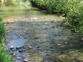
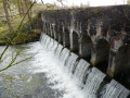
(4) Follow the street and, at the end of it, turn right. Walk to the bridge over the Thure and cross it. Turn right to walk alongside the river. Then take a wooden footbridge and turn slightly right to cross the Place du Marais.
At the end of the square, turn right onto Rue des Juifs, which leads to the church. Continue straight on along the Route Nationale to return to the starting point (S/E).

Waypoints

  1. S/E : mi 0 - alt. 541 ft - Heritage Centre / Tourist Office
  2. 1 : mi 0.16 - alt. 551 ft - Saint-Walbert Chapel
  3. 2 : mi 0.5 - alt. 646 ft - Saint-Roch Chapel
  4. 3 : mi 1.18 - alt. 551 ft - Notre-Dame de Guérison Chapel
  5. 4 : mi 1.59 - alt. 522 ft - Federal Pond - Thure (rivière)
  6. S/E : mi 2.13 - alt. 541 ft - Heritage Centre / Tourist Office

Worth a visit

Reviews and comments

3.7 / 5
Based on 2 reviews

Reliability of the description
4.5 / 5
Ease of following the route
3 / 5
Route interest
3.5 / 5
randodom(
randodom(

Overall rating : 4.7 / 5

Date of your route : Sep 19, 2024
Reliability of the description : ★★★★★ Very good
Ease of following the route : ★★★★★ Very good
Route interest : ★★★★☆ Good
Very busy route : No

An interesting route with information boards detailing the history
of the town’s historical landmarks;
A visit to the Museum of Talking Machines is an absolute must, led by an enthusiast

Machine-translated

henri57
henri57 ★

Hello,

Thank you for taking the time to give your feedback.

As the waymarking is not the responsibility of either the author or Visorando, the ‘Route on map’ feature is not intended to evaluate the waymarking itself, but rather to assess how closely the route shown on the map matches the actual terrain.

Visorando does not provide advice on signposting as this can be altered or removed… whereas the terrain features are a constant source of information.

Visorando provides a detailed route description (which can be improved) and an IGN route map at a scale of 1:25,000. And, if signposting is essential to you, Visorando offers a virtual signposting tool: a GPS app.

This tool, offered free of charge by Visorando, allows you to verify waypoints and thus resolve any doubts regarding navigation.

See you soon

Machine-translated

Brigetrene
Brigetrene

Overall rating : 2.7 / 5

Date of your route : Sep 16, 2019
Reliability of the description : ★★★★☆ Good
Ease of following the route : ★☆☆☆☆ Very disappointing
Route interest : ★★★☆☆ Average

There are no signposts

Machine-translated

Other walks in the area

For more walks, use our search engine .

The GPS track and description are the property of this route's author. Please do not copy them without permission.