


 Country:

 City:
City:


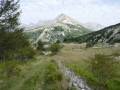
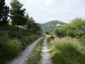
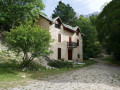

Coming from Gap or Veynes via the D937, pass the first turn-off to the village of La Cluse and take the second turn-off 500 metres further on. There is a car park right at the entrance to the village, but as it has few spaces, it is best to leave it for local residents and park a little before it on the left, by the rubbish bins.
(S/E) Walk a few dozen paces towards the village and you’ll find the path entrance on the left, marked by a sign pointing towards Mouche Chat, Rabioux and Le Festre. Take this path, which descends towards the road. Cross the road carefully and walk about a hundred metres to the left until you find the path entrance on the right-hand embankment.
(1) Turn right onto this path, which winds round a bend and then climbs straight up, following a small stream. You’ll soon reach the spot known as ‘Le Lac’ on the left, which is in fact a wetland – more specifically, a peat bog. Continue climbing until you find yourself in an open area, a plateau where you’ll join a track.
(2) At the place known as ‘Serre du Lièvre’ (signpost), take this track on the right towards Rabioux. You’ll soon pass a farm building on your left, slightly higher up, and carry on until you come to another track after a descent.
(3) Turn left (Rabioux is still signposted) and continue along this track until you reach a clearing in the middle of a valley, where you’ll find a cairn and the start of a path leading down to the right at the foot of a Scots pine. On the pine trunk, there is a yellow marker (circular loop) and a red and yellow marker (GRP®).
(4) Take this path, which descends steadily through a forest of Scots pines and larch trees, until you pass through a greener section of woodland, rich in deciduous trees, before emerging onto a track.
(5) You are now at the site of the ruined hamlet of Rabioux, as evidenced by the numerous wall stumps overgrown with vegetation. Continuing left along the track, you’ll reach a clearing in front of a beautiful building, the Retrouvance lodge: what a lovely name!
Turn round and take the track, following the signs for La Cluse (indicated on the signpost for the hamlet of Rabioux). You’ll soon pass a Forestry Commission hut, crossing two small streams. Further on, after a series of hairpin bends, you’ll pass a farm and continue until you reach a junction with a track coming from the right.
(6) Carry on along the same track until you reach the D937 road. Cross the road carefully and walk about forty metres to the right.
(7) Take the small road leading down to the left towards La Cluse and reach a junction just before a towering rock by the roadside overlooking the river. Continue to the right along the road overlooking the river and reach the junction with the track leading to Plate Contier (signpost). There is also a portable public toilet here.
(8) Turn right and head uphill towards the village, which you cross via its main street, passing the school, the church, the war memorial and a pretty fountain. Leave the village and, a little further on to the right, you’ll find the car park near the rubbish bins (S/E).



 Visorando Member
 Difficult
 Easy
Easy 
 Very difficult
