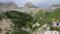
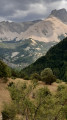
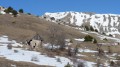
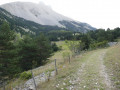
The Col du Lauteret from La Cluse

A hike with a southern flavour, starting amidst wild lavender. An easy walk following theGR® 94. Drinking water is available from the springs in the Vallon, after Boudelle.
You’ll come across cows, marmots… and chamois.

Details

n°2970583
Creation:
Last update:
Last review:
  • Walking
    Activity: Walking
  • ↔
    Distance: 5.65 mi
  • ◔
    Average duration: 4h 10 
  • ▲
    Difficulty: Moderate

  • ⚐
    Back to start: Yes
  • ↗
    Ascent: + 1,772 ft
  • ↘
    Descent: - 1,772 ft

  • ▲
    Highest point: 5,745 ft
  • ▼
    Lowest point: 3,999 ft

Photos

Description of the walk

Park at the car park, which has toilets, at the western exit of the village of La Cluse.

(S/E) Take theGR® 94 (marked in white and red) towards Oues, as far as Bauchière.

(1) Cross the bridge over the torrent and leave the forest track to follow a signposted path that climbs up in front of you.

(2) In an hour you’ll reach the Boudelle sheepfold, which you should bypass just after crossing a small stream. In 2020, theGR® climbs immediately to the right via a few steep hairpin bends, to preserve the shepherds’ peace and quiet. The forest gives way to mountain pastures.

(3) At the junction, follow the left-hand branch, whilst a path branches off to the right towards the Col de Plate Contier. You’ll reach the Col de Lauteret without difficulty via a few hairpin bends.

(4) This pass may tempt you to explore the surrounding area.
The return journey follows the same route back to the car park (S/E).

Waypoints

  1. S/E : mi 0 - alt. 3,999 ft - Car park at the western exit of La Cluse
  2. 1 : mi 0.53 - alt. 4,058 ft - Bridge - Béoux (torrent) - Affluent du Petit Buëch
  3. 2 : mi 1.29 - alt. 4,669 ft - Boudelle Parish House
  4. 3 : mi 2.43 - alt. 5,469 ft - Junction
  5. 4 : mi 2.77 - alt. 5,745 ft - Col de Lautaret
  6. S/E : mi 5.65 - alt. 3,999 ft - Car park at the western exit of La Cluse

Notes

No equipment required.

(2) Alternative return route via the Aune Forest Road from Boudelle (a wide track that takes you back to the bridge at Bauchière).

Always be cautious and plan ahead when you're outdoors. Visorando and the author of this route cannot be held responsible for any accidents occurring on this route.

The GR® and PR® markings are the intellectual property of the Fédération Française de Randonnée Pédestre.

Reviews and comments

4.7 / 5
Based on 1 review

Reliability of the description
5 / 5
Ease of following the route
5 / 5
Route interest
4 / 5
BÉRARD DANIEL
BÉRARD DANIEL

Overall rating : 4.7 / 5

Date of your route : Nov 14, 2022
Reliability of the description : ★★★★★ Very good
Ease of following the route : ★★★★★ Very good
Route interest : ★★★★☆ Good
Very busy route : Yes

At this time of year, there is no one in the mountain pastures above the ‘La Boudelle’ sheepfold.
We came back down via the alternative route.
A lovely day.

Machine-translated

Other walks in the area

For more walks, use our search engine .

The GPS track and description are the property of this route's author. Please do not copy them without permission.