La Cluse circular

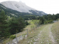
A lovely, easy walk at the southern gateway to the Dévoluy, with no difficulty. The route is clear and well-marked, following aGR® trail and wide forest tracks for the most part, and is accessible all year round, depending on snow conditions.
Two possible starting points: Col de Festre or the village of La Cluse. Water is available at both locations, and there are lodges there serving drinks!
The circular route can be walked in either direction, but the slopes that’ll really get you working up a sweat are just past La Cluse.

Details

2433833
Creation:
Last update:
Last review:
  • Walking
    Activity: Walking
  • ↔
    Distance: 6.26 mi
  • ◔
    Average duration: 4h 00 
  • ▲
    Difficulty: Moderate

  • ⚐
    Back to start: Yes
  • ↗
    Ascent: + 1,309 ft
  • ↘
    Descent: - 1,316 ft

  • ▲
    Highest point: 5,138 ft
  • ▼
    Lowest point: 4,065 ft

Photos

Description of the walk

Park in the car park at the Col de Festre on Route 937. This is the starting point for several walks of varying difficulty.

(S/E) Head south-south-west to join aPR® trail which runs along a wide path at the foot of the Chauvet. Follow it to the small Col des Plaines.

(1) Continue down the path and make sure you don’t miss the track branching off to the right (clearly marked by a cairn), which leads down a few hairpin bends to the village of La Cluse.

.(2) Turn left until you rejoin theGR® 94. On leaving the village, on the other side of the A937, the path climbs south-southeast to reach the Serre du Lièvre crossroads.

(3) Turn left towards the Col de Festre. TheGR® continues northwards and climbs for a few hundred metres. A few cairns on the right mark the path (which you’ll ignore) to the Pic de Bure via the Combe de La Cluse!
The forest track descends gently towards the Col de Festre and its car park (S/E).

Waypoints

  1. S/E : mi 0 - alt. 4,718 ft - Col de Festre car park
  2. 1 : mi 1.53 - alt. 5,131 ft - The Col des Plaines
  3. 2 : mi 2.88 - alt. 4,075 ft - La Cluse
  4. 3 : mi 3.66 - alt. 4,573 ft - Serre du Lièvre
  5. S/E : mi 6.26 - alt. 4,718 ft - Col du Festre car park

Notes

(2) Enjoy the drinking water from the fountain that flows freely in front of the Town Hall.
No special equipment is required, but in the mountains the weather can change quickly...

Worth a visit

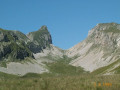
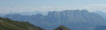
From the Col de Festre, there’s a lovely view of the Dévoluy Massif.
La Mère-Église isn’t too far away and is well worth a detour, if only for its architecture and its cemetery, where René Desmaison is buried.
In La Cluse, you can take a stroll along the water’s edge (there’s a picnic area) and dip your feet in the water.

Always be cautious and plan ahead when you're outdoors. Visorando and the author of this route cannot be held responsible for any accidents occurring on this route.

The GR® and PR® markings are the intellectual property of the Fédération Française de Randonnée Pédestre.

Reviews and comments

4.8 / 5
Based on 2 reviews

Reliability of the description
5 / 5
Ease of following the route
5 / 5
Route interest
4.5 / 5
neross
neross

Overall rating : 4.7 / 5

Date of your route : Dec 21, 2020
Reliability of the description : ★★★★★ Very good
Ease of following the route : ★★★★★ Very good
Route interest : ★★★★☆ Good
Very busy route : No

towards the Col du Festre, Les Garcin and La Cluse
A pleasant walk
La Cluse – Serre du Lièvre
Best done with crampons; the climb is steep.
At this time of year, it’s best to do the route in reverse.
A pleasant route

Machine-translated

1950bba
1950bba

Overall rating : 5 / 5

Date of your route : Aug 26, 2020
Reliability of the description : ★★★★★ Very good
Ease of following the route : ★★★★★ Very good
Route interest : ★★★★★ Very good
Very busy route : No

A very pleasant and varied walk.
A few sections of the path have collapsed on the descent to La Cluse.

Machine-translated

Other walks in the area

For more walks, use our search engine .

The GPS track and description are the property of this route's author. Please do not copy them without permission.