


 Country:
 City:
City:


Park in the car park at Baud Town Hall.
(S/E) Walk past the town hall and head down the D727 on your left, towards Bubry and Languidic. After 150 metres, turn right towards Pont-Augan. Take the second street on the left, then keep to the right. Next, take thefirst road on the left and turn left onto Rue de Pontivy, then turn left again onto Rue d’Avrillon.
(1) At the top of the street, turn right onto a magnificent sunken lane lined with hundred-year-old oak trees and head up to Rue des Écureuils, which you should follow to the left.
(2) At the bend, turn right and, 150 metres further on, turn right again onto an uphill farm track. At the junction, keep left.
(3) When you reach the road, turn left towards Coët Er Houarn. As you leave the hamlet, turn right onto a gently sloping track. After passing through a small copse, head left initially, then, 100 metres further on, turn right onto farm tracks.
(4) Carry on to the hamlet of Kerbresque, which you pass through to join the D3 on the right. Take care for 200 m: this is a busy road. After the bridge, turn right towards Kerbraz.
(5) In the hamlet, turn right onto a path through the woods. At the next junction, turn left towards the beautiful hamlet of Keraudrono.
(6) Continue along the small road towards the hamlet of Botcario. Keep going straight on until you pass through a tunnel, then turn left onto an uphill track.
(7) Take this path. At the junction, turn left and then right onto a farm track leading to the hamlet of Coët Vin.
(8) Turn right onto a small road and then right again to follow the D724. Take care: this is a busy road. Keep left towards Vénus de Quinipily.
(9) After the Vénus gardens, turn left to walk alongside the former Baud quarries, now converted into ponds, and head back up towards the village centre and the town hall via a footpath. As you walk alongside the road, keep to the left and then turn right at the four-way junction before continuing straight ahead until you reach the town hall (S/E).

 Tourist office
 Visorando Member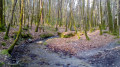
 Local authority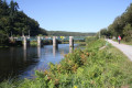
 Easy
Easy 
