The Montpont-en-Bresse Ponds Route

Before being renamed Montpont-en-Bresse in 1961, the village was first known as Mons Pavonis and then Montpaon.
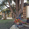
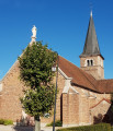
Dotted with ponds, streams and rivers, it also boasts a large area of woodland. The charm of this countryside lies in the diversity of its heritage, fine examples of which can be found in the village centre, with its brick church, its town hall housed in a former manor house, and its library set in a traditional Bresse-style building.

Details

n°4765740
Creation:
Last update:
Last review:
  • Walking
    Activity: Walking
  • ↔
    Distance: 6.09 mi
  • ◔
    Average duration: 2h 55 
  • ▲
    Difficulty: Easy

  • ⚐
    Back to start: Yes
  • ↗
    Ascent: + 138 ft
  • ↘
    Descent: - 135 ft

  • ▲
    Highest point: 669 ft
  • ▼
    Lowest point: 600 ft

Photos

Description of the walk

Park in the free car park at Prés de la Vavre.

(S/E) Keep the lake on your right and take the path that goes round all the buildings of a Bresse farm. Then, at the next bend, you’ll reach the junction with a dirt track

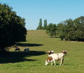
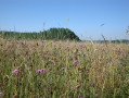
(1) Turn left onto it and continue through the wheat or maize fields.

(2) Cross the Sâne-Vive before reaching the hamlet of Reurre. Turn left after the hamlet and head for the junction with the D12 at the hamlet of Les Quatre Huteaux.
.
(3) Cross the road and the hamlet of Les Quatre Huteaux, then follow the stony track to the Route des Peuples.

(4) Turn right onto this road and leave it shortly afterwards to take thefirst stony track on the left. Continue along this track until you reach the Route du Petit Molard.

(5) Turn right onto this road and continue to Les Chirdets via the Route des Rigaudières. You’ll reach the edge of a wood.

(6) Take the track on the left at the edge of the woodland. Continue to the Impasse des Pommiers, turning left. At the end of this cul-de-sac, turn right towards Les Chirdets. Walk alongside a pond and enter a woodland. Just before the edge of the woodland, you’ll come to a Y-junction.

(7) Turn onto the path on the left and leave the woodland. Pass the houses at Étang Androt and then rejoin the Bois du Pontet.

(8) Cross it and reach a road. Turn right onto this road to reach the hamlet of Petit Molard, passing a cluster of Bresse-style farmhouses, and you’ll come to a Y-junction in the centre.

(9) Take the left-hand branch, then the D39 road, turning left again, to enter the hamlet of Molard. Continue to the T-junction in the hamlet of La Bretagne.

(10) Turn left onto Impasse de Bretagne and continue through the meadows. Pass, in turn, the Sâne-Vive and the Château de Montpont, a former stately home. Continue to the Route des Courtelets. From the Route des Courtelets, join and cross the Route de Romenay (D12) and continue to the Prés de la Vavre car park (S/E).


Waypoints

  1. S/E : mi 0 - alt. 617 ft - Car park at Prés de la Vavre
  2. 1 : mi 0.21 - alt. 650 ft - La Vavre
  3. 2 : mi 0.77 - alt. 604 ft - Sâne Vive (rivière)
  4. 3 : mi 1.14 - alt. 636 ft - Crossing the D12
  5. 4 : mi 1.42 - alt. 640 ft - Les Peuples
  6. 5 : mi 1.93 - alt. 656 ft - Route du Petit Molard
  7. 6 : mi 2.36 - alt. 659 ft - Edge of a woodland
  8. 7 : mi 3.25 - alt. 669 ft - Junction in the woods
  9. 8 : mi 3.87 - alt. 666 ft - Bois du Pontet
  10. 9 : mi 4.79 - alt. 653 ft - Petit Molard
  11. 10 : mi 5.2 - alt. 643 ft - Impasse de Bretagne
  12. S/E : mi 6.09 - alt. 617 ft - Car park at Prés de la Vavre

Notes

Trainers or light walking shoes are sufficient. The trail is signposted with directional signs (MEB2) and yellow arrow markings.
Free car park available at the start. Toilets and picnic tables available. Fitness trail.

Worth a visit

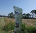
(S/E) Car park: A large sign shows the three green walking routes in the commune of Montpont-en-Bresse.
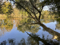
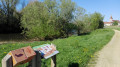
You can spend some time here with your family by the lake. It is also possible to go fishing with a day permit.

Reviews and comments

3.8 / 5
Based on 2 reviews

Reliability of the description
3.5 / 5
Ease of following the route
4.5 / 5
Route interest
3.5 / 5
OT Bresse Bourguignonne

Hello Mond21,

Thank you for taking the time to leave a review. We’ll keep a close eye on the maintenance of the route and won’t hesitate to raise the matter with the local council if we receive any further comments on this.
You also mentioned having difficulty finding your way around. As the route is signposted, did you have any problems with the signposting?
Please do not hesitate to contact us if you require any further information.

Kind regards,
Mélise
Bresse Bourguignonne Tourist Office

Machine-translated

Monde21
Monde21

Overall rating : 3.7 / 5

Date of your route : Jun 13, 2021
Reliability of the description : ★★★☆☆ Average
Ease of following the route : ★★★★★ Very good
Route interest : ★★★☆☆ Average
Very busy route : No

Hello,

A gentle walk, the sort you’d take on a Sunday, with no difficulty at all.
There isn’t much to see along the route, apart from a picnic by a lovely pond, which is private, but as long as you respect the property, you’re allowed to pass through.
It was hot that day: we were often out in the open!

The route description is rather poor: thank goodness I have the Visorando app (which is really, really good!): we were able to find our way thanks to the map tracking. Without it, we would have gone off course several times...
Especially as the route isn’t very well maintained: the grass is very tall in places (over a metre)

Monde21

Machine-translated

OT Bresse Bourguignonne

Hello Annie,

Thank you for taking the time to leave a review. We’re delighted that you enjoyed this walk. We’ll try to expand the Burgundian Bresse area by posting more routes on Visorando to help people explore the region.

Have a lovely day

Mélise
Bresse Bourguignonne Tourist Office

Machine-translated

gonnet annie
gonnet annie
• Edited:

Overall rating : 4 / 5

Date of your route : Apr 12, 2021
Reliability of the description : ★★★★☆ Good
Ease of following the route : ★★★★☆ Good
Route interest : ★★★★☆ Good
Very busy route : No

A lovely, peaceful walk through the woodland. Very little road.
Pleasant stretches leading to several ponds.

Machine-translated

Other walks in the area

For more walks, use our search engine .

The GPS track and description are the property of this route's author. Please do not copy them without permission.