Montpont-en-Bresse Forest Route

Before being named Montpont-en-Bresse in 1961, the village was first known as “Mons Pavonis” and then “Montpaon”.
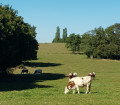
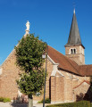
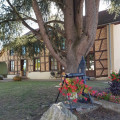
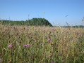
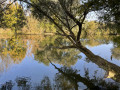
Dotted with ponds, streams and rivers, it also boasts a large area of woodland. The charm of this countryside lies in the diversity of its heritage, fine examples of which can be found in the village centre, with its brick church, its town hall housed in a former manor house, and its library situated in a traditional Bresse-style building.

Details

n°4767954
Creation:
Last update:
Last review:
  • Walking
    Activity: Walking
  • ↔
    Distance: 8.21 mi
  • ◔
    Average duration: 3h 55 
  • ▲
    Difficulty: Moderate

  • ⚐
    Back to start: Yes
  • ↗
    Ascent: + 164 ft
  • ↘
    Descent: - 138 ft

  • ▲
    Highest point: 669 ft
  • ▼
    Lowest point: 600 ft

Photos

Description of the walk

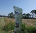
Start at Les Prés de la Vavre. Free car park available. A large sign shows the three ‘Balades Vertes’ routes in the commune of Montpont-en-Bresse.

(S/E) Keep the lake on your right and take the path that goes round all the buildings of a Bresse farm.

(1) Continue along the path on the right until you reach the Route de Lhomont.

(2) Turn left onto this road and follow it for 400 metres.

(3) Take the stony track on the right, pass a pond (on your right) and go through the woods. Join the Impasse des Rippes Loisy and carry on until you reach the Route de la Chapelle-Thècle (D39).

(4) Turn left onto this road (D39) and carry on until you reach thesecond road on the left, just before the woods. Turn onto this road, Impasse des Vendanges, and continue along the path that leads off it until you reach the next tarmac road, Route de Lhomont.

(5) Turn right and continue along the tarmac road to Lhomont. Pass in front of the Moulin de Lhomont.

(6) Carry on to the right along the same road and turn left onto Impasse de Lhomont. The path continues, first through cultivated fields and then through the Lhomont Forest.

(7) After about 1 km, in the woods, turn slightly left onto La Craffe, then left again onto the dirt track known as La Craffe.

(8) Turn right onto Route de la Craffe, just after an old Bresse-style farmhouse. Pass a pond on your right and continue until you reach Route de Rachessiat.

(9) Turn left onto this road, then, after 50 metres, take thefirst track on the right, which leads you across the meadows to the Chemin de Denizet and then to the Route de Romenay (D12). Cross this road (D12) with care and continue straight ahead to the hamlet of La Platière, where you will find a large farm.

(10) Turn left after passing the farm and the Route de Denizet, then take thefirst track on the right which goes round a private pond. Continue to the Route des Rigaudières.

(11) Turn left onto this road and carry on for 700 m.

(12) Turn onto the track on the left and carry on to the Route des Peuples.

(13) Turn right, then take thefirst left a few metres further on. Continue along Route de Denizet towards Les Quatre Huteaux.

(14) At Les Quatre Huteaux, cross the Route de Romenay (D12) with care and continue along the Impasse de Reurre, then onto the dirt track that follows on from it. You’ll pass over the Sâne Vive and continue on to La Vavre.

(1) Head downhill to the right towards the Prés de la Vavre and the lake (S/E).

Waypoints

  1. S/E : mi 0 - alt. 617 ft - Near La Vavre
  2. 1 : mi 0.21 - alt. 650 ft - La Vavre
  3. 2 : mi 0.35 - alt. 659 ft - Lhomont
  4. 3 : mi 0.58 - alt. 633 ft - Lhomont Pond
  5. 4 : mi 1.12 - alt. 666 ft - Les Rippes Loisy
  6. 5 : mi 2.31 - alt. 656 ft - Limay
  7. 6 : mi 2.9 - alt. 607 ft - Lhomont Mill after the - Sâne Vive (rivière)
  8. 7 : mi 3.7 - alt. 653 ft - La Craffe
  9. 8 : mi 4.14 - alt. 653 ft - Route de la Craffe
  10. 9 : mi 4.38 - alt. 653 ft - Route de Rachessiat
  11. 10 : mi 5.23 - alt. 656 ft - La Platière
  12. 11 : mi 5.84 - alt. 659 ft - Route de la Rigaudière
  13. 12 : mi 6.27 - alt. 656 ft - Le Petit Molard
  14. 13 : mi 6.74 - alt. 643 ft - Route des Peuples
  15. 14 : mi 7.05 - alt. 636 ft - Quatre Huteaux
  16. S/E : mi 8.21 - alt. 617 ft - Near La Vavre

Notes

Trainers or light walking shoes are sufficient. The trail is signposted with directional signs (MEB3) and yellow arrow markings.
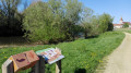
Free car park available at the start. Toilets and picnic tables available. Fitness trail.

Worth a visit

You can enjoy some family time around the lake. Fishing is also permitted with a day permit.

Reviews and comments

4.2 / 5
Based on 2 reviews

Reliability of the description
4.5 / 5
Ease of following the route
4.5 / 5
Route interest
3.5 / 5
OT Bresse Bourguignonne

Hello
Thank you for your review – we’re delighted that you enjoyed this walk.

Have a lovely day

Bresse Bourguignonne Tourist Office
Mélise

Machine-translated

User 20399328

Overall rating : 5 / 5

Date of your route : Sep 08, 2026
Reliability of the description : ★★★★★ Very good
Ease of following the route : ★★★★★ Very good
Route interest : ★★★★★ Very good
Very busy route : No

A lovely walk between the pond and the forest

Machine-translated

OT Bresse Bourguignonne

Hello Thierry,

Thank you for taking the time to leave a review. It’s a shame, indeed, that there isn’t more of a ‘trail’ section.
I hope you enjoyed the walk all the same.

Mélise
Bresse Bourguignonne Tourist Office

Machine-translated

ThierryC1966
ThierryC1966

Overall rating : 3.3 / 5

Date of your route : Aug 11, 2022
Reliability of the description : ★★★★☆ Good
Ease of following the route : ★★★★☆ Good
Route interest : ★★☆☆☆ Disappointing
Very busy route : No

A pleasant walk, but ultimately one that took place entirely on tarmac rather than through the woods.

Machine-translated

Other walks in the area

For more walks, use our search engine .

The GPS track and description are the property of this route's author. Please do not copy them without permission.