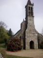
Trinivel to Scrignac route

This route allows you to explore the Lestrézec Wood, the Saint-Corentin Chapel and to cycle along Greenway No. 7, ‘La Vélodyssée’, a former railway line that runs alongside the River Squiriou.

Details

30842948
Creation:
Last update:
Last review:
  • Walking
    Activity: Walking
  • ↔
    Distance: 5.61 mi
  • ◔
    Average duration: 2h 55 
  • ▲
    Difficulty: Easy

  • ⚐
    Back to start: Yes
  • ↗
    Ascent: + 367 ft
  • ↘
    Descent: - 351 ft

  • ▲
    Highest point: 620 ft
  • ▼
    Lowest point: 371 ft

Photos

Description of the walk

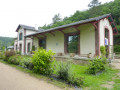
Park in the car park near the old Scrignac railway station.

(S/E) Head west towards Berrien on the D42, crossing the bridge over the Squiriou, and continue for about 750 m.

(1) Turn right onto a track.

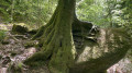
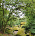
(2) Turn left into the Huelgoat State Forest (Bois de Lestrézec). Walk through the woods, following the signposts, and emerge near Milin Roz Lann (forest gate).

(3) Cross the bridge over the Mendy stream and head for the village of Trinivel.

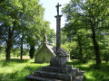
(4) Turn right, pass by the Saint-Corentin Chapel and arrive at Kermarzin.

(5) Turn right onto the local road and then immediately left onto a sunken track which, further on, rejoins the local road.

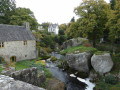
(6) Walk downhill for about 150 m, cross the Kermarzin Bridge and join the former Morlaix–Carhaix railway line, now converted into Greenway No. 7 – La Vélodyssée®.

(7) Turn right and carry on straight ahead for 3 km to return to the former Scrignac railway station (S/E).

Waypoints

  1. S/E : mi 0 - alt. 374 ft - Car park at the old Scrignac railway station
  2. 1 : mi 0.51 - alt. 463 ft - Junction
  3. 2 : mi 0.66 - alt. 446 ft - Junction
  4. 3 : mi 2.09 - alt. 446 ft - Forest gate
  5. 4 : mi 2.51 - alt. 489 ft - Trinivel
  6. 5 : mi 3.26 - alt. 509 ft - Kermazin
  7. 6 : mi 3.43 - alt. 433 ft - Local road
  8. 7 : mi 3.51 - alt. 433 ft - Greenway No. 7 – La Vélodyssée®
  9. S/E : mi 5.61 - alt. 374 ft - Car park at the old Scrignac railway station

Notes

Departmental roads: take care when crossing and walking along these roads.

Worth a visit

Reviews and comments

4.3 / 5
Based on 2 reviews

Reliability of the description
4 / 5
Ease of following the route
4.5 / 5
Route interest
4.5 / 5
ymahe999
ymahe999

Overall rating : 4 / 5

Date of your route : Mar 10, 2026
Reliability of the description : ★★★★☆ Good
Ease of following the route : ★★★★☆ Good
Route interest : ★★★★☆ Good
Very busy route : Yes

Machine-translated

Fanisa
Fanisa

Overall rating : 4.7 / 5

Date of your route : Aug 07, 2023
Reliability of the description : ★★★★☆ Good
Ease of following the route : ★★★★★ Very good
Route interest : ★★★★★ Very good
Very busy route : No

A wonderful exploration of the Arree Mountains

Machine-translated

papou239ana
papou239ana

walks planned for mid-June 2023

Machine-translated

papou239ana
papou239ana

walks planned for June 2023

Machine-translated

Other walks in the area

For more walks, use our search engine .

The GPS track and description are the property of this route's author. Please do not copy them without permission.