Route de Goënidou à Berrien

A lovely day’s walk in the hills of the Monts d’Arrée, following in the footsteps of the first settlers of this barren yet beautiful and mysterious land...

Details

n°25681662
Creation:
Last update:
Last review:
  • Walking
    Activity: Walking
  • ↔
    Distance: 13.72 mi
  • ◔
    Average duration: 7h 05 
  • ▲
    Difficulty: Difficult

  • ⚐
    Back to start: Yes
  • ↗
    Ascent: + 919 ft
  • ↘
    Descent: - 925 ft

  • ▲
    Highest point: 1,017 ft
  • ▼
    Lowest point: 518 ft

Photos

Description of the walk

Park in the square between the town hall and the church in Berrien.

(S/E) Near the town hall, take the Carn ar Verger alleyway behind Saint-Pierre Church and the cemetery. At the end, turn right towards the D42. Continue straight on for 450 m.

(1) Leave the D42 and turn right after a stream towards Kernévez.

(2) Walk through the village and, on leaving it, turn left towards Croaz an Hent Cam. Continue straight on along a dirt track until you reach the Goënidou archaeological site (the remains of a medieval farm, situated 100 m to the right).

(3) Carry on straight ahead for 1.2 km.

(4) Turn right onto a track suitable for vehicles and pass under a power line.

(5) Shortly afterwards, on the descent, turn left onto a grassy track leading to the entrance to the village of Trédudon-le-Moine. At the end of the track, turn right and then cross the village, where there is a memorial stone commemorating thefirst village in France to join the Resistance.

(6) Continue to the right along the Route du Relec.

(7) At the crossroads (marked by a cross base), carry straight on for 1.8 km.

(8) Turn right onto the GR® de Pays de Morlaix. Pass La Roche Saint-Barnabé on your left. (A small path leads up to the summit for a panoramic view.) Continue to the D769.

(9) Cross the departmental road with care and, 100 m further on, turn sharply right and continue to a T-junction.

(10) At the T-junction, turn right until you reach a three-way junction.

(11) At the three-way junction with a track suitable for vehicles, leave the GR® de Pays and head down to the right to reach Kerséac’h. Turn right before the village to return to the D769.

(12) Turn left and proceed with caution for 250 m, then head up to the right towards the village of Kernon and walk through the village.

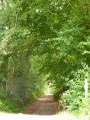
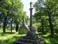
(13) After the wayside cross, turn left onto a stony, shaded path leading to the entrance to Goasquintin.

(14) Turn left onto the village road, cross the D769 with care and head straight on towards Le Mendy. Walk through the village until you reach a crossroads.

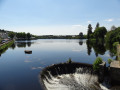
(15) Turn right and continue along the edge of a stretch of water, then veer left.

(16) Leave the road and take a track on the right leading to Le Reuniou. After the large shed, continue along a track suitable for vehicles leading to the water tower to reach the junction with the Morlaix road. (You can turn right after 100 metres to see the ruins of the Sainte-Barbe Chapel).

(17) Cross the D769 with care and take the D14 opposite to head back towards Berrien Town Hall (S/E).

Waypoints

  1. S/E : mi 0 - alt. 863 ft - Town Hall Square - Église Saint-Pierre (Berrien)
  2. 1 : mi 0.38 - alt. 778 ft - T-junction
  3. 2 : mi 1.26 - alt. 810 ft - Kernevez
  4. 3 : mi 2.79 - alt. 883 ft - Village médiéval du Goënidou
  5. 4 : mi 3.55 - alt. 942 ft - GR junction
  6. 5 : mi 4.26 - alt. 945 ft - Path to Trédudon-le-Moine
  7. 6 : mi 4.85 - alt. 948 ft - Memorial stone in Trédudon-le-Moine
  8. 7 : mi 5.37 - alt. 988 ft - Crossroads of footpaths
  9. 8 : mi 6.5 - alt. 896 ft - GR junction
  10. 9 : mi 8 - alt. 807 ft - Junction with the D769
  11. 10 : mi 8.78 - alt. 830 ft - T-junction
  12. 11 : mi 9.41 - alt. 646 ft - Three-way junction
  13. 12 : mi 9.93 - alt. 591 ft - Road D769
  14. 13 : mi 10.37 - alt. 679 ft - Kernon Calvary
  15. 14 : mi 11.24 - alt. 722 ft - Junction on a local road
  16. 15 : mi 11.9 - alt. 538 ft - Crossroads
  17. 16 : mi 12.54 - alt. 699 ft - Path leading to the village of Le Reuniou
  18. 17 : mi 13.4 - alt. 850 ft - Crossroads – Ruins of the - Chapelle Sainte-Barbe (Berrien)
  19. S/E : mi 13.72 - alt. 863 ft - Town Hall Square - Église Saint-Pierre (Berrien)

Notes

District roads: take care when crossing and walking along them!

Worth a visit

Always be cautious and plan ahead when you're outdoors. Visorando and the author of this route cannot be held responsible for any accidents occurring on this route.

The GR® and PR® markings are the intellectual property of the Fédération Française de Randonnée Pédestre.

Reviews and comments

4.7 / 5
Based on 2 reviews

Reliability of the description
5 / 5
Ease of following the route
5 / 5
Route interest
4 / 5
kerand29
kerand29

Overall rating : 5 / 5

Date of your route : Oct 19, 2026
Reliability of the description : ★★★★★ Very good
Ease of following the route : ★★★★★ Very good
Route interest : ★★★★★ Very good
Very busy route : No

A lovely route, even if there is a bit of tarmac at the start. It takes you through some very pretty hamlets. Around 8 km of trail in the heart of the countryside. A complete change of scenery. The distance is actually closer to 24 km. It’s best to be aware of this, as the route ends with a steep descent followed by a climb that’s just as steep.

Machine-translated

jibe22
jibe22
• Edited:

Overall rating : 4.3 / 5

Date of your route : Jul 06, 2023
Reliability of the description : ★★★★★ Very good
Ease of following the route : ★★★★★ Very good
Route interest : ★★★☆☆ Average
Very busy route : No

We set off at around 6.30 am, arriving at around 1.00 pm with a break at around 10.00 am.
A walk with little elevation gain, though the distance does start to take its toll towards the end. Personally, I’d expected more from this area; this walk does offer some lovely views, such as at La Roche St Barnabé, but it also involves far too much tarmac, even though you come across very few cars. I didn’t meet any other walkers, so in places the path isn’t always obvious (before Kernon, when you have to cross the D769).
The highlights are discovering some superb sunken paths and ‘ribines’, with their own sense of mystery. The route ends in the village of Trédudon-le-Moine, following a small stream.
The sections through the moorland are also lovely.

Machine-translated

Other walks in the area

For more walks, use our search engine .

The GPS track and description are the property of this route's author. Please do not copy them without permission.