The Saint-Vinec (or Saint-Guinec) to Huelgoat route

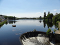
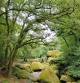
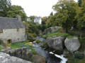
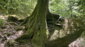
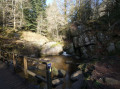
This walk takes you along Lake Huelgoat before heading out into the countryside to discover hamlets and heritage sites steeped in history: the hamlet of Le Crann and its bakehouse, the Menhir du Cloître, and the gorse millstone.

Details

n°29749377
Creation:
Last update:
Last review:
  • Walking
    Activity: Walking
  • ↔
    Distance: 5.95 mi
  • ◔
    Average duration: 3h 05 
  • ▲
    Difficulty: Easy

  • ⚐
    Back to start: Yes
  • ↗
    Ascent: + 397 ft
  • ↘
    Descent: - 387 ft

  • ▲
    Highest point: 846 ft
  • ▼
    Lowest point: 551 ft

Photos

Description of the walk

The walk starts on Rue Général de Gaulle, opposite the Hôtel du Lac.

(S/E) Head towards La Feuillée. Follow the River Fao past the municipal campsite and cross it via a wooden footbridge.

(1) Turn left onto the Route de l’ancienne piscine, then turn right onto a path.

(2) At the junction with a tarmac road, turn left. You’ll pass an old gorse mill. Continue along this road for about 500 m.

(3) Turn left onto a farm track to reach the hamlet of Le Crann (Berrien).

(4) As you leave the track, take the village lane on the left towards the hamlet.

(5) At the next junction, turn left towards an old bread oven. Carry on straight ahead, then, at the first junction, turn left to join a local road.

(6) At the Stop sign, turn left, then after 100 metres turn right to cross the village of Saint-Vinec (Saint-Guinec on the IGN map).

(7) At the junction (where there is an old granite quarry), head straight on to reach the hamlet of Le Cloître.

(8) Carry on past the Cloître menhir (private property, no entry) and turn left at the next junction.

(9) Carry on along the road to the village of Kervinaouet-Izella and turn first right, then left. Take a sunken lane which leads onto a local road. Cross it and take the Route de la Piscine.

(1) Cross the footbridge over the Rivière du Fao and continue along the path running alongside the local road to return to the starting point (S/E).

Waypoints

  1. S/E : mi 0 - alt. 554 ft - Rue Général de Gaulle. Near the - Rivère d'Argent (rivère) - Affluent de l'Aulne
  2. 1 : mi 0.6 - alt. 558 ft - Junction
  3. 2 : mi 0.89 - alt. 623 ft - Route du Fao junction
  4. 3 : mi 1.27 - alt. 633 ft - Junction
  5. 4 : mi 1.71 - alt. 636 ft - Local track
  6. 5 : mi 2.03 - alt. 663 ft - The village of Le Crann
  7. 6 : mi 2.81 - alt. 617 ft - Local road
  8. 7 : mi 3.24 - alt. 801 ft - Junction
  9. 8 : mi 3.58 - alt. 833 ft - The Cloister Village
  10. 9 : mi 3.87 - alt. 837 ft - Junction
  11. S/E : mi 5.95 - alt. 554 ft - Rue Général de Gaulle

Notes

Huelgoat has been awarded the ‘Communes du Patrimoine Rural de Bretagne’ label.

Worth a visit

Reviews and comments

3.7 / 5
Based on 2 reviews

Reliability of the description
4.5 / 5
Ease of following the route
4.5 / 5
Route interest
2 / 5
User 27400178

Overall rating : 4 / 5

Date of your route : Aug 24, 2026
Reliability of the description : ★★★★★ Very good
Ease of following the route : ★★★★★ Very good
Route interest : ★★☆☆☆ Disappointing
Very busy route : No

This route consists largely of sections on tarmac roads and is quite exposed, so it should be avoided in hot weather. The gorse mill and the old bread oven are the only notable heritage sites. There are a few lovely views around point 9.

Machine-translated

User 183261

Overall rating : 3.3 / 5

Date of your route : Jul 18, 2025
Reliability of the description : ★★★★☆ Good
Ease of following the route : ★★★★☆ Good
Route interest : ★★☆☆☆ Disappointing
Very busy route : No

A route consisting of 80 per cent roads; not particularly interesting, except for walking.

Machine-translated

Other walks in the area

For more walks, use our search engine .

The GPS track and description are the property of this route's author. Please do not copy them without permission.