Country:

 City:


Park in the square near the town hall.
(S/E) Near Berrien Town Hall, take Venelle Carn ar Verger behind St Peter’s Church. At the end, turn right towards the D42 for 100 metres.
(1) Turn left, pass through the village of Kermaria and continue to a bridge.
(2) After the bridge, turn left onto a wide track leading to Niquelvez, 1 km away.
(3) Cross the road onto a narrower path, continue southwards, passing under a power line, and reach the junction with the GR® 37–GR® de Pays des Monts d’Arrée.
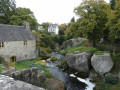
(4) Follow the GR® signs to the left and reach the road leading to the entrance to Kerampeulven, where you can see a 6-metre-high menhir.
(5) Head up the stony path to the right and join the D14.
(6) Cross this road, then enter the Huelgoat State Forest near the medieval motte and the Camp d’Artus (see the Kreizy Archéo information panel).
(7) Leave the GR® trails and continue along the path furthest to the left, which leads to a stream. Head up to the right to reach Restidiou-Bihan (narrow, muddy section). Continue left along the road.
(8) On leaving the village, turn left onto a shaded path to reach Kergariou. Follow the road towards Roc’hellec, pass through the village and reach the junction with the “deer route”.
(9) Carry on to the left until you reach the village of Le Brignou. Pass through the hamlet, then veer slightly to the right and turn right at the next crossroads to reach the junction with the “Lestrézec route”.
(10) Follow a wide path to the left, running alongside a high-voltage pylon, and continue to the D42.
(11) Turn left onto it to return to Berrien church and the town hall square (S/E).

 Local authority

 Difficult

 Easy
 Visorando Member