Route from Lestrézec to Berrien

A picturesque heritage route that passes through the Huelgoat State Forest and the Lestrézec woods.

Details

25536663
Creation:
Last update:
Last review:
  • Walking
    Activity: Walking
  • ↔
    Distance: 7.67 mi
  • ◔
    Average duration: 4h 00 
  • ▲
    Difficulty: Moderate

  • ⚐
    Back to start: Yes
  • ↗
    Ascent: + 574 ft
  • ↘
    Descent: - 591 ft

  • ▲
    Highest point: 873 ft
  • ▼
    Lowest point: 436 ft

Photos

Description of the walk

Park in the square near the town hall.

(S/E) In the centre of Berrien, with your back to the town hall, walk alongside the cemetery and, at the first junction, head towards Scrignac along Rue de l’Ancienne Forge for about 300 metres.

(, turn left1) Turn right onto a wide track, passing under a high-voltage power line.

(2) At the T-junction, turn left to join the D769.

(3) Follow it to the left for 35 m, then turn right. Before a detached house, turn right onto a path for 400 m, then turn right onto a local road and follow it for 200 m.

(4) Turn left onto a wide track. Cross a local road and then the D42 before entering the Huelgoat State Forest. (Off the route: the hamlet of Lestrézec, featuring an oak tree designated a “Remarkable Tree” and a memorial to the Resistance fighters of the 1939–45 war). You will reach a wide forest track.

(5) Turn left onto a wide forest track through the Bois de Lestrézec and reach a bridge over the Ruisseau du Mendy.

(6) Turn right onto a wide stony track leading to Trinivel.

(7) Cross the hamlet, continuing left along the village road, and pass the water source.
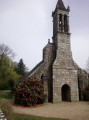
(You can turn right after 250 m to reach the Saint-Corentin Chapel, situated in the commune of Scrignac).

(8) Turn left onto a path leading to another local road, which you follow down to the left.

(9) Turn left, cross the Ruisseau du Mendy, pass the access road to the village of Le Mendy and continue uphill to a three-way junction near a pond.

(10) About a hundred metres past the three-way junction, leave the road and turn right onto a wide track leading up to Le Reuniou. As you approach the D769, turn left, ignore two roads on the right and pass a large shed on the left-hand side. Continue along a track suitable for vehicles leading to the water tower to reach the junction with the Morlaix road (D769).

(11) Cross the road and take the D14 straight ahead to return to the centre of Berrien (you can turn left after 100 metres to see the ruins of the Sainte-Barbe Chapel). You’ll arrive at the town hall square (S/E).

Waypoints

  1. S/E : mi 0 - alt. 863 ft - Town Hall Square - Église Saint-Pierre (Berrien)
  2. 1 : mi 0.27 - alt. 856 ft - Off the beaten track
  3. 2 : mi 1.12 - alt. 846 ft - T-junction
  4. 3 : mi 1.61 - alt. 705 ft - Crossing the D769
  5. 4 : mi 2.15 - alt. 686 ft - Junction on a wide path
  6. 5 : mi 3.24 - alt. 528 ft - Lestrézec Wood
  7. 6 : mi 4.23 - alt. 443 ft - Bridge over the Mendy Stream
  8. 7 : mi 4.61 - alt. 489 ft - Junction - Chapelle St Corentin
  9. 8 : mi 5 - alt. 512 ft - T-junction after the spring
  10. 9 : mi 5.63 - alt. 548 ft - Local road
  11. 10 : mi 6.5 - alt. 699 ft - Path leading to Le Réuniou
  12. 11 : mi 7.36 - alt. 850 ft - Crossroads – Ruins of the - Chapelle Sainte-Barbe (Berrien)
  13. S/E : mi 7.67 - alt. 863 ft - Town Hall Square - Église Saint-Pierre (Berrien)

Notes

County roads: take care when crossing and walking along them!

Worth a visit

A bit of history
The village of Berrien, situated in the north-east of the Monts d’Arrée, has been inhabited since at least the Mesolithic period.
Numerous archaeological excavations, as well as megalithic monuments, Bronze Age burial sites and Gallo-Roman remains, reveal a constant and uninterrupted occupation of the area. In medieval times, the inhabitants lived under the ‘quévaise’ system, which enabled the cultivation of often barren land and helped to settle the population. The settler-farmer was thus provided with a dwelling and a plot of land; in return, he worked for free on compulsory labour days and paid a rent to the landowner (the monks of Relec Abbey).

The hamlet of Lestrézec

Saint Corentin Chapel

Saint Barbe’s Chapel

Reviews and comments

4.5 / 5
Based on 2 reviews

Reliability of the description
4.5 / 5
Ease of following the route
5 / 5
Route interest
4 / 5
MatthieuGD
MatthieuGD

Overall rating : 4.3 / 5

Date of your route : Aug 03, 2025
Reliability of the description : ★★★★★ Very good
Ease of following the route : ★★★★★ Very good
Route interest : ★★★☆☆ Average
Very busy route : Yes

We did the circuit after visiting the tourist office in Huelgoat.
No particular difficulties, possibility to refill water supplies at the stream between points 5 and 6, fairly wooded, no real view but you can loop back with other routes.

Machine-translated

HLG
HLG

Overall rating : 4.7 / 5

Date of your route : Mar 01, 2023
Reliability of the description : ★★★★☆ Good
Ease of following the route : ★★★★★ Very good
Route interest : ★★★★★ Very good
Very busy route : No

A very varied walk, featuring a succession of landscapes comprising valleys and forests. An easy route. Perfect for adults, though perhaps a little long for children. Very suitable for mountain biking. Ideal for all seasons!

Machine-translated

Other walks in the area

For more walks, use our search engine .

The GPS track and description are the property of this route's author. Please do not copy them without permission.