Route de Saint-Martin-des-Champs

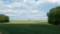
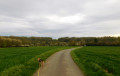
A brisk walk offering views of various parts of the Seine-et-Marne countryside. The places you pass through are all linked to water and agriculture.

Details

126254
Creation:
Last update:
Last review:
  • Walking
    Activity: Walking
  • ↔
    Distance: 6.56 mi
  • ◔
    Average duration: 3h 20 
  • ▲
    Difficulty: Easy

  • ⚐
    Back to start: Yes
  • ↗
    Ascent: + 318 ft
  • ↘
    Descent: - 305 ft

  • ▲
    Highest point: 646 ft
  • ▼
    Lowest point: 384 ft

Photos

Description of the walk

(S) Saint-Martin-des-Champs community hall

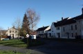
(1) From the community hall, walk down the main street, past the town hall and then the church, and turn onto a small path on the left. Turn immediately right and join the old railway line. Go through the tunnel under the old railway line, turn first left then right, and cross the bridge over the Grand Morin. Continue until you reach a Fork in the road.

(2) Take the path on the left to join a tarmac road. Take this road and follow it to the Moulin de la Fosse crossroads.

(3) Take the road on the left, which will lead you to Trotignon, the starting point for the Vallée du Grand Morin rail bike.

(4) In Trotignon, turn right. Keep left at the first Fork in the road, then turn right at the next T-junction. Continue straight on (east, then east-north-east) until you reach a crossroads.

(5) At the crossroads leading to Montvinot, turn left, then take the road on the right and immediately turn left. Continue straight on along the grassy track between the fields until you reach the D14.

(6) Take the D14 to the right, then turn left straight away and follow the grassy track uphill for about 600 metres.

(7) At the junction, take the path on the left until you reach the Route de La Grande Renoue (tarmac road), then take the path immediately on the left. Follow it to the T-junction, ignoring the turnings to the left and then to the right.

(8) Turn right and, after about 600 metres, turn right again to head back up towards the village of Coupigny.

(9) In Coupigny, turn left, then right, then left again, and take a grassy track, following it to the junction.

(10) At the end of this grassy path, turn left and carry on straight ahead to return to Saint-Martin-des-Champs. At the end of the path, continue along the tarmac road to return to your starting point.


Waypoints

  1. S/E : mi 0 - alt. 489 ft
  2. 1 : mi 0.05 - alt. 479 ft - Main street
  3. 2 : mi 0.42 - alt. 384 ft - Fork in the road: turn left
  4. 3 : mi 0.75 - alt. 400 ft - Moulin de la Fosse crossroads
  5. 4 : mi 0.97 - alt. 400 ft - Station
  6. 5 : mi 2.21 - alt. 574 ft - At the crossroads, turn left
  7. 6 : mi 2.81 - alt. 643 ft - D14: first turn right then left
  8. 7 : mi 3.27 - alt. 604 ft - At the junction, turn left
  9. 8 : mi 4.57 - alt. 610 ft - At the T-junction, turn right
  10. 9 : mi 5.33 - alt. 574 ft - Coupigny, on the left
  11. 10 : mi 5.66 - alt. 538 ft - Crossroads: turn left
  12. S/E : mi 6.56 - alt. 489 ft

Notes

There is a water point at the Petite Renoue farm.
Please note that some sections are in the sun, so do bring a hat.

Worth a visit

At the start of the walk, visit the Church of Saint-Martin des (13th–16th centuries).
The Templar Commandery is best visited after the walk, as it is located off the route.
The war memorial features a plaque listing 10 names of those who died in the First World War. A plaque has been added to commemorate the sole casualty of the Second World War.

Reviews and comments

3.9 / 5
Based on 3 reviews

Reliability of the description
3.7 / 5
Ease of following the route
4 / 5
Route interest
4 / 5
alainmartin77
alainmartin77

Hello
Thank you very much for this additional information; I’ll make a note of it in the route description
Enjoy your future hikes
@lain

Machine-translated

pb77
pb77

Overall rating : 4.7 / 5

Date of your route : Nov 10, 2021
Reliability of the description : ★★★★★ Very good
Ease of following the route : ★★★★★ Very good
Route interest : ★★★★☆ Good
Very busy route : No

A very pleasant route, which we rounded off with a circular route via the commandery.
Also worth noting is the Romnel goat farm along the route.

Machine-translated

denysferrier
denysferrier

Overall rating : 3.7 / 5

Date of your route : Aug 11, 2018
Reliability of the description : ★★★☆☆ Average
Ease of following the route : ★★★★☆ Good
Route interest : ★★★★☆ Good

A pleasant walk, but flat and through a lot of rather monotonous fields. Up to point 5, it follows a PR trail marked with yellow signposts. After that, the route description becomes unreliable because, in the fields, the paths can change depending on farmers’ activities. In the final section, the route description is confusing and unusable: it’s best to know the area well and be able to use a compass to find your way back to the starting point. It’s a shame, as there are very clear street signs in the village of Coupigny. In this case, it would have been enough to write: follow the tarmac road northwards until you reach Chemin du Bois Huon, which you’ll take on the left. After about three hundred metres, you’ll come to a T-junction: turn left at a right angle, heading south (Saint Martin des Champs is then about 900 metres away).

Machine-translated

alainmartin77
alainmartin77

@ Lucie S1
Hello Lucie,
I’m surprised to hear about the problem at the start of the walk. You simply need to go down the road, turn left at the house and follow the path – there’s no castle in that area.
There are also no busy roads; the ones people do use are very quiet and are just ‘rough tracks’. I think you may have set off in a different direction, as the only road with heavy traffic is the D934, which is completely off the route, several hundred metres away.
Could you please give me some details on the map so that I can check?
Thank you
Alain

Machine-translated

alainmartin77
alainmartin77

Hello
I’ve been a bit slow to reply as I’m not yet familiar with the email system.
Unfortunately, it isn’t possible to start this walk from a railway station, as the SNCF line was closed down years ago. You’ll need to get to Coulommiers station and then take a coach to get there.
Kind regards
Alain

Machine-translated

Lucie S1.
Lucie S1.

Overall rating : 3.3 / 5

Date of your route : Jul 15, 2015
Reliability of the description : ★★★☆☆ Average
Ease of following the route : ★★★☆☆ Average
Route interest : ★★★★☆ Good

A pleasant walk through a lovely forest. The map isn’t very clear at the start when it comes to following the road around the castle. It’s a shame to have to walk along a busy road to reach the end of the route. We went through a small village a little further on to avoid the dual carriageway.

Machine-translated

andre.brochotissy
andre.brochotissy

Can you start this walk from a railway station?
Thank you

Machine-translated

Other walks in the area

For more walks, use our search engine .

The GPS track and description are the property of this route's author. Please do not copy them without permission.