The Bois Saint-Jacques

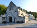
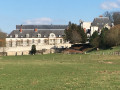
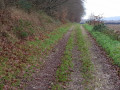
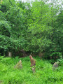
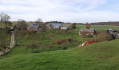
Partly shaded route, with views of the beautiful Abbey of Saint-Wandrille, formerly the Abbey of Fontenelle.

Details

4102496
Creation:
Last update:
Last review:
  • Walking
    Activity: Walking
  • ↔
    Distance: 5.00 mi
  • ◔
    Average duration: 2h 45 
  • ▲
    Difficulty: Moderate

  • ⚐
    Back to start: Yes
  • ↗
    Ascent: + 538 ft
  • ↘
    Descent: - 541 ft

  • ▲
    Highest point: 348 ft
  • ▼
    Lowest point: 23 ft

Photos

Description of the walk

Parking and starting point at the post office car park, Rue de l’Oiseau Bleu.

(S/E) Set off to the left and, after the church, turn left into Rue Saint-Jacques. Walk past the entrance and the abbey shop and go up the slope to the first turn-off on the right.

(1) Turn right towards Clos Saint-Jacques and, at the next bend, take the path on the left.

(2) A few metres further on, at the Y-junction, continue left for 480 m.

(3) Ignore the turn-off on the left leading to the D33 and go straight on. Turn left onto the first path that runs parallel to the D33 before veering away from it. Pass through the forest gate. Continue along this path, which is circular in nature as it climbs, until you reach the Route d’Étaintot.

(4) Cross the road and take the track opposite, which heads off to the left. Continue to the Y-junction, which is about 800 m further on.

(5) Turn right until you reach the next fork.

(6) Turn right until you reach Route d’Étaintot.

(7) Cross the road and turn left for 15 metres. Then take the path on the right and turn left immediately to head down to Clos Saint-Jacques.

(2) Keep to the left. Return to the road you crossed earlier and continue straight on.

(1) Turn left and follow the outbound route in the opposite direction to return to the starting point (S/E).


Waypoints

  1. S/E : mi 0 - alt. 59 ft - Rue de l’Oiseau Bleu
  2. 1 : mi 0.4 - alt. 92 ft - Turn right onto the Route d’Étaintot
  3. 2 : mi 0.47 - alt. 135 ft - Clos Saint-Jacques, junction of the circular loop
  4. 3 : mi 0.76 - alt. 82 ft - Straight on
  5. 4 : mi 2.78 - alt. 331 ft - Étaintot Road
  6. 5 : mi 3.3 - alt. 289 ft - Crossroads
  7. 6 : mi 3.47 - alt. 128 ft - Crossroads
  8. 7 : mi 4.37 - alt. 249 ft - Étaintot Road
  9. S/E : mi 5 - alt. 56 ft - Rue de l’Oiseau Bleu

Notes

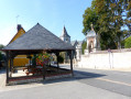
D22, the road directly opposite the church: there are two picnic tables with benches, covered by a roof.
The tobacconist’s next to the post office also serves as a small grocery shop for essentials.

Please note: between (5) and (6), the paths are quite cluttered, though in places they are more clearly visible.

Worth a visit

Saint-Wandrille Abbey.
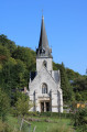
Saint-Michel Church in Saint-Wandrille.
Notre-Dame de Rançon Church.
Saint-Saturnin Chapel.
Notre-Dame Chapel (Caillouville).
The wheat mill on the River Rançon.
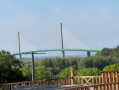
The Brotonne Bridge.

Reviews and comments

3.8 / 5
Based on 4 reviews

Reliability of the description
4 / 5
Ease of following the route
4 / 5
Route interest
3.5 / 5
Bertra
Bertra

Overall rating : 4 / 5

Date of your route : Apr 29, 2026
Reliability of the description : ★★★★☆ Good
Ease of following the route : ★★★★☆ Good
Route interest : ★★★★☆ Good
Very busy route : No

There are several fallen trees along the route. You have to go round the obstacle by heading into the woods, sometimes through brambles (not ideal). It might be best to wait until the paths are clear again before recommending this walk.

Machine-translated

benoitrando
benoitrando

In light of the latest comments, I have amended the route from point 5 to point 6

Machine-translated

Louise1989
Louise1989

Overall rating : 2.7 / 5

Date of your route : Sep 19, 2023
Reliability of the description : ★★★☆☆ Average
Ease of following the route : ★★★☆☆ Average
Route interest : ★★☆☆☆ Disappointing
Very busy route : No

Right, right, right… I must have got it wrong at some point. Everything was going fine, and then I got to point 5 – that’s when all hell broke loose. Scratches? That’s an understatement, Captain – these are battle scars. Not to mention the number of times the brambles tripped me up. The grass was so tall I couldn’t see where to put my feet, and several times I nearly fell over. Anyway, at some point my nightmare came to an end and I found what you could actually call a path...
I wouldn’t recommend this walk – it’s not very interesting and, as mentioned earlier, the section between points 5 and 6 is tricky.

Machine-translated

vince1901
vince1901

Overall rating : 4 / 5

Date of your route : Aug 18, 2023
Reliability of the description : ★★★★☆ Good
Ease of following the route : ★★★★☆ Good
Route interest : ★★★★☆ Good
Very busy route : Yes

Hello,
It’s true that between points 5 and 6, part of this path is overgrown with brambles; it’s not impassable, but let’s just say that if you’re wearing shorts, you’ll come out with scratched legs… (it’s better to take the path that branches off to the right at point 5).
Also, be careful just after point 3: we turned off to the right and started climbing a path without realising, as it’s quite natural to follow it. The GPS on our phones quickly alerted us that we were no longer on the right track… Apart from that, the walk is lovely and fairly easy; it took us about 2 hours 30 minutes to complete.

Machine-translated

benoitrando
benoitrando

Hello tatouille76,
You’re right to point out the difficulty of sections 5 to 6 – this will certainly catch the attention of any future walkers.
The difficulty is mentioned in the description, and it’s certainly quite a challenge in practice.

Thank you, tatouille76

Machine-translated

tatouille76
tatouille76

Overall rating : 4.7 / 5

Date of your route : Feb 14, 2021
Reliability of the description : ★★★★★ Very good
Ease of following the route : ★★★★★ Very good
Route interest : ★★★★☆ Good
Very busy route : No

Hike completed today, in 2 hours
The only downside is that, between points 5 and 6, it’s best to take the path that descends to the right at point 5 to reach point 6 directly; the route recommended by the walk guide is overgrown, chaotic and unclear, and the path down to point 6 is poorly signposted. As soon as you come across a path on the right, follow it uphill to reach point 6. If you take the ‘shortcut’ between points 5 and 6, you stay on the same path at point 6; you miss out on a patch of land with magnificent oak trees, but the path is much better.

Machine-translated

Other walks in the area

For more walks, use our search engine .

The GPS track and description are the property of this route's author. Please do not copy them without permission.