La Viverie Route

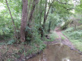
The route starts on the shores of Lac du Graon and follows sunken paths, crossing two small streams: the Fossé Châlon, which feeds into Lac du Graon, and the Marzelle.

Details

3615293
Creation:
Last update:
Last review:
  • Walking
    Activity: Walking
  • ↔
    Distance: 5.28 mi
  • ◔
    Average duration: 2h 40 
  • ▲
    Difficulty: Easy

  • ⚐
    Back to start: Yes
  • ↗
    Ascent: + 243 ft
  • ↘
    Descent: - 266 ft

  • ▲
    Highest point: 210 ft
  • ▼
    Lowest point: 75 ft

Photos

Description of the walk

Start from Place de l’Église.

Green signposting

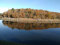
(S/E) Cross this square and take Rue du Choselier to reach the shores of Lac du Graon, skirting the leisure area on the left.

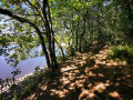
(1) Walk along the left-hand side of the lake until you reach the road that forms a branch of the lake.

(2) Follow this road across the lake and take the path on the right towards the Îlôt.

(3) At the end of the track, take the road on the left and head towards the crossroads. Cross the crossroads and take the path opposite. Continue along this path, which turns right, until you reach an old farm at a place called Moreau.

(4) Pass the buildings, continue along a small road and take the first path on the left. Follow this sunken path which crosses the Ruisseau du Fossé Châlon. Cross the road and take the path opposite.

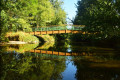
(5) To cross the Ruisseau de la Marzelle, take a small footbridge.

(6) In the village, rejoin the road on the left and carry on to the crossroads. Turn left and continue along theGR® 364. Pass the next crossroads and carry on straight ahead. Walk through the village of La Paynière.

(7) On leaving the village, turn onto the path on the left and continue as far as the Poitevinière farm.

(8) Leave theGR®364, take the road on the right and, at the next junction, turn left and carry on until the next bend.

(9) Take the path opposite and continue along this path, which runs alongside some housing estates. When you reach the houses, take the path opposite and head downhill to the small bridge which crosses the Ruisseau du Fossé Châlon once more. Take the road on the left, cross the bridge and head back up to join Rue des Forges just after the campsite. Turn right and, at the Stop sign, turn right again to reach Place de l’Église (S/E).


Waypoints

  1. S/E : mi 0 - alt. 148 ft - Place de l’Église
  2. 1 : mi 0.21 - alt. 112 ft - Lac du Graon
  3. 2 : mi 1.08 - alt. 115 ft - Crossing the lake
  4. 3 : mi 1.49 - alt. 200 ft - Les Petites Touches
  5. 4 : mi 2.32 - alt. 177 ft - Moreau Farm
  6. 5 : mi 3.08 - alt. 131 ft - La Marzelle stream
  7. 6 : mi 3.17 - alt. 180 ft - La Viverie
  8. 7 : mi 3.64 - alt. 171 ft - La Paynière
  9. 8 : mi 4.22 - alt. 171 ft - Ferme de la Poitevinière
  10. 9 : mi 4.54 - alt. 167 ft - Path behind the Moratière housing estate
  11. S/E : mi 5.28 - alt. 148 ft - Place de l’Église

Notes

Toilets are available at the start, next to the town hall and at the leisure area.

Always be cautious and plan ahead when you're outdoors. Visorando and the author of this route cannot be held responsible for any accidents occurring on this route.

The GR® and PR® markings are the intellectual property of the Fédération Française de Randonnée Pédestre.

Reviews and comments

4.1 / 5
Based on 4 reviews

Reliability of the description
4.3 / 5
Ease of following the route
4.3 / 5
Route interest
3.8 / 5
chambrelent
chambrelent

Overall rating : 3.7 / 5

Date of your route : Sep 14, 2022
Reliability of the description : ★★★★☆ Good
Ease of following the route : ★★★★☆ Good
Route interest : ★★★☆☆ Average
Very busy route : No

We soon leave the lakeside behind and head back onto the tarmac.
It’s actually quite pleasant and easy.

Machine-translated

spontour
spontour

Overall rating : 4.7 / 5

Date of your route : May 31, 2021
Reliability of the description : ★★★★★ Very good
Ease of following the route : ★★★★★ Very good
Route interest : ★★★★☆ Good
Very busy route : No

Please note that whether you are walking the Tour du Lac de Graon, the Viverie route, or both in succession, we would ask walkers to avoid parking their vehicles in the church square or the town hall square, even though these are the first places you see and the most accessible. There is a 50-space car park that is very well signposted and easily accessible.

Machine-translated

LDAH
LDAH

Hello,
Thank you for letting us know; the sign has probably been removed. We will take the necessary steps to resolve this issue.

Machine-translated

Pilou85
Pilou85

Overall rating : 4 / 5

Date of your route : Mar 08, 2021
Reliability of the description : ★★★★☆ Good
Ease of following the route : ★★★★☆ Good
Route interest : ★★★★☆ Good
Very busy route : No

Please note: at waypoint 3, as you reach the tarmac road, be sure to turn left (there is no longer a small sign saying ‘Route de La Viverie’ at this point). Do not follow the yellow markings any further, as they take you on a long detour around Lake Graon.
The lakeside is very pleasant; after that, it’s countryside.

Machine-translated

pinho85
pinho85

Overall rating : 4 / 5

Date of your route : Oct 07, 2020
Reliability of the description : ★★★★☆ Good
Ease of following the route : ★★★★☆ Good
Route interest : ★★★★☆ Good
Very busy route : No

A lovely walk that takes you through a variety of landscapes.

Machine-translated

Other walks in the area

For more walks, use our search engine .

The GPS track and description are the property of this route's author. Please do not copy them without permission.