La Panerie Les Vignes trail, starting from Champ-Saint-Père

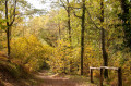
A circular walk starting from the station car park in Champ-Saint-Père, following some beautiful sunken paths and crossing a vineyard through the hillsides.
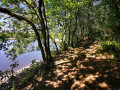
A shaded route.

Details

3398998
Creation:
Last update:
Last review:
  • Walking
    Activity: Walking
  • ↔
    Distance: 5.41 mi
  • ◔
    Average duration: 2h 45 
  • ▲
    Difficulty: Easy

  • ⚐
    Back to start: Yes
  • ↗
    Ascent: + 331 ft
  • ↘
    Descent: - 344 ft

  • ▲
    Highest point: 207 ft
  • ▼
    Lowest point: 43 ft

Photos

Description of the walk

Park in the car park at Champ-Saint-Père station, near the level crossing.

(S/E) Head towards the railway line, cross the level crossing towards Mareuil and follow the D19.

(1) Take thefirst path on the left, then immediately turn right. Continue on and cross the Ruisseau de la Narbonnière. At the next junction, join theGR®®364. Follow it straight ahead, cross a road and reach a crossroads of footpaths.

(2) Leave theGR®® and follow the path leading uphill to the right for about 130 m, which takes you to the edge of the D19. Take the path on the left; do not go onto the road.
Carry on straight ahead; at the end of the sunken lane, turn left and walk alongside a small pond. Turn left at the junction after the pond and continue on to reach the Y-junction at Malvas.

(3) Turn right onto the country road and continue to a further Y-junction at the Baffardière lay-by.

(4) At the far end of the car park, turn left, head down to a wooden railing, then take a path slightly to the left which descends to the bottom of the valley.
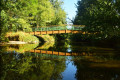
Continue along the path to the left of the Péron stream. Stay on this main path on the left and you’ll reach a small bridge.

(5) Cross this wooden bridge on the right and take the path furthest to the left, which leads to La Baffardière. At the road, turn left to enter the village.

(6) Then follow the ‘Pierre au Fées’ circular route, signposted in yellow. Join the road linking Saint-Hubert to La Baffardière.

(7) Take the path on the left; do not cross the road. Continue along this path, pass Le Péron and carry on until you come to another road. Turn left onto it and you will soon rejoin theGR®®364.

(8) Turn right onto it and follow it until you reach the crossroads you passed on the way there.

(2) Retrace your steps along the route you took on the way there until you reach La Grande Fillonnière. Leave theGR®® and turn right, cross the Ruisseau de La Narbonnière and emerge onto Rue de La Narbonnière.

(9) Follow this road to the left to easily find the car park at Champ-Saint-Père station near the level crossing (S/E).

Waypoints

  1. S/E : mi 0 - alt. 131 ft - Car park at Champ-Saint-Père station
  2. 1 : mi 0.19 - alt. 118 ft - La Fouinerie
  3. 2 : mi 0.71 - alt. 128 ft - Crossroads at the end of the circular loop
  4. 3 : mi 1.89 - alt. 197 ft - Malvas Y-junction
  5. 4 : mi 2.18 - alt. 177 ft - La Baffardière area
  6. 5 : mi 2.62 - alt. 82 ft - Small wooden bridge
  7. 6 : mi 2.88 - alt. 203 ft - The village of La Baffardière
  8. 7 : mi 3.33 - alt. 144 ft - Road linking Saint-Hubert to La Baffardière
  9. 8 : mi 3.86 - alt. 197 ft - GR364 junction
  10. 9 : mi 5.22 - alt. 135 ft - Rue de La Narbonnière
  11. S/E : mi 5.41 - alt. 131 ft - Car park at Champ-Saint-Père station

Notes

Make sure you wear sturdy shoes, or even waterproof ones in winter.
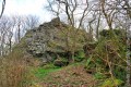
You can have a picnic on the slopes of the Pierre aux Fées near Le Perron.

Worth a visit

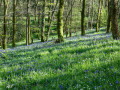
The hillsides are particularly full of flowers during April and May.
- Wild hyacinths in abundance.
- Clandestines
(4) The Luçon plain stretches as far as the eye can see, with the bell tower of Luçon Cathedral visible in the distance on a clear day.

Always be cautious and plan ahead when you're outdoors. Visorando and the author of this route cannot be held responsible for any accidents occurring on this route.

The GR® and PR® markings are the intellectual property of the Fédération Française de Randonnée Pédestre.

Reviews and comments

4.7 / 5
Based on 1 review

Reliability of the description
5 / 5
Ease of following the route
5 / 5
Route interest
4 / 5
plebuse
plebuse

Overall rating : 4.7 / 5

Date of your route : Aug 12, 2021
Reliability of the description : ★★★★★ Very good
Ease of following the route : ★★★★★ Very good
Route interest : ★★★★☆ Good
Very busy route : No

A lovely walk taken by two adults, lasting 1 hour 50 minutes. Two-thirds of the route is well shaded, with very little elevation gain – perfect for a safe outing during a heatwave.

Machine-translated

Other walks in the area

For more walks, use our search engine .

The GPS track and description are the property of this route's author. Please do not copy them without permission.