Quercy Outdoor: The ancient Roman road

In ancient times, the Romans improved and expanded the road network. Many of today’s roads follow the route of these ancient tracks!
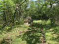
Marminiac was situated on the Roman road linking Périgueux to Cahors. This idyllic walk will take you through unspoilt countryside and, who knows, as you round a sunken lane, you might even come across traces of these ancient roads!

Details

4413353
Creation:
Last update:
Last review:
  • Walking
    Activity: Walking
  • ↔
    Distance: 5.37 mi
  • ◔
    Average duration: 3h 00 
  • ▲
    Difficulty: Easy

  • ⚐
    Back to start: Yes
  • ↗
    Ascent: + 587 ft
  • ↘
    Descent: - 571 ft

  • ▲
    Highest point: 1,115 ft
  • ▼
    Lowest point: 751 ft

Description of the walk

Park in the small car park opposite Marminiac Town Hall.

(S/E) Cross the D13 at the pedestrian crossing, walk past the town hall and follow the small street which joins the D63. Walk along the road to the left for about 250 m.

(1) Turn left at a cross signposted “Mourlanes”: there’s a typical house with a dovecote on the left. Walk through an old farm. At the crossroads, take the left-hand path leading up onto a plateau (walnut grove, dovecote on the right).

(2) At the junction with a road (cross), turn right and continue along a path leading downhill, bordered by a low wall. When you reach a meadow, near the Grès buildings, turn right into the woodland.
Further on, turn left onto the path to join a road. Follow it to the left, take the next path on the right (wash house) and you’ll come out onto the D13.

(3) Cross the road with care as the bend obscures visibility, then continue along the path opposite for approximately 1.5 km.

(4) At the Lédrier junction and before reaching the D13, turn left onto a path through the woods (not shown on the map). Follow it to the road and turn left towards the hamlet of Le Courteau.
Before you reach it, take a track on the right and continue to the four-way junction.

(5) Turn left. Walk past the Bancuq farm and, at the next junction, take a road on the left.

(6) Cross the D63 with care and take the path opposite. Join a road and follow it to the right as far as the hamlet of Lalbenque Basse.

(7) Before the first building on the left, take the path on the left which descends between the meadows and then climbs back up through the woods. When you reach a wider path, turn left until you reach the D63. Turn immediately right onto the path which descends into the woods.

(8) At the hamlet (cross), turn right towards Briguemil (horse riders should continue straight on), then take the first path on the left. Back on the D13, head towards Marminiac on the right and arrive at the car park (S/E).


Waypoints

  1. S/E : mi 0 - alt. 784 ft - Marminiac car park
  2. 1 : mi 0.12 - alt. 751 ft - Cross, junction to the right
  3. 2 : mi 0.62 - alt. 853 ft - Road, cross – on the right
  4. 3 : mi 1.53 - alt. 850 ft - D13
  5. 4 : mi 2.29 - alt. 951 ft - Ledrier, path on the left
  6. 5 : mi 2.97 - alt. 1,115 ft - Crossroads, turn left
  7. 6 : mi 3.58 - alt. 1,014 ft - D63
  8. 7 : mi 4.18 - alt. 935 ft - Lalbenque Basse
  9. 8 : mi 4.9 - alt. 853 ft - D13, cross – path on the right
  10. S/E : mi 5.37 - alt. 784 ft - Marminiac car park

Reviews and comments

4.3 / 5
Based on 3 reviews

Reliability of the description
4.3 / 5
Ease of following the route
4.7 / 5
Route interest
4 / 5
OTCS
OTCS

Hello Celineetfrederic,
Thank you for your review and feedback regarding the description.
Please do feel free to continue exploring the Quercy-Outdoor routes!

Gwendoline

Machine-translated

Celineetfrederic
Celineetfrederic

Overall rating : 4.3 / 5

Date of your route : Mar 30, 2025
Reliability of the description : ★★★★☆ Good
Ease of following the route : ★★★★★ Very good
Route interest : ★★★★☆ Good
Very busy route : No

Very pleasant.
At point 5, it’s more of a track than a road, on the left.
Conversely, at point 7, rather than a ‘wide path’, it’s a tarmac track.
Thank you very much for sharing this.

Machine-translated

OTCS
OTCS
• Edited:

Hello Aloix,
Thank you for taking the time to share your thoughts!
Perhaps we’ll see you soon on the trails at Quercy Outdoor (Cazals-Salviac)!
Laurence
Cazals-Salviac Tourist Office

Machine-translated

aloix
aloix

Overall rating : 5 / 5

Date of your route : May 20, 2024
Reliability of the description : ★★★★★ Very good
Ease of following the route : ★★★★★ Very good
Route interest : ★★★★★ Very good
Very busy route : No

A lovely walk

Machine-translated

Bil24
Bil24

Overall rating : 3.7 / 5

Date of your route : Sep 03, 2023
Reliability of the description : ★★★★☆ Good
Ease of following the route : ★★★★☆ Good
Route interest : ★★★☆☆ Average
Very busy route : No

A lovely path through the woods, a lovely village, but there are lots of horseflies in August…

Machine-translated

Other walks in the area

For more walks, use our search engine .

The GPS track and description are the property of this route's author. Please do not copy them without permission.